2 entries match your criteria.
Related Historical Markers
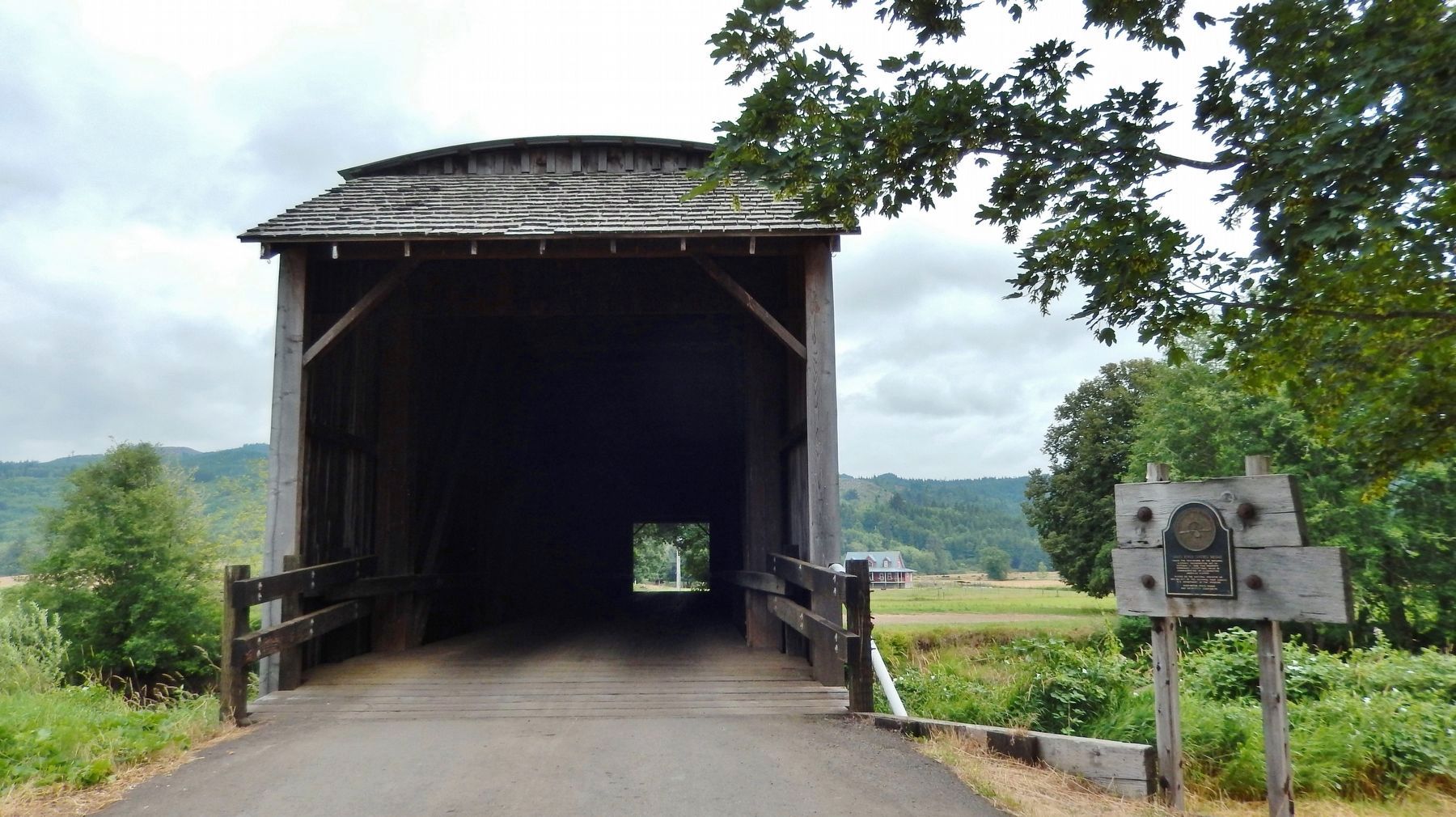
Grays River Covered Bridge
By Cosmos Mariner, July 10, 2015
Grays River Covered Bridge Marker (wide view; marker right of bridge)
SHOWN IN SOURCE-SPECIFIED ORDER
| On Covered Bridge Road, 0.1 miles south of Loop Road, on the right when traveling south. |
| |
Under the provisions of the National
Historic Preservation Act of
October 15, 1966, this property
possesses exceptional value in
commemorating, or illustrating
American history
Placed on the National Register on
Nov. 23, 1971 . . . — — Map (db m116590) HM |
| On Covered Bridge Road, 0.1 miles south of Loop Road, on the right when traveling south. |
| |
Owned and operated by the Wahkiakum Community Foundation, the five-acre Ahlberg Park was purchased in 2007 with funding from private donors and the taxpayers of Washington State with the support of late County Commissioner Mark Linguist, State . . . — — Map (db m116591) HM |
May. 2, 2024