2 entries match your criteria.
Related Historical Markers
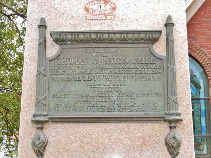
Christ Episcopal Church & Thomas Johnston Grier Statue
By Cosmos Mariner, July 12, 2018
Thomas Johnston Grier Marker (tall view)
SHOWN IN SOURCE-SPECIFIED ORDER
| On West Main Street / CanAm Highway (U.S. 85) east of Paul Street, on the right when traveling north. |
| | . . . — — Map (db m120088) HM |
| On West Main Street / CanAm Highway (U.S. 85) north of Paul Street, on the right when traveling north. |
| |
Lead's Episcopal congregation selected a site for a new church in July of 1896 and work was begun immediately. The Lead Call noted, "A more central and easily accessible location could not have been decided upon and when finished, . . . — — Map (db m121533) HM |
May. 19, 2024