2 entries match your criteria.
Related Historical Markers
The changing landscape of Cockspur Island
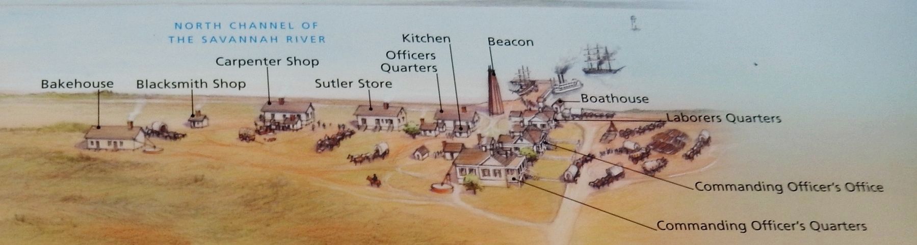
Marker detail: Buildings along North Channel of the Savannah River
SHOWN IN SOURCE-SPECIFIED ORDER
| On Fort Pulaski Road, 0.9 miles north of U.S. 80, on the left when traveling north. |
| | In front of you, reaching to the North Channel, a busy village supported Fort Pulaski. Originally built to house workers constructing the fort, the village became an extension of the post. How people used village buildings changed over time. The . . . — — Map (db m134069) HM |
| Near Fort Pulaski Road, 1 mile north of U.S. 80. |
| | In the 1800s, a busy village stood where you now see a wooded area beyond the parking lot.
Here at the mouth of the Savannah River, Cockspur Island was a strategic military outpost from before the Revolutionary War until after World War II. Tides . . . — — Map (db m134101) HM |
May. 8, 2024