4 entries match your criteria.
Related Historical Markers
By David Graff, April 26, 2012
Noble Ellis and Tour Stop #8 Markers
SHOWN IN SOURCE-SPECIFIED ORDER
| On Mill Springs Battlefield Road at Sellars Road (County Route 1523D) when traveling south on Mill Springs Battlefield Road. Reported permanently removed. |
| | Night of January 10-20, 1862 Confederate General Zollicoffer's pleas for more men and supplies to meet the strong Union force he expected went mostly unheeded. General Albert Sidney Johnston did, however, send a river steamer, the Noble . . . — — Map (db m55880) HM |
| On Mill Springs Battlefield Road, 3 miles Kentucky Highway 235, on the right when traveling south. Reported permanently removed. |
| | "The position ... is a fine basis for operations in front." - Felix K. Zollicoffer Inset photo on left of Gen. Felix K. Zollicoffer In November 1861 Gen. Felix Zollicoffer sent engineer officers Capt. Thomas Estill and Capt. Victor Von . . . — — Map (db m55778) HM |
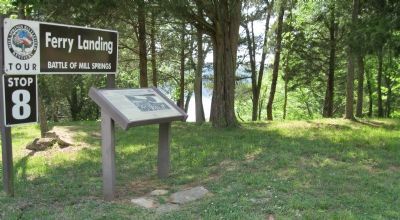
| Near Mill Springs Battlefield Road, 3 miles south of Kentucky Route 235, on the right when traveling south. |
| | By late December, General Felix Zollicoffer had decided to winter his command at Beech Grove. "The time has come," he wrote, "when huts must be constructed to protect the forces of the Brigade against inclement weather. Commanding officer . . . — — Map (db m69970) HM |
| Near Mill Springs Battlefield Road, 3 miles south of Kentucky Route 235, on the right when traveling south. |
| |
"Their fort was admirable situated on a high piece of ground three-quarters of a mile from the Cumberland River, surrounded with a breastwork and rifle pits, with embrasures for cannon and as strong a position as could be found." — . . . — — Map (db m69982) HM |
May. 1, 2024