2 entries match your criteria.
Related Historical Markers
By Cosmos Mariner, September 1, 2014
William Austin Burt Marker (side 2)
SHOWN IN SOURCE-SPECIFIED ORDER
| Near 26 Mile Road at Main Park Drive. |
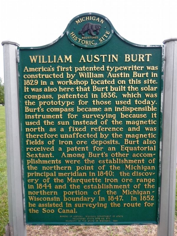
| | (side 1) Near this site lived William Austin Burt, inventor, legislator, surveyor, and millwright. Born in Massachusetts in 1792, Burt settled in this area in 1824, after spending several years in Erie County, New York. There he had been a . . . — — Map (db m154165) HM |
| On West Pier Drive west of West Portage Avenue, on the left when traveling west. |
| | On August 25, 1840, United States Deputy Surveyor, Wm. A. Burt, established at this point the north end of the principal meridian from which all land in Michigan is surveyed. — — Map (db m198456) HM |
May. 5, 2024