4 entries match your criteria.
Related Historical Markers
By Anton Schwarzmueller, August 8, 2020
Niagara Gorge R.R. Marker
SHOWN IN SOURCE-SPECIFIED ORDER
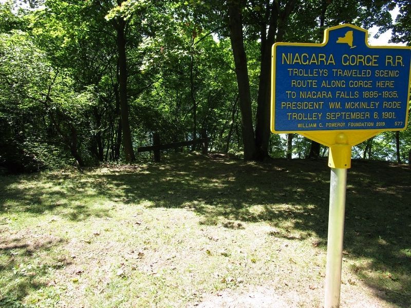
| | Niagara Gorge R.R. Trolleys traveled scenic route along gorge here to Niagara Falls 1895-1935. President Wm. McKinley rode trolley September 6, 1901 — — Map (db m154542) HM |
| | The Great Gorge Route (1895-1935) once offered spectacular trolley rides through the Niagara Gorge. Initially, the route ran from Niagara Falls to Lewiston, NY. After the Lewiston-Queenston Suspension Bridge opened in 1899, however, the line . . . — — Map (db m75312) HM |
| | Located at the base of the Niagara Escarpment, the ravine known as the Gully provided a naturally sheltered docking area where the Niagara River flows out of the steep and unnavigable Niagara Gorge. From this docking area, the Gully provided access . . . — — Map (db m94983) HM |
| | This tollhouse was part of the Lewiston-Queenston Suspension Bridge which spanned the Lower Niagara River at the foot of the Niagara Escarpment near today’s Artpark.
Historic Lewiston Bridge Linked U.S. with Canada
After the first . . . — — Map (db m189520) HM |
May. 4, 2024