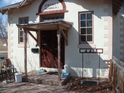
4 entries match your criteria.
Related Historical Markers
These are marker pages referencing Dane County one-room schoolhouses.

By William J. Toman, April 2, 2011
Hiestand School Marker
SHOWN IN SOURCE-SPECIFIED ORDER
| Near Milwaukee Street at Heistand Drive, on the right when traveling west. |
| | Since about 1855 this site has been the location of the Blooming Grove township school. Named for pioneer tobacco grower, Jacob Hiestand, whose farmstead lay across the road, the original frame building was razed in 1915 to make way for this fully . . . — — Map (db m42206) HM |
| On State Highway 19 at County Highway F, on the right when traveling west on State Highway 19. |
| | This building is Dane County's oldest existing country schoolhouse. Repeated remodelings conceal an original framework of logs.
The land was donated for school purposes in 1844 by Mary Fowler, a widow and member of the British Temperance . . . — — Map (db m41392) HM |
| On Otto Kerl Road at County Highway KP, on the right when traveling south on Otto Kerl Road. |
| | Land for the Kerl School was donated by Otto Kerl, farmer and homeopathic practitioner. The school was built of native limestone by John Miller for $325 and opened in 1874. Early teachers earned $25 to $30 per month. From 1887 to 1907, there were . . . — — Map (db m41963) HM |
| On County Road Y, 0.1 miles west of St. Norbert Street, on the right when traveling west. |
| | Father Adalbert Inama a Norbertine Missionary was born in Wilton Tyrol Austria on December 26, 1798. He came to the Roxbury - Sac Prairie area in November 1845. Early the next year he built an 18 x 20 foot log cabin one mile west of here on the . . . — — Map (db m32352) HM |
May. 3, 2024
