7 entries match your criteria.
Related Historical Markers
View series of markers relating to the Battle of Falling Waters.
By Bill Coughlin, August 3, 2012
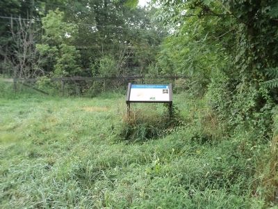
Battles of Falling Waters Marker
SHOWN IN SOURCE-SPECIFIED ORDER
| On Encampment Road east of Williamsport Pike (U.S. 11), on the left when traveling south. |
| | During the Civil War, the strategically important Valley Turnpike crossed the stream just above the small waterfall here. Two battles were fought nearby. The first occurred on July 2, 1861, half a mile south on the Porterfield Farm. On the morning . . . — — Map (db m58083) HM |
| On Williamsport Pike (U.S. 11) 0.2 miles north of West Virginia Route 901, on the right when traveling north. Reported missing. |
| | On the morning of July 2, 1861, Federal troops under General Robert Patterson crossed the Potomac River from Maryland and marched toward Martinsburg. Confederate Colonel Thomas J. Jackson’s command marched from Camp Stephens, four miles north of . . . — — Map (db m180733) HM |
| On Hammonds Mill Road (County Route 901) at Williamsport Pike (U.S. 11), on the left when traveling east on Hammonds Mill Road. |
| | On the morning of July 2, 1861, Federal troops under General Robert Patterson crossed the Potomac River from Maryland and marched toward Martinsburg. Confederate Colonel Thomas J. Jackson’s command marched from Camp Stephens, four miles north of . . . — — Map (db m58080) HM |
| On Williamsport Pike (U.S. 11) at Hammonds Mill Road (County Route 901), on the right when traveling south on Williamsport Pike. |
| | On the morning of July 2, 1861, Federal troops under General Robert Patterson crossed the Potomac River from Maryland and marched toward Martinsburg. Confederate Colonel Thomas J. Jackson’s command marched from Camp Stephens, four miles north of . . . — — Map (db m58078) HM |
| On Hammonds Mill Road (West Virginia Route 901) at St. Andrews Drive (County Route 3/1), on the right when traveling west on Hammonds Mill Road. Reported damaged. |
| |
Here at Stumpy’s Hollow on the morning of July 2, 1861, Confederate Lieutenant Colonel J.E.B. Stuart captured a Union infantry company almost single-handedly. The Federals – Company I, fifteenth Pennsylvania Volunteers – were acting as . . . — — Map (db m45596) HM |
| On Williamsport Pike (U.S. 11), on the right when traveling north. |
| | On the morning of July 2, 1861, Federal troops under Gen. Robert Patterson crossed the Potomac River from Maryland and marched south toward Martinsburg. Colonel Thomas J. Jackson sent his men north from their camp north of town to block them and to . . . — — Map (db m41631) HM |
| On Williamsport Pike (U.S. 11), on the right when traveling north. |
| | In Memory of General “Stonewall” Jackson This tablet is erected by the Berkeley County Chapter United Daughters of the Confederacy to commemorate an instance of General Jackson’s remarkable bravery at all times in the face of the gravest . . . — — Map (db m41626) HM |
Apr. 29, 2024