2 entries match your criteria.
Related Historical Markers
By J. J. Prats, May 30, 2015
Great Eastern Divide Marker
SHOWN IN SOURCE-SPECIFIED ORDER
| 1 ► Virginia, Craig County, New Castle — KH-2 — Great Eastern Divide — Elevation — 2704 Feet — |
| This point marks a spot along the geographical feature known as the Great Eastern Divide. From here water of Sinking Creek flows southwest into the New River. The New River, probably the oldest stream in eastern North America, becomes the Kanawha . . . — — Map (db m84180) HM | |||
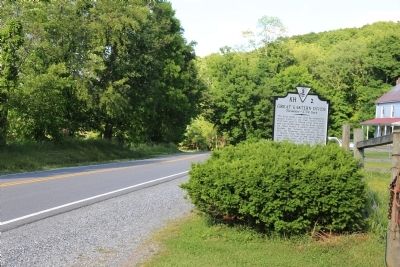
| 2 ► West Virginia, Monroe County, Centennial — Great Eastern Divide — |
| At this point atop the Alleghenies is the geographical feature known as the Great Eastern Divide, a natural barrier from which water flows to the Atlantic Ocean by way of the Jackson and James rivers and to the Gulf of Mexico via the Greebrier, New, . . . — — Map (db m62558) HM | |||