3 entries match your criteria.
Related Historical Markers
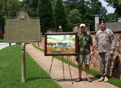
Battle of Utoy Creek by markers.
By Mrs. Sarahlyn Davies Bennett, Contributor BBC, August 6, 2009
Battle of Utoy Creek Marker
SHOWN IN SOURCE-SPECIFIED ORDER
| On Cascade Road (Georgia Route 154) at Woodland Terrace, on the right when traveling west on Cascade Road. |
| | Federal siege operations not only involved the encircling line of Atlanta's defenses, but threatened the 2 railroads S.W. of the city. Pursuant thereto, Federal forces after the Battle of Ezra Church were shifted S., only to be confronted by a line . . . — — Map (db m71443) HM |
| On Cascade Road (Georgia Route 154) at Woodland Terrace, on the right when traveling west on Cascade Road. |
| | Aug 6, 1864. The ridge just S. (densely wooded at the time) was fortified & held by Gen. W. B. Bate's div., Hardee's A.C. (CSA). It extended west from the Atlanta to East Point works, & blocked further Federal moves toward the railroads. To . . . — — Map (db m8839) HM |
| On Cahaba Drive at Bayberry Drive, on the left when traveling north on Cahaba Drive. |
| | Utoy Primitive Baptist Church, the oldest Baptist Church in present Fulton County, was constituted August 15, 1824, in a log house just west of here. The church was moved to its present location in the summer of 1828. In 1864 the church was used as . . . — — Map (db m8876) HM |
May. 10, 2024