3 entries match your criteria.
Related Historical Markers
To better understand the relationship, study each marker in the order shown.
By Richard E. Miller, August 7, 2010
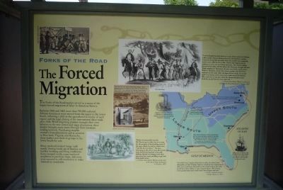
Forks of the Road Historical Site Marker, Panel 2
SHOWN IN SOURCE-SPECIFIED ORDER
| On Liberty Road south of St. Catherine St. (U.S. 61), on the right when traveling north. |
| On Liberty Road at St Catherine Street and Devereaux Drive (Business U.S. 61), on the left when traveling north on Liberty Road. |
| On West Street at Duke Street (Virginia Route 236) on West Street. |
May. 7, 2024