6 entries match your criteria.
Related Historical Markers
To better understand the relationship, study each marker in the order shown. All relate to TMER&L (The Milwaukee Electric Railway & Light Co.)
By Paul F, May 3, 2010
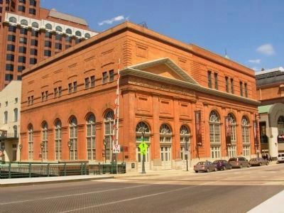
Oneida Street Station and Marker
SHOWN IN SOURCE-SPECIFIED ORDER
| On East Wells Street, 0.1 miles west of North Water Street, on the left when traveling east. |
| On Washington Ave., on the right when traveling north. |
| On North 3rd Street at West Michigan Street on North 3rd Street. |
| On South Calhoun Road, 0.5 miles south of West Greenfield Avenue (Wisconsin Highway 59), on the right when traveling south. |
| On Oakton Road, 0.2 miles west of County Route SS, on the right when traveling west. |
| On Pioneer Drive, 0.2 miles south of Janesville Road, on the right when traveling south. |
May. 18, 2024