Captain George A. Carver was born in 1836. He was, in turn, a ship's carpenter, builder, owner and master. Later Carver helped found a successful New York ship chandlery business.Retiring in 1893, Carver returned to Searsport, . . . — — Map (db m46646) HM
Originally erected in 1870 between Mt. Ephraim and Goodall Streets, this monument displays the names of 18 fallen Searsport men. It was dismantled in 1896 and moved to the current location in front of the new Masonic and Odd Fellows . . . — — Map (db m46641) HM
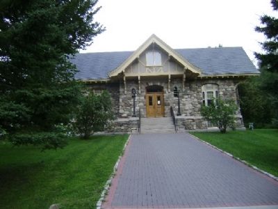
Early financial business in Searsport was transacted in Counting Houses. The growth of commerce and industry in the mid 19th Century created the need for a bank. On August 1, 1853, Jeremiah Merithew organized the Searsport Bank which . . . — — Map (db m46652) HM
"First came the short white undershirt and underpants. Next came the vest with two rows of buttons the first of which held up the underpants, then the white blouse with a large Buster Brown collar tied with a very wide bow. The . . . — — Map (db m46642) HM
When Searsport was incorporated in 1845, Main Street consisted of 2 rows of shops and homes. The first brick building, Leach Block, built in 1834, is in center right of the photograph. To the left of that building is the tall three . . . — — Map (db m46650) HM
In the 19th Century, Searsport was a busy prosperous town. Although best known for shipbuilding and its supporting industries, there was a barrel factory, a spool factory and grain and lumber mills. In one block on Main Street there . . . — — Map (db m46648) HM
For the better part of the 19th Century Searsport shores were busy with shipbuilding and supporting industries. Close to the yards were steam sheds for bending timbers and planking, blacksmith shops, oakum shops, an iron foundry and . . . — — Map (db m46651) HM
In 1850, 216 Searsport men listed their occupations as sailor. This work was what they knew; it was traditional in this and other maritime communities. The men were often gone for years at a time. Young men also left Searsport to go . . . — — Map (db m46653) HM
It was about 1:30 PM - a hot still afternoon. Thunder clouds built up rapidly. A black funnel cloud appeared northwest of town. The air was full of dust and flying debris. The 1859 Phineas Pendleton House across the street was lifted . . . — — Map (db m46658) HM
Searsport House was one of the best hotels to be found outside the larger cities, according to The Industrial Journal, Dec. 1909. Built in 1831, the original building was occupied as a private dwelling until 1835 when it was . . . — — Map (db m46654) HM
Until 1800, Settlers in the area were occupied in establishing themselves on the land. At the same time trade up and down the coast and with Massachusetts was by water in sloops and small schooners. These coastal farmers were as much . . . — — Map (db m46659) HM
Captain Freeman McGilvery (1824-1864) captained two ships prior to the Civil War. At age 38, at sea, he learned of the "Southern Insurrection" and returned to Maine to offer his services to the governor. Assigned to command the 6th . . . — — Map (db m46661) HM
On the site across the stream, there was first a grain and then a lumber mill. The dammed up stream provided power to turn the wheel to grind the grain or saw the logs. The stream also provided a conduit for logs floated down to the . . . — — Map (db m46657) HM
Local entrepreneur Frank Lane constructed this building in 1860. A Boston architect, George Harding, designed it as a venue for traveling and local theater productions and community receptions. It was also used for basketball in the . . . — — Map (db m46644) HM
In the 1850s, with no public transportation, children had to walk to school or ride in a wagon. If Searsport families wanted to educate their children, facilities had to be provided within walking distance of their homes. There were . . . — — Map (db m46655) HM