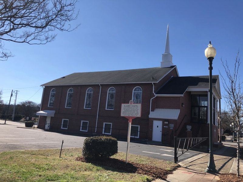
This trail honors the people and places – both the well-known and the unsung – that were critical to the Civil Rights Movement in North Carolina. Plans call for installing 50 markers across the Tar Heel State between 2021 and 2023. Supported by the William G. Pomeroy Foundation, the trail is presented by the NC African American Heritage Commission in partnership with the NC Office of Archives & History and Visit NC.
On East Union Street (Business U.S. 70) north of Bouchelle Street, on the right.
Black mothers led fight for equality in education. Organized meetings and demonstrations here, 1961. Inspired nonviolent change. — — Map (db m240443) HM
On East Warren Street east of South Dale Street, on the right when traveling east.
African Americans, led by local high school students, held sit-ins and picketed businesses in Feb. 1960 to demand desegregation. — — Map (db m196330) HM
On Panola Street at East Chuirch Street, on the right when traveling south on Panola Street.
East Tarboro Citizens League formed here June 1963. Led by Dr. Moses Ray. Improved housing, jobs, and voting rights for black residents. — — Map (db m226885) HM
Near East Florida Street east of Randolph Avenue, on the right when traveling east.
On Dec. 7, 1955, six Black
men teed up at whites-only
Gillespie Golf Course. Act
of civil disobedience paved
way for 1962 integration. — — Map (db m234029) HM
On South Main Street (North Carolina Route 1993) at Nathan Hunt Drive, on the right when traveling north on South Main Street.
African American doctors played golf in Dec. 1954 to challenge segregation at city's Blair Park course. Integrated in March 1956. — — Map (db m234019) HM
On Pope Street east of Lodge Street, on the left when traveling east.
County-wide org. led voter registration drives. Held protests and other civil rights activities, 1964-69. Headquarters were here. — — Map (db m290869) HM
On South McDaniel Street (U.S. 301) at East Burnette Avenue, on the right when traveling south on South McDaniel Street.
Johnson v. Branch, Federal Appeals Court case in 1966, protected teachers involved in civil rights movement. The plaintiff lived here. — — Map (db m260620) HM
On East Johnston Street west of South 3rd Street, on the right when traveling east.
In 1957, four Black citizens entered town library to demand access. Resulting action and advocacy ended segregation in the library. — — Map (db m291718) HM
On Dr Martin Luther King Jr Boulevard (North Carolina Route 55) at East Washington Avenue, on the right when traveling north on Dr Martin Luther King Jr Boulevard.
Adkin High School students walked out in protest of inferior facilities. Led to construction of new gymnasium & classrooms. — — Map (db m226229) HM
On East Caswell Street east of North Queen Street, on the left when traveling east.
African American women & youth led sit-ins, boycotts, and picketing, 1960-1961. Effort led to desegregation of downtown businesses. — — Map (db m226234) HM
On North 3rd Street at Princess Street, on the right when traveling north on North 3rd Street.
Doctor, Civil Rights leader, influential tennis mentor, early advocate for improved schools & access to medical care. Lived in this vicinity. — — Map (db m224841) HM
On North Church Street (North Carolina Route 305) at Bagley Drive, on the left when traveling north on North Church Street.
County's first black School Board member, 1971. Led efforts to integrate local schools and provide equity in education & facilities. — — Map (db m227062) HM
On North Roberson Street 0.1 miles north of West Rosemary Street, on the right when traveling north.
Est. as community center for African Americans in 1945. Became key space for fellowship and organizing local civil rights activities. — — Map (db m232687) HM
On East Main Street west of South Martin Luther King Jr. Drive, on the left when traveling west.
On Feb. 11, students from nearby Elizabeth City State began sit-ins at W. T. Grant lunch counter, here. Chain integrated counters July 11. — — Map (db m266252) HM
On Oberlin Road 0.1 miles south of Wade Avenue, on the right when traveling south.
From 1956 to 1959, Joseph and Elwyna Holt led effort to integrate the City of Raleigh school system. They lived 120 yards south. — — Map (db m233353) HM
On Woodburn Road north of Clark Avenue, on the right when traveling north.
Protests against segregated lunch counters. Here, Feb. 1960, led to 41 arrests. Later acquittals marked noted civil rights victory. — — Map (db m233232) HM
On West Franklin Street west of South Main Street (U.S. 401), on the left when traveling west.
Built by black citizens in 1936 as library, lavatory, & gathering space. Hub for educational programs and civil rights activities. — — Map (db m257386) HM