After filtering for Wyoming, 109 entries match your criteria. Entries 101 through 109 are listed.⊲ Previous 100
Native Americans Topic
By Bill Coughlin, July 25, 2015
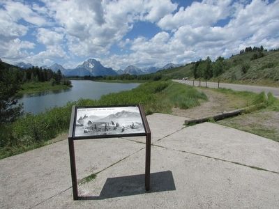
11,000 Summers in the Tetons Marker
| 101 ► Wyoming, Teton County, Moran — 11,000 Summers in the Tetons — Grand Teton National Park — |
| This slow-moving channel of the Snake River at Oxbow Bend sustains many different animals. Every year thousands of visitors come here to see them. Like you, Indian tribes such as Shoshone, Bannock, Blackfoot, Crow, Nez Perce and Gros Ventre have . . . — — Map (db m87601) HM | |||
| 102 ► Wyoming, Teton County, Moran — Leading the Way — |
| Togwotee (pronounced "TOE-go-tee") Pass lies at the head of the Wind River, astride the Great Divide. This 9,658-foot pass was an ancient travel route for the Tukudika people, who lived among these high, rugged peaks and migrated on foot for . . . — — Map (db m96370) HM | |||
| 103 ► Wyoming, Teton County, Yellowstone National Park — Chance Encounter — |
| Across the meadow, a fire burned in the campsite of nine tourists on the night of August 23, 1877. The Cowan party had unknowingly camped near hundreds of Nez Perce men, women, and children who were under violent pursuit by the United States Army. . . . — — Map (db m45254) HM | |||
| 104 ► Wyoming, Teton County, Yellowstone National Park — Nez Perce War — |
| Journey through Yellowstone On August 23, 1887, more than 600 men, women, and children camped in the woods near here. Sustained by courage, social structure, and knowledge of the land, they were midway from their homeland in . . . — — Map (db m45256) HM | |||
| 105 ► Wyoming, Uinta County, Evanston — Bear River Watershed — |
| The Bear River Watershed spreads across 7,500 square miles of mountain and valley lands that encompass portions of Idaho, Utah, and Wyoming. Bear River is the main tributary to the Great Salt Lake and is the longest stream in the western hemisphere . . . — — Map (db m67972) HM | |||
| 106 ► Wyoming, Uinta County, Evanston — Native Americans — |
| Both Shoshone and Arapahoe Indians camped in this area from the early 1800s until the Fort Bridger Treaty Council of 1868 established the Wind River Reservation. They traded beadwork and pelts to the early pioneers for other goods. Chief . . . — — Map (db m90123) HM | |||
| 107 ► Wyoming, Uinta County, Evanston — Wyoming's Sagebrush Sea — |
| Your trip across Wyoming takes you through vast expanses of shrublands made up mostly of sagebrush. To the casual observer this landscape may appear desolate, but sagebrush shrublands are diverse and home to a variety of wildflowers, birds, and . . . — — Map (db m67971) HM | |||
| 108 ► Wyoming, Uinta County, Fort Bridger — Women at the Trading Post — |
| This archaeological excavation has helped to document the prominent roll Native American women played in the day-to-dat activities of the trading post. They traded with travelers, provided food for guests, and at times, actually ran the post. . . . — — Map (db m90620) HM | |||
| 109 ► Wyoming, Weston County, Newcastle — Salt Creek Overlook — |
| The Black Hills, named after the dark green carpets of pines that cover the hills, are a geological wonder. Covering some 125 miles north to south and 65 miles east to west, the Hills rise 3,000 to 4,000 feet above the red valley floor. Below you . . . — — Map (db m98171) HM | |||
109 entries matched your criteria. Entries 101 through 109 are listed above. ⊲ Previous 100