
Annapolis in Anne Arundel County, Maryland — The American Northeast (Mid-Atlantic)
Maryland State House
The Naval War of 1812 in Annapolis
| — | Don't Give Up the Ship! | — |
Photographed by Allen C. Browne, February 8, 2013
1. Maryland State House Marker
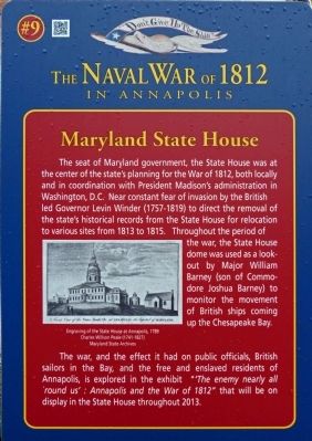
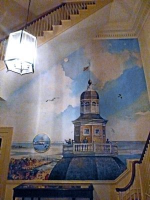
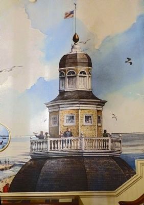
The seat of Maryland government, the State House was at the center of the state's planning for the War of 1812, both locally and in coordination with President Madison's administration in Washington, D.C. Near constant fear of invasion by the British led Governor Levin Winder (1757-1819) to direct the removal of the state's historical records from the State House for relocation to various sites from 1813 to 1815. Throughout the period of the war, the State House dome was used as a lookout by Major William Barney (son of Commodore Joshua Barney) to monitor the movement of British ships coming up the Chesapeake Bay.
The war, and the effect it had on public officials, British sailors in the Bay, and the free and enslaved residents of Annapolis, is explored in the exhibit "'The enemy nearly all `round us' : Annapolis and the War of 1812" that will be on display in the State House throughout 2013.
[Caption:]
Charles Willson Peale (1741-1827)
Maryland State Archives
Erected by United States Naval Academy. (Marker Number 9.)
Topics and series. This historical
this page online
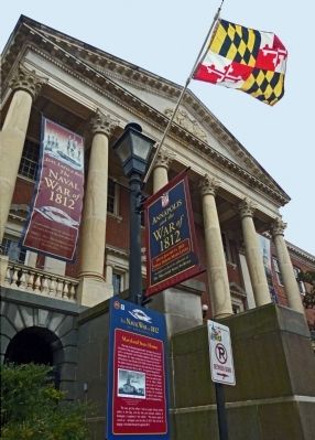
Location. Marker has been permanently removed. It was located near 38° 58.723′ N, 76° 29.485′ W. Marker was in Annapolis, Maryland, in Anne Arundel County. It was on State Circle. Marker is to the left of the front door of the Maryland State House. Touch for map. Marker was in this post office area: Annapolis MD 21401, United States of America.
We have been informed that this marker is no longer there and will not be replaced. This page is an archival view of what was.
Regionally, this marker was in Central Maryland. It was also in the American Mid-Atlantic, in the Chesapeake Bay Region, and on the Eastern Seaboard. Globally, it was in the North Atlantic Region, North America, the Western Hemisphere, the Western World, and the Anglosphere. Historically, it found itself in what was once one of the original Thirteen Colonies and also the Antebellum South.

Other nearby markers. At
Photographed by Allen C. Browne, February 8, 2013
2. Maryland State House Marker
Another marker is no longer nearby. Baron Johann de Kalb, 1721 - 1780 (was within shouting distance of this marker but has been replaced with another marker now near it).
Related markers. Click here for a list of markers that are related to this marker. The Naval War of 1812 in Annapolis Walking Tour.
Photographed by Allen C. Browne, February 8, 2013
3. The State House Dome and Maryland Flag
Photographed by Allen C. Browne, February 8, 2013
4. Richard Schlecht’s War of 1812 Mural
Photographed by Allen C. Browne, February 8, 2013
5. Watching from the State House Dome
Commodore Barney's Son William views the British Fleet from the State House Dome on Richard Schlecht’s Mural
Photographed by Allen C. Browne, February 8, 2013
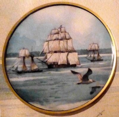
6. The HMS Menelaus
Seen through an "excellent glass" from the State House dome on August 20, 1814, on Richard Schlecht’s Mural.
21 enslaved African Americans from Annapolis took the opportunity of the panic engendered by the British presence to escape to the Menelaus.
21 enslaved African Americans from Annapolis took the opportunity of the panic engendered by the British presence to escape to the Menelaus.
Photographed by Allen C. Browne, February 8, 2013
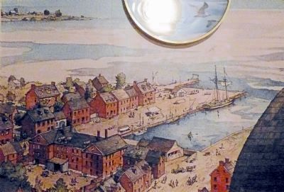
7. The Port of Annapolis
During the war of 1812 the Naval Academy had yet to be founded. Annapolis was an important Maryland sea-port and the Capital of the State. Detail from Richard Schlecht’s Mural.
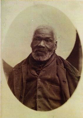
8. Gabriel Hall
The exhibit "The Enemy Nearly All 'Round Us" in the State House includes this photo of Gabriel Hall, an African American Refugee from Maryland who went over to the British during the War of 1812. He settled in Halifax Nova Scotia following the war.(Nova Scotia Archives and Records Management)
Credits. This page was last revised on July 13, 2026. It was originally submitted on February 23, 2013, by Allen C. Browne of Silver Spring, Maryland. This page has been viewed 1,027 times since then and 35 times this year. Last updated on July 10, 2026, by Evan Dwyer of Richmond, Virginia. Photos: 1, 2, 3, 4, 5, 6, 7, 8. submitted on February 23, 2013, by Allen C. Browne of Silver Spring, Maryland. • Devry Becker Jones was the editor who published this page.
