Utrecht, Netherlands — Northwestern Europe
Mariakerk / St. Mary's Church
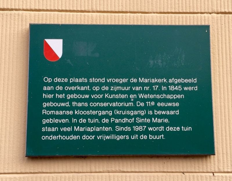
[English translation:]
Topics. This historical marker is listed in this topic list: Churches & Religion.
Location. 52° 5.385′ N, 5° 7.01′ E. Marker is in Utrecht. Marker is at the intersection of Mariaplaats and Mariastraat, on the right when traveling east on Mariaplaats. Touch for map. Marker is in this post office area: Utrecht 3511 LL, Netherlands. Touch for directions.
Other nearby markers. At least 8 other markers are within walking distance of this marker. Sociëteit De Vereeniging / “The Association” Society (within shouting distance of this marker); Congresgebouw De Vereeniging / Congress Building of “De Vereeniging” (within shouting distance of this marker); Gebouw Voor Kunst En Wetenschappen / Arts and Science Building (within shouting distance of this marker); Een Singel Rondom / A Defensive Canal All Around (about 90 meters away, measured in a direct line); Eloyen Gasthuis / Eloyen Almshouse (about 150 meters away); Het Vakwerkhuis / The Half-Timbered House (about 210 meters away); Het Duitse Huis / The German House (about 210 meters away); Maartensbrug en Oude Gracht / "St. Martin's Bridge" on the Old Canal (approx. 0.2 kilometers away). Touch for a list and map of all markers in Utrecht.
Regarding Mariakerk / St. Mary's Church. The "Marian Plants" mentioned on the marker are plants that are related to St. Mary by tradition or biblically, e.g. roses and lilies.
Also see . . .
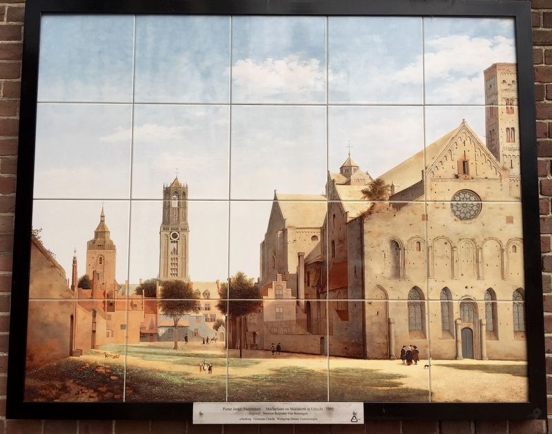
1. St. Mary's Church, Utrecht (Wikipedia). St. Mary's Church, also called Mariakerk or Maria Maior, was one of five collegiate churches in the Dutch city of
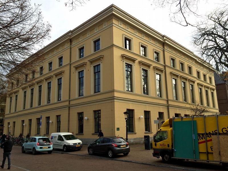
Utrecht, the others being St. Martin's Cathedral, St. Salvator's Church, the Pieterskerk, and the Janskerk. It dated from the eleventh century and was considered one of the finest buildings in Romanesque style in the Netherlands....The church was demolished in stages during the first half of the nineteenth century. Today only the cloister at the Mariaplaats remains, behind the Gebouw voor Kunsten en Wetenschappen which houses the Utrecht Conservatory. (Submitted on December 22, 2016.)
2. Mariakerk in Utrecht, kunsthistorische afbeeldingen, exterieur (derode3d.nl). A collection of numerous depictions of the Mariakerk by various artists. (Submitted on December 22, 2016.)

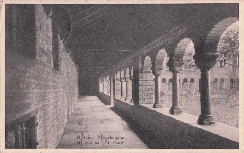
Postcard by Veenenk & Snel, den Haag, 1933
4. Kloostergang der kerk van St. Marie - The church cloister
The cloister of St. Mary's Church was spared because at the time of the demolition of the church it resided on the territory of the Old Catholic Church. Of the three arms is the western arm is the oldest, originating in the eleventh century. The other arms arose around 1140. During later repairs of the cloister, the original tuff walls were replaced by brick. The columns and capitals are sandstone. The westarm was rebuilt in 1633. Restorations took place during the early twentieth century. - Wikipedia
Credits. This page was last revised on January 1, 2024. It was originally submitted on December 22, 2016, by Andrew Ruppenstein of Lamorinda, California. This page has been viewed 221 times since then and 7 times this year. Photos: 1, 2, 3, 4. submitted on December 22, 2016, by Andrew Ruppenstein of Lamorinda, California.


