Grand Island in Erie County, New York — The American Northeast (Mid-Atlantic)
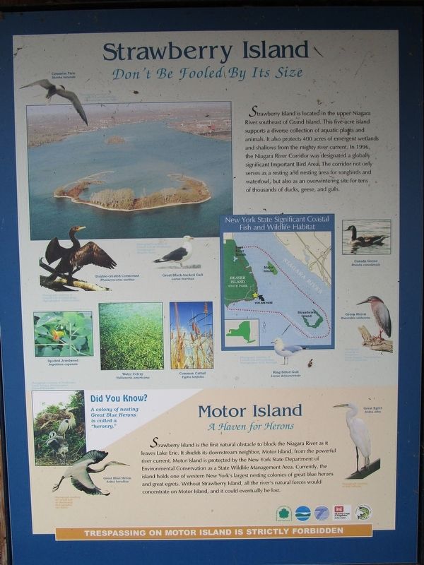
Strawberry Island
Don't Be Fooled By Its Size
[map] New York State Significant Coastal Fish and Wildlife Habitat.
[captions:]
Common Tern, Sterna hirundo. Photograph courtesy of Cornell Lab of Ornithology. Photographer [illegible].
Double-crested Cormorant, Phalacrocorax auritus. Photograph courtesy of Cornell Lab of Ornithology. Photographer: Chris Crowley.
Great Black-backed Gull, Larus marinus. Photograph courtesy of Cornell Lab of Ornithology. Photographer: Stephen Kress.
Spotted Jewelweed, Impatiens capensis.
Water Celery, Vallisneria americana.
Common Cattail, Typha latifolia. Canada Goose, Branta canadensis. Photograph courtesy of Freshwater Creek Images. Photographer: Edward Sambolin
Green Heron, Butorides virescens.
Ring-billed Gull, Larus delawarensis. Photograph courtesy of Cornell Lab of Ornithology. Photographer: O.S. Pettingill.
Did You Know? A colony of nesting Great Blue Herons is called a "heronry." Photograph courtesy of Freshwater Creek Images. Photographer: Edward Sambolin.
Motor Island A haven for Herons.
Strawberry Island is the first natural obstacle to block the Niagara River as it leaves Lake Erie. It shields its downstream neighbor, Motor Island, from the powerful river current. Motor Island is protected by the New York State Department of Environmental Conservation as a State Wildlife Management Area. Currently, the island holds one of western New York's largest nesting colonies of great blue herons and great egrets. Without Strawberry Island, all the river's natural forces would concentrate on Motor Island, and it could eventually be lost.
Trespassing on Motor Island is strictly forbidden.
[captions:]
Great Blue Heron, Ardea herodias. Photograph courtesy of Cornell Lab of Ornithology. Photographer: Lee Kuhn.
Great Egret, ardea alba. Photograph courtesy of Bob Labuski.
Topics. This historical marker is listed in these topic lists: Animals • Entertainment • Waterways & Vessels.
Location. 42° 57.551′ N, 78° 56.329′ W. Marker is on Grand Island, New York, in Erie County. Marker is on Park Road Loop at Area 3, on the
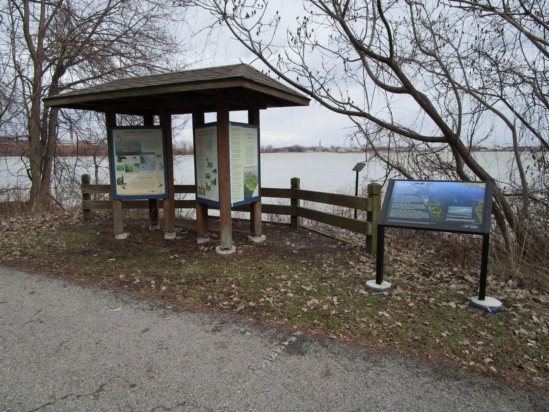
right when traveling east. Marker is along the park road loop beyond area 3 in Beaver Island State Park. Touch for map. Marker is in this post office area: Grand Island NY 14072, United States of America. Touch for directions.
Other nearby markers. At least 8 other markers are within walking distance of this marker. Management (here, next to this marker); Recovery (here, next to this marker); Did You Ever Wonder What It Takes to Restore an Island? (here, next to this marker); a different marker also named Strawberry Island (here, next to this marker); A Home for Fish (here, next to this marker); Island Life (here, next to this marker); Allenton Farm/Creating Beaver Island State Park (approx. 0.2 miles away); Grover Cleveland & Grand Island / Lewis F. Allen & Western New York (approx. 0.2 miles away). Touch for a list and map of all markers in Grand Island.
Also see . . . Beaver Island - New York State Office of Parks, Recreation & Historic Preservation. Vehicle entrance fee collected in season. (Submitted on January 28, 2017, by Anton Schwarzmueller of Wilson, New York.)
Credits. This page was last revised on January 28, 2017. It was originally submitted on January 28, 2017, by Anton Schwarzmueller of Wilson, New York. This page has been viewed 385 times since then and 29 times this year. Photos: 1, 2, 3. submitted on January 28, 2017, by Anton Schwarzmueller of Wilson, New York.


