Colonia Tabacalera in Ciudad de México, Mexico — The Valley of Mexico (The Central Highlands)
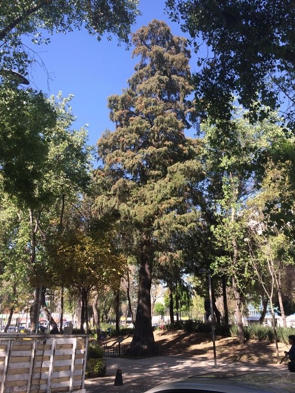
The Juárez Tree
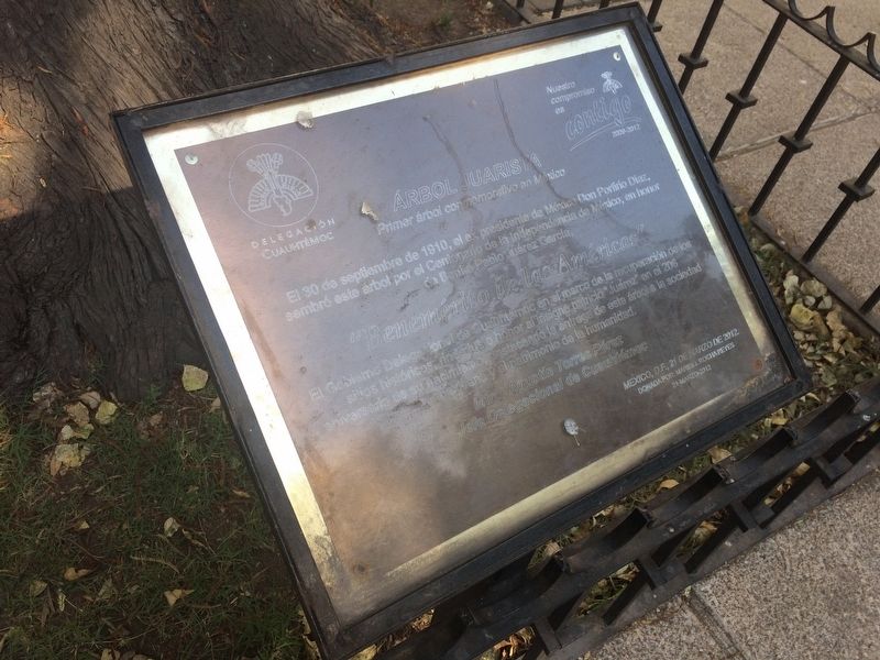
Primer ábol conmemorativo en México
El 30 de septiembre de 1910, el ex presidente de México Don Porfirio Díaz,
sembró este árbol por el Centenario de la Independencia de México, en honor
de Benito Pablo Juárez García.
“Benemérito de la Ámericas”
El Gobierno Delegacional de Cuauhtémoc en el marco de la recuperación de los
sitios históricos, rinde justo honor al insigne patricio “Juárez” en el 206
aniversario de su nacimiento, destacando la entrega de este árbol a la sociedad
mexicana y al patrimonio de la humanidad.
Mtro. Agustín Torres Pérez
Jefe Delegacional de Cuauhtémoc
México, D.F., 21 de Marzo de 2012.
Donado por: Maribel Rocha Reyes
21-Marzo-2012
First commemorative tree in Mexico
On September 30, 1910, the ex-president of Mexico, Porfirio Díaz, planted this tree on the 100th anniversary of the independence of Mexico, in honor of Benito Pablo Juárez García.
“Most Worthy of the Americas”
The Government of the Delegation of Cuauhtémoc, as part of their ongoing effort to recover historic sites, honors the illustrious statesman “Juárez” on the 206th anniversary of his birth, and remembers this tree to both the Mexican society and as a part of the world’s heritage.
Agustín Torres Pérez
Cuauhtémoc Delegation Chief
México, D.F., Marzo 21, 2012.
Donated by: Maribel Rocha Reyes
March 21, 2012
Erected 2012 by Gobierno Delegacional de Cuauhtémoc.
Topics and series. This historical marker is listed in these topic lists: Government & Politics • Patriots & Patriotism • Wars, Non-US. In addition, it is included in the Historic Trees series list. A significant historical date for this entry is March 21, 2012.
Location. 19° 25.904′ N, 99° 9.491′ W. Marker is in Ciudad de México. It is in Colonia Tabacalera. Marker is on Paseo de la Reforma just east of Calzada Manuel Villalongín, on the right when traveling west. Touch for map. Marker is in this post office area: Ciudad de México 06030, Mexico. Touch for directions.
Other nearby markers. At least 8 other markers are within walking distance of this marker. Manuel Ojinaga (a few steps from this marker); Plutarco González (within shouting distance of this marker); Louis Pasteur (within shouting distance of this marker); León Guzmán (within shouting distance of this marker); Esteban Coronado (within shouting distance of this marker); Guadalupe Victoria (within shouting distance of this marker); Francisco Zarco (within shouting distance of this marker); Monument to Cuauhtémoc and His Warriors (about 120 meters away, measured in a direct line). Touch for a list and map of all markers in Ciudad de México.

Photographed By J. Makali Bruton, January 23, 2017
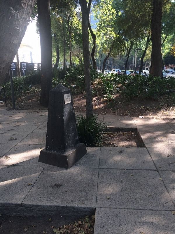
3. The Zero Level Point of the Paseo de la Reforma
Near the Juárez Tree is this small monument to the point used to plan the Paseo de la Reforma. It reads:
Nivel Cero de la Ciudad de Mexico
Plan de Nivel del
Paseo de la Reforma
Fijado en 1875 para servir
de referencia topografica
para el trazo de la avenida
English translation:
The Zero Point of the City of Mexico
The Construction Plan of the Paseo de la Reforma
Fixed in 1875 in order to serve as the topographic reference point for the construction of the avenue.
Plan de Nivel del
Paseo de la Reforma
Fijado en 1875 para servir
de referencia topografica
para el trazo de la avenida
The Construction Plan of the Paseo de la Reforma
Fixed in 1875 in order to serve as the topographic reference point for the construction of the avenue.
Credits. This page was last revised on April 17, 2020. It was originally submitted on May 8, 2017, by J. Makali Bruton of Accra, Ghana. This page has been viewed 207 times since then and 20 times this year. Photos: 1, 2, 3. submitted on May 8, 2017, by J. Makali Bruton of Accra, Ghana.

