From Dirt Path to Main Street
Brunswick
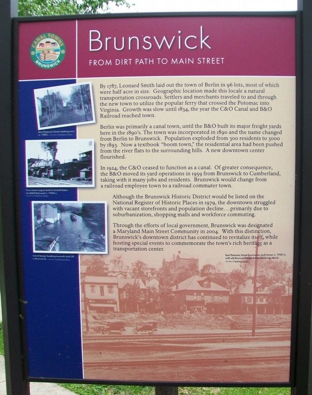
By 1787, Leonard Smith laid out the town of Berlin in 96 lots, most of which were half acre in size. Geographic location made this locale a natural transportation crossroads. Settlers and merchants traveled to and through the new town to utilize the popular ferry that crossed the Potomac into Virginia. Growth was slow until 1834, the year the C&O Canal and B&O Railroad reached town.
Berlin was primarily a canal town, until the B&O built its major freight yards here in the 1890's. The town was incorporated in 1890 and the name changed from Berlin to Brunswick. Population exploded from 300 residents to 3000 by 1893. Now a textbook "boom town," the residential area had been pushed from the river flats to the surrounding hills. A new downtown center flourished.
In 1924, the C&O ceased to function as a canal. Of greater consequence, the B&O moved its yard operations in 1959 from Brunswick to Cumberland, taking with it many jobs and residents. Brunswick would change from a railroad employee town to a railroad commuter town.
Although the Brunswick Historic District would be listed on the National Register of Historic Places in 1979, the downtown struggled with vacant storefronts and population decline....primarily due to suburbanization, shopping malls and workforce commuting.
Through the efforts of local government, Brunswick
was designated a Maryland Main Street Community in 2004. With this distinction, Brunswick's downtown district has continued to revitalize itself, while hosting special events to commemorate the town's rich heritage as a transportation center.
[Photo captions, from top to bottom, read]
East Potomac Street looking west (c. 1905).
First steam engine built in United States for B&O Railroad (c. 1930's). [This is an incorrect statement]
Canal barge heading towards Lock 30 in Brunswick.
East Potomac Street businesses and homes (c. 1920's). with old Brunswick High School hovering above.
[Side B]
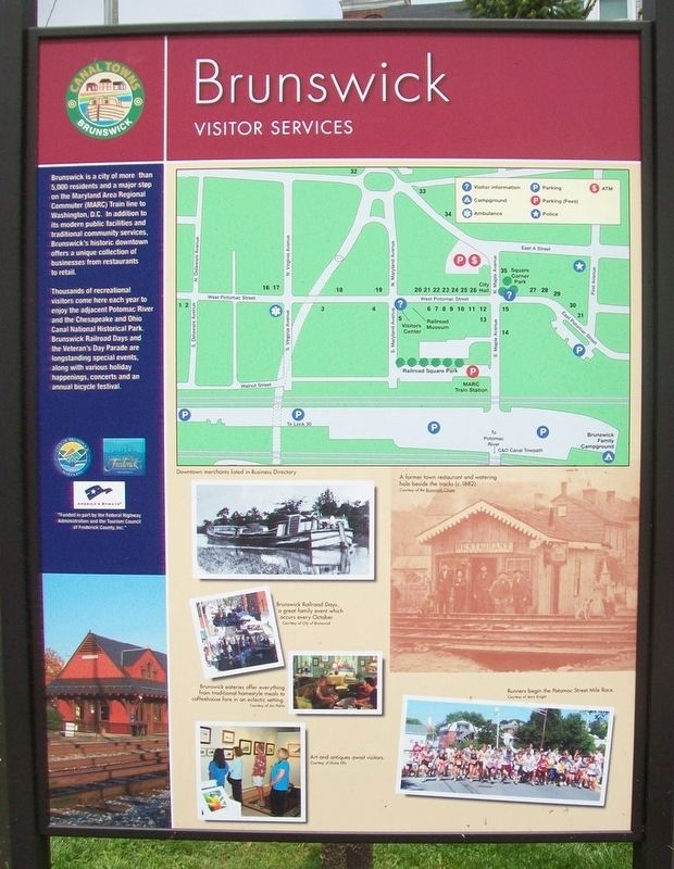
Brunswick Visitor Services
[Sepia colored photo caption reads] A former town restaurant and watering hole beside the tracks (c. 1882).
[Balance of marker is not historical in nature and is not transcribed]
Erected by Federal Highway Commission and the Tourism Council of Frederick County, Inc.
Topics. This historical marker is listed in these topic lists: Industry & Commerce • Railroads & Streetcars • Settlements & Settlers • Waterways & Vessels. A significant historical year for this entry is 1787.
Location. 39° 18.78′ N, 77° 37.609′ W. Marker is in Brunswick, Maryland, in Frederick County. Marker is at the intersection of Maple Avenue and
Other nearby markers. At least 8 other markers are within walking distance of this marker. Brunswick River Mural (within shouting distance of this marker); Iraq / Afghanistan Veterans Memorial (about 300 feet away, measured in a direct line); Brunswick (about 300 feet away); Veterans Memorial (about 400 feet away); Train No. 286 Bell Memorial (about 400 feet away); One Time Rivals (about 400 feet away); a different marker also named Brunswick (about 400 feet away); M-5 "JEB Stuart" Tank (about 500 feet away). Touch for a list and map of all markers in Brunswick.
Also see . . .
1. A Brief History of Brunswick. (Submitted on May 15, 2017, by William Fischer, Jr. of Scranton, Pennsylvania.)
2. Smoketown History (Brunswick, Md.) on Facebook. (Submitted on May 15, 2017, by William Fischer, Jr. of Scranton, Pennsylvania.)
3. Chesapeake & Ohio Canal National Historical Park. (Submitted on May 15, 2017, by William Fischer, Jr. of Scranton, Pennsylvania.)
Credits. This page was last revised on May 15, 2017. It was originally submitted on May 15, 2017, by William Fischer, Jr. of Scranton, Pennsylvania. This page has been viewed 261 times since then and 12 times this year. Photos: 1, 2, 3, 4. submitted on May 15, 2017, by William Fischer, Jr. of Scranton, Pennsylvania.


