Lansing in Ingham County, Michigan — The American Midwest (Great Lakes)
The Grand River / Grand River History
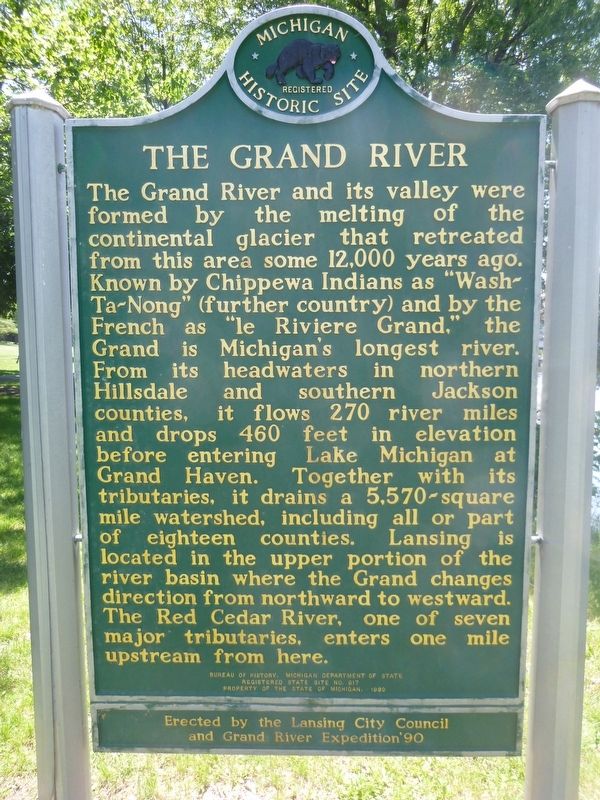
The Grand River and its valley were formed by the melting of the continental glacier that retreated from this area some 12,000 years ago. Known by Chippewa Indians as Washtanong (further country) and by the French as le Riviere Grand, the Grand is Michigan's longest river. From its headwaters in northern Hillsdale and southern Jackson counties, it flows 270 river miles and drops 460 feet in elevation before entering Lake Michigan at Grand Haven. Together with its tributaries, it drains a 5,570-square-mile water shed, including all or part of eighteen counties. Lansing is located in the upper portion of the river basin where the Grand changes direction from northward to westward. The Red Cedar River, one of seven major tributaries, enters one mile upstream from here.
Grand River History
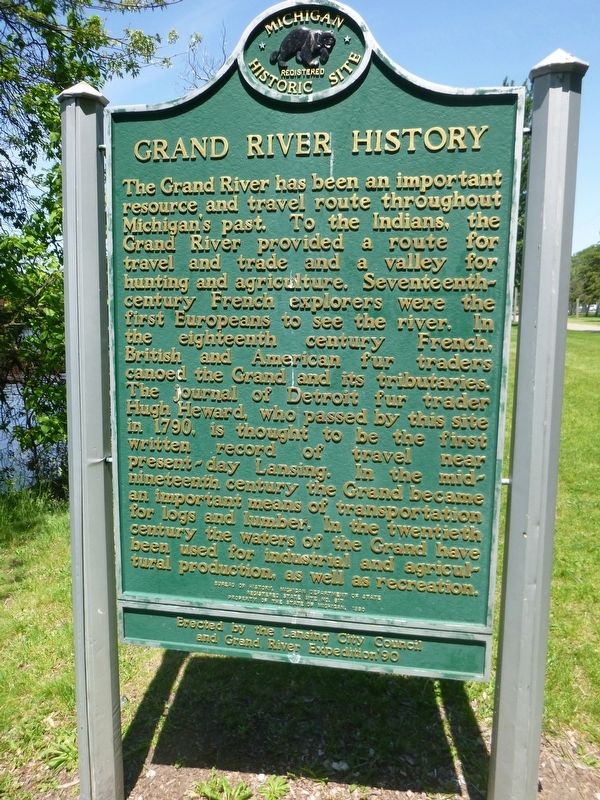
The Grand River has been an important resource and travel route throughout Michigan's past. To the Indians, the Grand River provided a route for travel and trade and a valley for hunting and agriculture. Seventeenth-century French explorers were the first Europeans to see the river. In the eighteenth century French, British and American fur traders canoed the Grand and its tributaries. The journal of Detroit fur trader Hugh Heward, who passed by this site in 1790, is thought to be the first written record of travel near present-day Lansing. In the mid-nineteenth century the Grand became an important means of transportation for logs and lumber. In the twentieth century the waters of the Grand have been used for industrial and agricultural production, as well as recreation.
Erected 1990 by Bureau of History, Michigan Department of State, Lansing City Council, and Grand River Expedition '90. (Marker Number S0617.)
Topics and series. This historical marker is listed in this topic list: Waterways & Vessels. In addition, it is included in the Michigan Historical Commission series list. A significant historical year for this entry is 1790.
Location. 42° 44.284′ N, 84° 32.846′ W. Marker is in Lansing, Michigan, in Ingham County. Marker can be reached from E. Shiawassee Street. The marker is located east of the Grand River in Lansing's Adado Riverfront Park. The park lies east of N. Grand Ave., between E. Saginaw on the north, and E. Shiawassee on the south. Touch for map. Marker is in this post office area: Lansing MI 48933, United States of America. Touch for directions.
Other nearby markers. At least 8 other markers are within walking distance of this marker. Joseph E. Warner (approx. 0.2 miles away); Lansing 9/11 Memorial (approx. 0.2 miles away); Drs. Pearl Kendrick and Grace Eldering (approx. ¼ mile away); Mack-e-te-be-nessy “Andrew J. Blackbird” c. 1815-1908 (approx. ¼ mile away); Jonas Salk (approx. ¼ mile away); William Crapo “Billy” Durant 1861-1947 (approx. 0.3 miles away); Walter Reuther 1907-1970 (approx. 0.3 miles away); Elijah McCoy 1843-1929 (approx. 0.3 miles away). Touch for a list and map of all markers in Lansing.
Credits. This page was last revised on June 3, 2017. It was originally submitted on June 2, 2017, by Bill Rieske of Lansing, Michigan. This page has been viewed 519 times since then and 84 times this year. Photos: 1, 2, 3, 4. submitted on June 2, 2017, by Bill Rieske of Lansing, Michigan. • Bill Pfingsten was the editor who published this page.


