North Virginia Beach , Virginia — The American South (Mid-Atlantic)
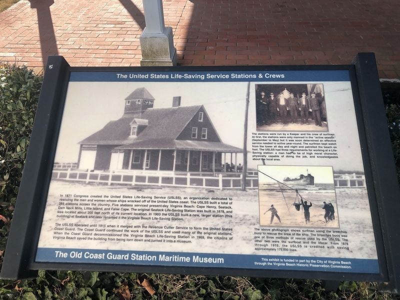
The United States Life-Saving Service Stations & Crews
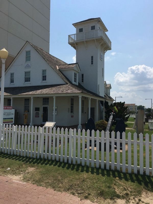
The Old Coast Guard Station Maritime Museum

Photographed By Devry Becker Jones (CC0), January 30, 2021
1. The United States Life-Saving Service Stations & Crews Marker
The USLSS operated until 1915 when it merged with Revenue Cutter Service to form the United States Coast Guard. The Coast Guard decommissioned the Virginia Beach Life-Saving Station in 1969, the citizens of Virginia Beach saved the building from being torn down and turned it into a museum.
(captions)
(top right) The stations were run by a Keeper and his crew of surfmen. At first, the stations were only manned in the “active season” (September to May) but it was soon determined an effective service needed to active year-round. The surfmen kept watch from the tower all day and night and patrolled the beach on foot. The USLSS had three requirements for working at a Life-Saving station: a man had to be of high moral character, physically capable of doing the job, and knowledgeable about the area.
(bottom right) The above photograph shows surfmen using the breeches buoy to rescue the crew of the ship. The breeches buoy was one of three methods of rescue used by the USLSS. The other two were the surfboat and the lifecar. From 1878 through 1915, the USLSS is credited with saving approximately 175,00o lives.
Erected by The Virginia Beach Historic Preservation Commission.
Topics. This historical marker is listed in these topic lists: Disasters • Waterways & Vessels.
Location. 36° 51.139′ N, 75° 58.53′ W. Marker is in Virginia Beach, Virginia. It is in North Virginia Beach. Marker can be reached from the intersection of Atlantic Avenue and 24th Street, on the right when traveling north. Located near the entrance to the Virginia Beach Surf & Rescue Museum, on the west side of the building. Touch for map. Marker is at or near this postal address: 2401 Atlantic Ave, Virginia Beach VA 23451, United States of America. Touch for directions.
Other nearby markers. At least 8 other markers are within walking distance of this marker. U.S. Coast Guard Virginia Lifeboat Stations (here, next to this marker); U-boats Off the Mid-Atlantic Coast (a few steps from this marker); Replica Race Point Surfboat (a few steps from this marker); The Life-Saving Station (a few steps from this marker); Outer planking from a vessel (a few steps from this marker); 24th Street Park (a few steps from this marker); Old Coast Guard Station (a few steps from this marker); The War of 1812 / President – Little Belt Affair (a few steps from this marker). Touch for a list and map of all markers in Virginia Beach.
Also see . . . Virginia Beach Surf & Rescue Museum. (Submitted on July 1, 2017.)
Credits. This page was last revised on February 1, 2023. It was originally submitted on June 30, 2017, by Brandon D Cross of Flagler Beach, Florida. This page has been viewed 442 times since then and 39 times this year. Photos: 1. submitted on January 31, 2021, by Devry Becker Jones of Washington, District of Columbia. 2. submitted on June 30, 2017, by Brandon D Cross of Flagler Beach, Florida. • Bernard Fisher was the editor who published this page.
