Emigrant Gap in Placer County, California — The American West (Pacific Coastal)
Big Bend
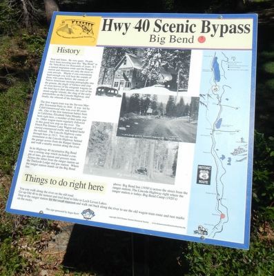
Hwy 40 Scenic Bypass
Inscription.
Stop and listen. Be very quiet. People have been traveling past this "Big Bend" in the Yuba River for thousands of years. It's a natural migration route and the Ranger station and museum are only the most recent arrivals. Maybe if you concentrate hard enough you will hear the sounds of Native Americans incising petroglyphs into the granite, the jingle of harness and the clop of oxen hooves of the emigrant wagons on their final leg to their dreams, the wail of the steam engine whistle, the chug of the early automobiles on the Lincoln Highway, and finally, the whoosh of the Interstate.
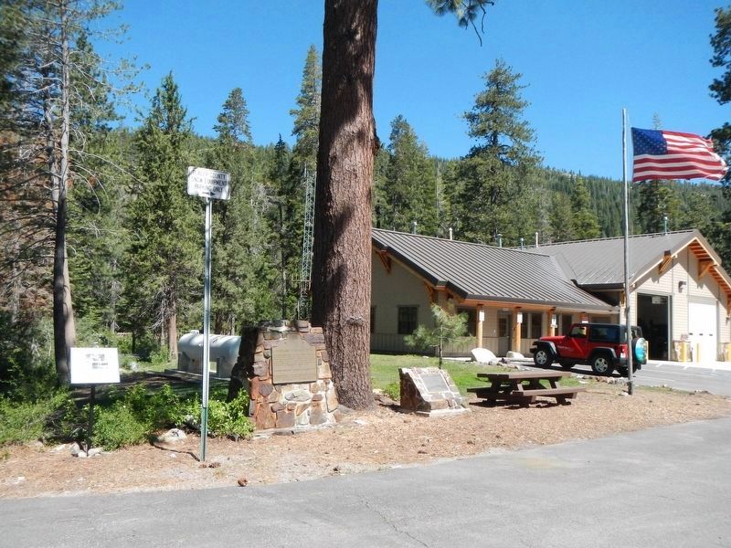
The first wagon train was the Stevens Murphy Townsend Party in 1844. It was led by Caleb Greenwood who was over 80 years old. One of the first American babies born in California, Elizabeth Yuba Murphy, was born right here, a member of that same party. Other wagon trains regularly followed to this good rest stop on the river. The Dutch Flat Donner Lake Wagon toll road carried commercial traffic and helped build the railroad. The Lincoln Highway came through here in 1913. You can see the monument to the Lincoln Highway behind the garage across from the Ranger Station and walk nearby section along the river.
In its Highway 40 incarnation Big Bend was a resting stop which included a couple of inns, gas station and grocery store. Across the street from the ranger station sat the Trailsyde Lodge and gas station. Where the ranger station stands sat the Big Bend Inn.
You can walk along the river on the old road. Go up Old 40 to the turnout and trail head to hike to Loch Leven Lakes. Stop at the ranger station for the small museum and walk out back along the river to see the old wagon train route and rust marks on the rocks.
Erected by Donner Summit Historical Society. (Marker Number 5.)
Topics and series. This historical marker is listed in this topic list: Roads & Vehicles. In addition, it is included in the Donner Summit Historical Society series list. A significant historical year for this entry is 1844.
Location. 39° 18.396′ N, 120° 31.068′ W. Marker is in Emigrant Gap, California, in Placer County. Marker is on Hampshire Rocks Road near Rainbow Road, on the left when traveling east. Touch for map. Marker is at or near this postal address: 49649 Hampshire Rocks Road, Emigrant Gap CA 95715, United States of America. Touch for directions.
Other nearby markers. At least 8 other markers are within 3 miles of this marker, measured as the crow flies. Overland Emigrant Trail (within shouting distance of this marker); Stephens-Townsend-Murphy Party (within shouting distance of this marker); The Lincoln Highway (about 300 feet away, measured in a direct line); a different marker also named Lincoln Highway (approx. 0.4 miles away); Rainbow Lodge (approx. half a mile away); Forest Gift Shop, Cisco Grove (approx. 1.4 miles away); Susan's Spot (approx. 1.4 miles away); Truckee Trail - Ascent to Lake and Valley (approx. 2.7 miles away). Touch for a list and map of all markers in Emigrant Gap.
Credits. This page was last revised on July 7, 2017. It was originally submitted on July 7, 2017, by Barry Swackhamer of Brentwood, California. This page has been viewed 493 times since then and 51 times this year. Photos: 1, 2. submitted on July 7, 2017, by Barry Swackhamer of Brentwood, California.

