Near Cullman in Cullman County, Alabama — The American South (East South Central)
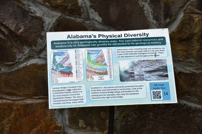
Alabama's Physical Diversity
Clarkson Bridge is located in the physiographic region called the Cumberland Plateau, which is at the most southern end of the Appalachian Plateau. The area is characterized by flat-topped high elevation and deep, steep valleys.
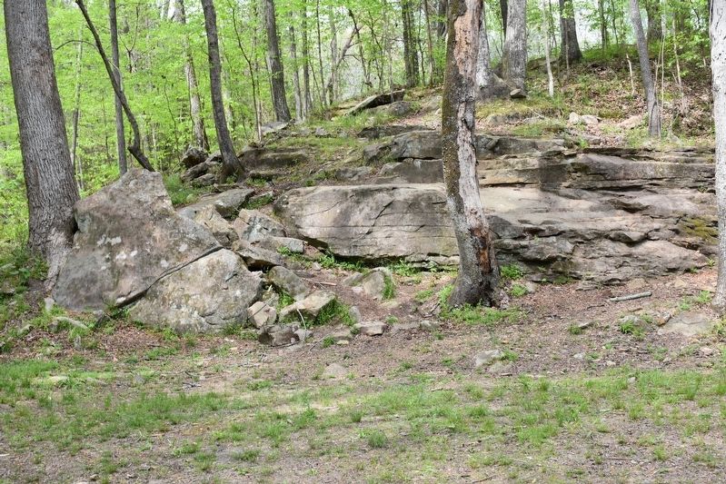
Sandstone is very porous and easily penetrated by water. It has been used commonly in construction. Look at the Clarkson Covered bridge pilings and boulders in the parking area for examples. Also note the sandstone exposed to the right of the bridge.
Sedimentary rocks, including shale and sandstone are the most common rock types found in the area which is part of the Pottsville Geological Formation. There are also deposits of coal throughout the region.
Topics. This historical marker is listed in these topic lists: Bridges & Viaducts • Environment.
Location. 34° 12.434′ N, 86° 59.427′ W. Marker is near Cullman, Alabama, in Cullman County. Marker is on County Road 1043. Located in Clarkson Covered Bridge Park. Touch for map. Marker is at or near this postal address: 1240 Co Rd 1043, Cullman AL 35057, United States of America. Touch for directions.
Other nearby markers. At least 8 other markers are within 2 miles of this marker, measured as the crow flies . Land-Use and Water Quality (a few steps from this marker); Clarkson Covered Bridge (within shouting distance of this marker); Alabama's Aquatic Biodiversity (within shouting distance of this marker); What happens to my wastewater? (within shouting distance of this marker); Where does your drinking water come from? (within shouting distance of this marker); Birds of Alabama (within shouting distance of this marker); Streight’s Raid (approx. 1.9 miles away); a different marker also named Streight’s Raid (approx. 1.9 miles away). Touch for a list and map of all markers in Cullman.
Also see . . . Clarkson Covered Bridge. One of Cullman's most well known attractions and historically rich sites, Clarkson Covered Bridge, originally built in 1904, and was once used regularly by farmers and travelers to cross Crooked Creek, the weatherworn bridge is now closed to traffic, the centerpiece of a park built in period fashion to showcase the bridge and its historical significance. The bridge was torn in two, in 1921 by a huge storm. One piece was left intact, the other swept down stream and soon salvaged. One year later, the project to repair the bridge with the salvaged material was completed. (Submitted on July 25, 2017, by Sandra Hughes Tidwell of Killen, Alabama, USA.)
Credits. This page was last revised on December 24, 2021. It was originally submitted on July 25, 2017, by Sandra Hughes Tidwell of Killen, Alabama, USA. This page has been viewed 297 times since then and 22 times this year. Photos: 1, 2. submitted on July 25, 2017, by Sandra Hughes Tidwell of Killen, Alabama, USA. • Bill Pfingsten was the editor who published this page.

