Marker Logo HMdb.org THE HISTORICAL
MARKER DATABASE
“Bite-Size Bits of Local, National, and Global History”
Lubbock in Lubbock County, Texas — The American South (West South Central)
 

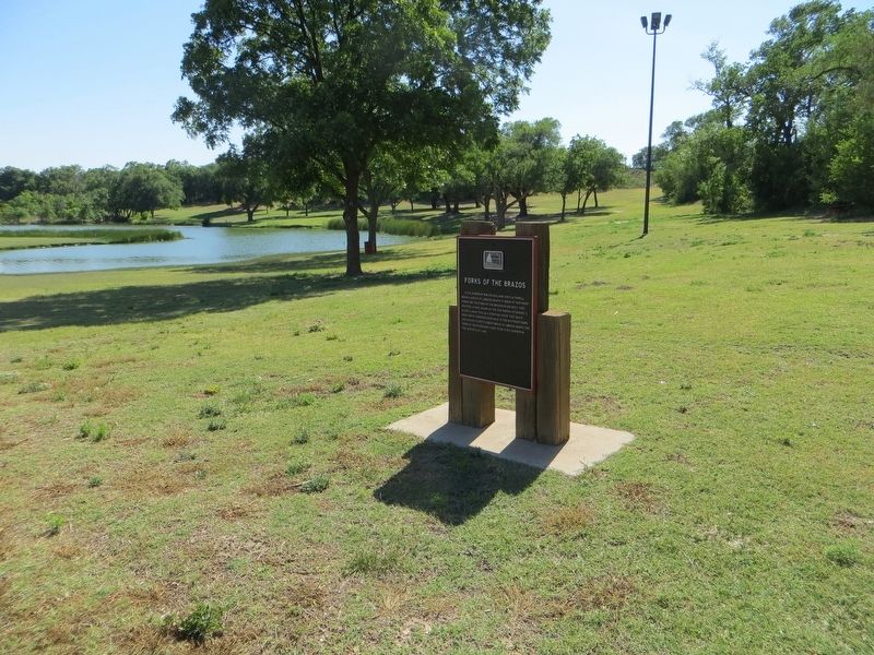
Forks of the Brazos


Forks of the Brazos Marker image. Click for full size.
Photographed By Bill Kirchner, June 9, 2017
1. Forks of the Brazos Marker
Inscription. In the summer of 1878, O.W. Williams and E.M. Powell began a survey of Lubbock County. It began at this point where the two forks of the Brazos River meet. They erected a rock mound at the S.W. corner of survey 1, block A. using this as a starting point, they built rock survey corners every mile to the southeast down the canyon. As settlement began in Lubbock county, the forks of the river continued to be a key corner in the surveys of land.
 
Topics. This historical marker is listed in these topic lists: ExplorationWaterways & Vessels. A significant historical year for this entry is 1878.
 
Location. 33° 35.427′ N, 101° 49.771′ W. Marker is in Lubbock, Texas, in Lubbock County. Marker is on Cesar E. Chavez Drive, 0.4 miles north of East Broadway, on the left when traveling north. Touch for map. Marker is in this post office area: Lubbock TX 79403, United States of America. Touch for directions.
 
Other nearby markers. At least 8 other markers are within walking distance of this marker. General Ranald Slidell Mackenzie (about 800 feet away, measured in a direct line); Yellowhouse Canyon (approx. 0.4 miles away); Quanah Parker Trail (approx. half a mile away); Prairie Dog Town (approx. 0.6 miles away); Lubbock's First Cotton Gin (approx. 0.9 miles away); Lubbock Post Office and Federal Building (approx. 0.9 miles away);
Paid Advertisement
Click on the ad for more information.
Please report objectionable advertising to the Editor.
Click or scan to see
this page online
Mackenzie Scout Trail (approx. 0.9 miles away); Nicolett Hotel (approx. one mile away). Touch for a list and map of all markers in Lubbock.
 
Forks of the Brazos Marker image. Click for full size.
Photographed By Bill Kirchner, June 9, 2017
2. Forks of the Brazos Marker
Forks of the Brazos Marker image. Click for full size.
Photographed By Bill Kirchner, June 9, 2017
3. Forks of the Brazos Marker
View south on Cesar E. Chavez Drive.
 
 
Credits. This page was last revised on August 1, 2017. It was originally submitted on July 31, 2017, by Bill Kirchner of Tucson, Arizona. This page has been viewed 329 times since then and 16 times this year. Photos:   1, 2, 3. submitted on July 31, 2017, by Bill Kirchner of Tucson, Arizona.

Share this page.  
Share on Tumblr
m=106363

CeraNet Cloud Computing sponsors the Historical Marker Database.
This website earns income from purchases you make after using our links to Amazon.com. We appreciate your support.
Paid Advertisement
May. 10, 2024