Cumberland Township near Gettysburg in Adams County, Pennsylvania — The American Northeast (Mid-Atlantic)
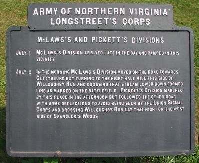
McLaws's and Pickett's Divisions
Longstreet's Corps
— Army of Northern Virginia —
Longstreet's Corps
McLaws's and Pickett's Divisions
July 1 McLaws's Division arrived late in the day and camped in this vicinity.
July 2 In the morning McLaws's Division moved on the road towards Gettysburg but turning to the right half mile this side of Willoughby Run and crossing that stream lower down formed line as marked on the Battlefield. Pickett's Division marched by this place in the afternoon but followed the other road with some deflections to avoid being seen by the Union Signal Corps and crossing Willoughby Run lay that night in the west side of Spangler's Woods.
Erected by Gettysburg National Military Park Commission.
Topics. This historical marker is listed in this topic list: War, US Civil. A significant historical month for this entry is July 1864.
Location. 39° 49.119′ N, 77° 17.03′ W. Marker is near Gettysburg, Pennsylvania, in Adams County. It is in Cumberland Township. Marker is at the intersection of Fairfield Road (State Highway 116) and Black Horse Tavern Road, on the right when traveling west on Fairfield Road. Located in front of the historic Black Horse Tavern. Touch for map. Marker is in this post office area: Gettysburg PA 17325, United States of America. Touch for directions.
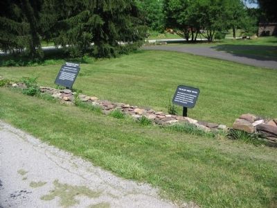
Other nearby markers. At least 8 other markers are within 2 miles of this marker, measured as the crow flies . Francis Bream Black Horse Tavern (here, next to this marker); The Black Horse Tavern (here, next to this marker); Gettysburg Campaign (about 300 feet away, measured in a direct line); Civil War Hospital (approx. half a mile away); Adam Butt Farm & Schoolhouse (approx. 0.7 miles away); Christian Byers Farm (approx. 0.9 miles away); Sachs Covered Bridge (approx. 1.4 miles away); "…the most historic covered bridge in Pennyslvania…" (approx. 1½ miles away). Touch for a list and map of all markers in Gettysburg.
Credits. This page was last revised on February 7, 2023. It was originally submitted on August 27, 2008, by Craig Swain of Leesburg, Virginia. This page has been viewed 1,050 times since then and 25 times this year. Photos: 1, 2, 3. submitted on August 27, 2008, by Craig Swain of Leesburg, Virginia.


