Kingsport in Sullivan County, Tennessee — The American South (East South Central)
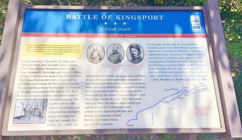
Battle of Kingsport
A Flank Attack
— Stoneman's Raid —
[Inset]
On December 10, 1864, Union Gen. George Stoneman led 5,700 horse artillerists and cavalrymen east from Knoxville, Tennessee, to destroy iron-, lead-, and saltworks in Virginia that were essential to the Confederate war effort.
After actions at Kingsport and Bristol, Stoneman struck at Marion, Wytheville, and Austinville, then destroyed the saltworks at Saltville. Stoneman returned to Tennessee on January 1, 1865, having laid waste to every factory, railroad, depot, and warehouse in his path.
On the morning of December 13, 1864, after riding for three days in frigid, winter weather, Union Gen. George Stoneman's forces under Gens. Stephen G. Burbridge and Alvan C. Gillem arrived on the western bank of the Holston River. They massed across the river to your right in the fields surrounding the Rotherwood mansion. You are standing where Confederate Col. Richard C. Morgan, commanding 300 men of Gen. Basil W. Duke's brigade, stood on the eastern bank to defend Kingsport. The old Ross Bridge that crossed the Holston and connected the two banks was in disrepair and could not support foot traffic. As a result, the well-positioned Confederate troops were confident in spite of being overwhelmingly outnumbered, and they thought that a Union attack was unlikely. While part of the Federal force remained in front, Col. Samuel Patton led two regiments roughly three miles up the western bank to Cloud's Ford, where they crossed the river. They then made their way down the eastern bank behind you and surprised the Confederates with a flank attack, capturing Morgan and driving his command toward Bristol. The Federal forces soon set off in pursuit.
"At daylight on the 13th we found Duke's brigade, under Col. Dick Morgan, posted to oppose our crossing the Holston. I sent two regiments of my command to support General [Alvan C.] Gillem, who, after a short engagement, flanked the enemy on the left by crossing a ford two miles up the stream, and charging him in rear and routed his forces, killing and wounding 15 and capturing 85 prisoners, with a train of 13 wagons." Gen. Stephen G. Burbridge, Jan. 3, 1865
[Photo caption]
Bottom left: Rotherwood - City of Kingsport
Top middle: Gen. Georger Stoneman, Gen. Alvan C. Gillem, Col. Richard C. Morgan Bottom right map: Route of Stoneman's Raid in Tennessee and Virginia, December 1864
Erected by Tennessee Civil War Trails.
Topics and series. This historical marker is listed in this topic list: War, US Civil. In addition, it is included in the Tennessee Civil War Trails series list. A significant historical date for this entry is January 1, 1865.
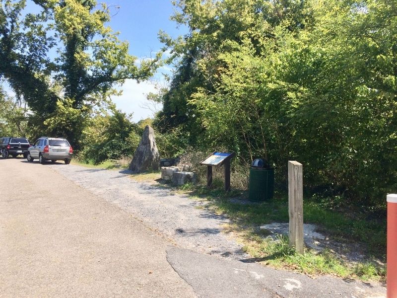
Location. 36° 32.961′ N, 82° 36.729′ W. Marker is in Kingsport, Tennessee, in Sullivan County. Marker can be reached from the intersection of Netherland Inn Road and Riverwoods Place. Located at the Kingsport Greenbelt park at the confluence of the North & South Forks of the Holston River. Touch for map. Marker is at or near this postal address: Netherland Inn Road, Kingsport TN 37660, United States of America. Touch for directions.
Other nearby markers. At least 8 other markers are within walking distance of this marker. A different marker also named Battle of Kingsport (within shouting distance of this marker); The Great Indian Warpath (approx. 0.3 miles away); Colonel Gilbert Christian (approx. 0.9 miles away); Flatboat (approx. one mile away); The Boat Yard (approx. one mile away); The Old Schoolhouse (approx. one mile away); Netherland Inn / King's Boat Yard (approx. one mile away); Old Kingsport Presbyterian Church (approx. one mile away). Touch for a list and map of all markers in Kingsport.
Credits. This page was last revised on September 11, 2017. It was originally submitted on September 11, 2017, by Mark Hilton of Montgomery, Alabama. This page has been viewed 896 times since then and 75 times this year. Photos: 1, 2. submitted on September 11, 2017, by Mark Hilton of Montgomery, Alabama.

