Near Carey in Blaine County, Idaho — The American West (Mountains)
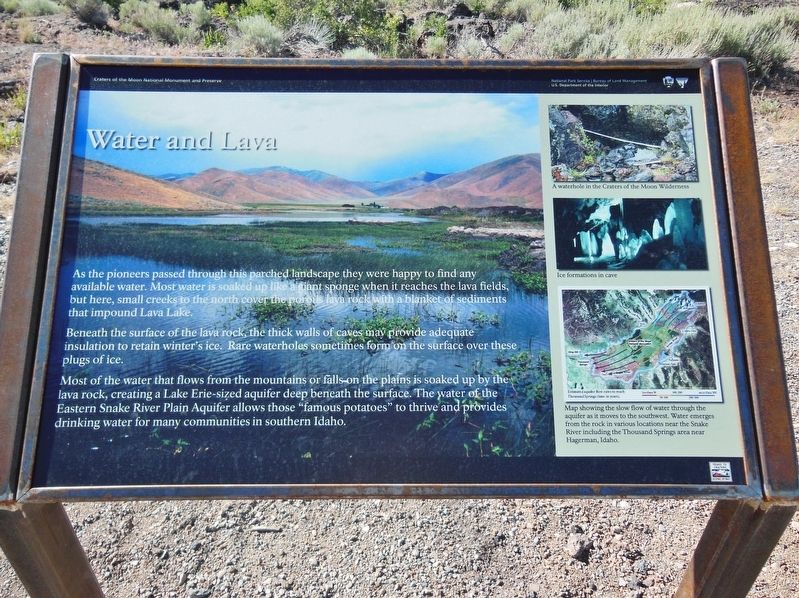
Water and Lava
Beneath the surface of the lava rock, the thick walls of caves may provide adequate insulation to retain winter’s ice. Rare waterholes sometimes form on the surface over these plugs of ice.
Most of the water that flows from the mountains or falls on the plains is soaked up by the lava rock, creating a Lake Erie-sized aquifer deep beneath the surface. The water of the Eastern Snake River Plain Aquifer allows those “famous potatoes” to thrive and provides drinking water for many communities in southern Idaho.
Erected by National Park Service, Bureau of Land Management, U.S. Department of the Interior.
Topics. This historical marker is listed in these topic lists: Agriculture • Exploration • Settlements & Settlers.
Location. 43° 22.78′ N, 113° 43.241′ W. Marker is near Carey, Idaho, in Blaine County. Marker is on U.S. 26, on the right when traveling west. Marker is located in a pull-out on the north side of US Highway 20/26/93. Touch for map. Marker is in this post office area: Carey ID 83320, United States of America. Touch for directions.
Other nearby markers. At least 8 other markers are within 10 miles of this marker, measured as the crow flies. Goodale's Cutoff (here, next to this marker); Pronghorn Passage (approx. 5.6 miles away); a different marker also named Goodale's Cutoff (approx. 5.6 miles away); Big Cinder Butte (approx. 5.6 miles away); Just Down the Road (approx. 8.4 miles away); Silent Cone (approx. 8.4 miles away); Volcanoes Along the Rift (approx. 8.4 miles away); Are We Loving Them to Death? (approx. 9.2 miles away).
Also see . . . The Eastern Snake River Plain Aquifer.
The aquifer beneath the eastern Snake River Plain is perhaps the single-most important aquifer in Idaho. Composed of layered basalt lava flows and some sediment, it covers an area of approximately 10,800 square mile. Although the total thickness of basalts is estimated to be more than 5,000 feet (figure 1), groundwater flows most rapidly in the upper 300 - 500 feet, which is the most productive portion of the aquifer. Interconnected pore spaces in the rubbly tops of lava flows transmit water very readily, and well yields above 3,000 gallons per minute are not uncommon. (Submitted on November 11, 2017, by Cosmos Mariner of Cape Canaveral, Florida.)
Credits. This page was last revised on October 19, 2020. It was originally submitted on November 11, 2017, by Cosmos Mariner of Cape Canaveral, Florida. This page has been viewed 202 times since then and 8 times this year. Photos: 1, 2. submitted on November 11, 2017, by Cosmos Mariner of Cape Canaveral, Florida. • Bill Pfingsten was the editor who published this page.

