Manor Park in Northwest Washington in Washington, District of Columbia — The American Northeast (Mid-Atlantic)
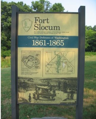
Fort Slocum
Civil War Defenses of Washington
— 1861-1865 —
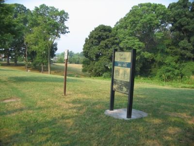
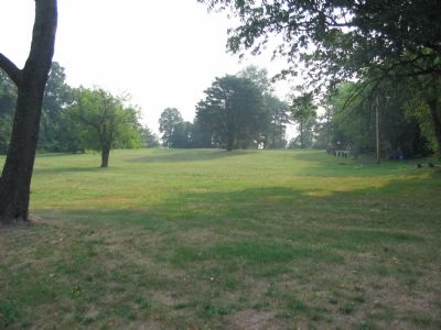
No visible evidence remains of Fort Slocum, which stood here and across Kansas Avenue to your left.
Cannon mounted at Fort Totten helped repulse a Confederate attack on Fort Stevens, July 11-12, 1864.
Erected by National Park Service, U.S. Department of the Interior.
Topics and series. This historical marker is listed in these topic lists: Forts and Castles • War, US Civil. In addition, it is included in the Defenses of Washington series list. A significant historical date for this entry is July 11, 1864.
Location. 38° 57.587′ N, 77° 0.768′ W. Marker is in Northwest Washington in Washington, District of Columbia. It is in Manor Park. Marker is at the intersection of Kansas Avenue Northwest and Nicholson Street Northwest, on the right when traveling south on Kansas Avenue Northwest. Located in the Fort Slocum Park unit of the Rock Creek Park. Touch for map. Marker is at or near this postal address: 5727 Kansas Avenue Northwest, Washington DC 20011, United States of America. Touch for directions.
Other nearby markers. At least 8 other markers are within walking distance of this marker. The Washington Animal Rescue League (approx. ¼ mile away); Legacy Memorial Park (approx. 0.3 miles away); Civil War Defenses of Washington (approx. 0.3 miles away); June 22, 2009 Memorial (approx. 0.4 miles away); Immigrant Day of Resilience (approx. 0.4 miles away); Welcome to The Lamond Community (approx. 0.4 miles away); Gethsemane Baptist Church (approx. half a mile away); WOOK-TV Building (approx. 0.6 miles away). Touch for a list and map of all markers in Northwest Washington.
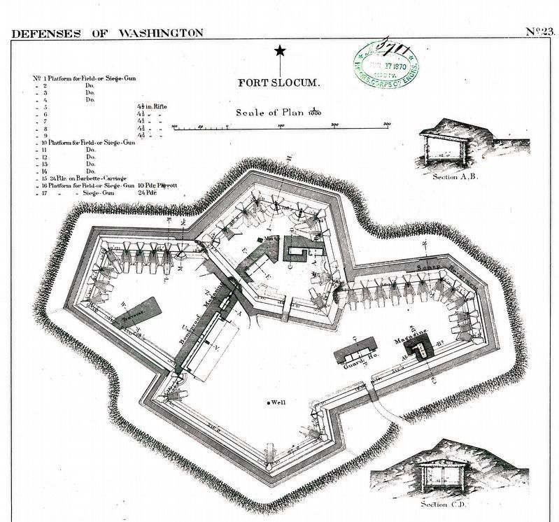
More about this marker. The marker displays a diagram of "Fort Slocum from U.S. Army Corps of Engineers drawing," on the left. On the right is a map showing "Other Civil War fort locations administered by Rock Creek Park," with Fort Slocum indicated with a red dot. The lower portion of the marker is a photograph from the war of a cannon mounted at one of Washington, DC's forts, "During the Civil War, Washington's forts overlooked farm land." The photograph is of a 100-pdr Parrott Rifled Cannon in place at the nearby Fort Totten during the war.
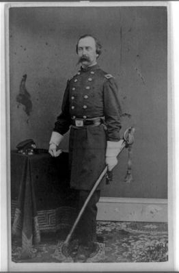
Also see . . . Col. John S. Slocum. (Submitted on March 13, 2011, by Richard E. Miller of Oxon Hill, Maryland.)
Additional commentary.
1. Description of Fort Slocum
From "Mr. Lincoln's Forts: A Guide to the Civil War Defenses of Washington," by Benjamin Franklin
Cooling III and Walton H. Owen II:
Fort Slocum was named for Colonel John S. Slocum, killed at First Manassas, from the 2nd Rhode Island Infantry, the unit that built the fort. The fort perimeter was 653 yards and covered the Rock Creek Church Road (modern Blair Road and New Hampshire Avenue). The fort contained one 8-inch siege howitzer, two 24-pdr siege guns, two 24-pdr seacoast guns, four 24-pdr howitzers, seven 4.5in rifled cannon, six 10-pdr rifled Parrott cannon, one 10-inch siege mortar and two 24-pdr Coehorn mortars.
Had they been completed, batteries on the east and west of Fort Slocum would have added ten more cannons to the overall firepower. While the earthworks were constructed, no cannon appear to have been mounted. Much of the fort and it's outer works were damaged during World War II when Victory Gardens were planted in and around the area.
During the Civil War, elements of the 76th New York Infantry, 1st New Hampshire Heavy Artillery, 150th Ohio National Guard, 14th Michigan Battery, and Knapp's Pennsylvania Artillery garrisoned the fort at different times.
When the Confederates demonstrated against Fort Stevens, to the west, Fort Slocum had the honor of opening the engagement by firing its long range guns. During the battle, some 1,500 employees of the Army Quartermaster office, led by General Montgomery Meigs, assisted the fort's
garrison. In addition some 2,800 convalescents, commanded by Colonel Francis Price, from nearby hospitals also augmented the fort's defenders.
— Submitted October 16, 2007, by Craig Swain of Leesburg, Virginia.
Credits. This page was last revised on March 11, 2024. It was originally submitted on October 16, 2007, by Craig Swain of Leesburg, Virginia. This page has been viewed 4,118 times since then and 45 times this year. Last updated on November 19, 2017, by Devry Becker Jones of Washington, District of Columbia. Photos: 1, 2, 3, 4. submitted on October 16, 2007, by Craig Swain of Leesburg, Virginia. 5. submitted on March 11, 2024, by Allen C. Browne of Silver Spring, Maryland. 6. submitted on March 13, 2011, by Richard E. Miller of Oxon Hill, Maryland. • Bill Pfingsten was the editor who published this page.
