Near Millhaven in Screven County, Georgia — The American South (South Atlantic)
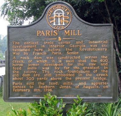
Paris' Mill
A rick dam was constructed across the creek, of which it is said that the 400 horse power developed for the feed and saw mills was by far the greatest in the colony. The rock foundations of the old dam are still embedded in the creek about 300 yards above the present bridge.
Paris sold the land, mills, and appurtenances to Seaborn Jones, of Augusta, on February 8th, 1796.
Erected 1953 by Georgia Historical Commission. (Marker Number 124-3.)
Topics and series. This historical marker is listed in these topic lists: Colonial Era • Industry & Commerce. In addition, it is included in the Georgia Historical Society series list. A significant historical month for this entry is February 1781.
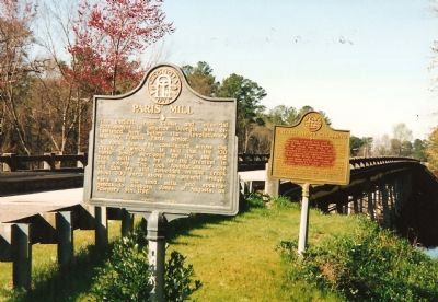
Location. 32° 56.015′ N, 81° 39.002′ W. Marker is near Millhaven, Georgia, in Screven County. Marker is at the intersection of Millhaven Road and Gin House Road, on the right when traveling south on Millhaven Road. On the east side of the bridge over Brier Creek. Touch for map. Marker is in this post office area: Sylvania GA 30467, United States of America. Touch for directions.
Other nearby markers. At least 8 other markers are within 8 miles of this marker, measured as the crow flies. British Army Crossing (here, next to this marker); Old Quaker Road (approx. 4.2 miles away); First McCanaan Baptist Church (approx. 4.6 miles away); Bethel United Methodist Church (approx. 6.6 miles away); Brick (Bethel) Church (approx. 6.6 miles away); Sardis Baptist Church (approx. 6.8 miles away); Jacksonborough (approx. 7˝ miles away); Jacksonboro (approx. 7˝ miles away).
Credits. This page was last revised on June 16, 2016. It was originally submitted on September 4, 2008, by Craig Swain of Leesburg, Virginia. This page has been viewed 1,393 times since then and 46 times this year. Last updated on September 4, 2008, by David Seibert of Sandy Springs, Georgia. Photos: 1. submitted on September 4, 2008, by David Seibert of Sandy Springs, Georgia. 2. submitted on September 4, 2008, by Craig Swain of Leesburg, Virginia.

