Near Karnack in Harrison County, Texas — The American South (West South Central)
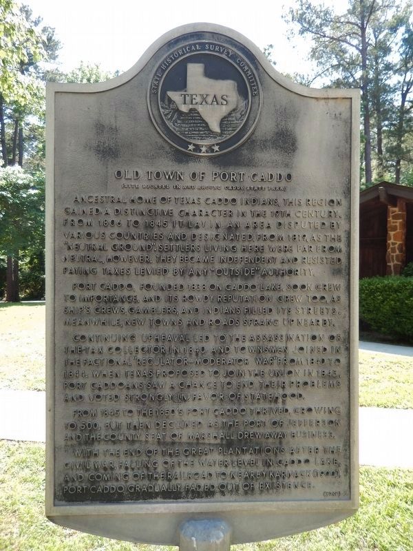
Old Town of Port Caddo
(Site located in and around Caddo State Park)
Port Caddo, founded 1838 on Caddo Lake, soon grew to importance, and its rowdy reputation grew too, as ship’s crews, gamblers, and Indians filled its streets. Meanwhile, new towns and roads sprang up nearby.
Continuing upheaval led to the assassination of the tax collector in 1840 and townsmen joined in the factional “Regulator–Moderator War” from 1840 to 1844. When Texas proposed to join the Union in 1845, Port Caddoans saw a chance to end their problems and voted strongly in favor of statehood.
From 1845 to the 1850’s Port Caddo thrived, growing to 500, but then declined as the Port of Jefferson and the County Seat of Marshall drew away business.
With the end of the great plantations after the Civil War, falling of the water level in Caddo Lake, and coming of the railroad to nearby Karnack (1900), Port Caddo gradually faded out of existence.
Erected 1968 by State Historical Survey Committee. (Marker Number 10207.)
Topics. This historical marker is listed in these topic lists: Native Americans • Notable Places • Settlements & Settlers.
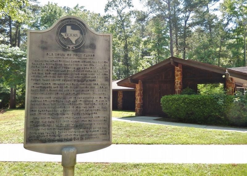
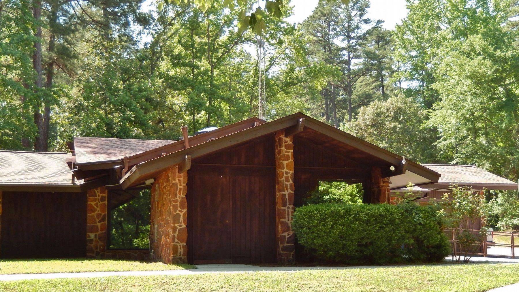
Location. 32° 40.814′ N, 94° 10.565′ W. Marker is near Karnack, Texas, in Harrison County. Marker can be reached from Park Road 2, 0.1 miles north of Farm to Market Road 2198, on the right when traveling north. Marker is located inside Caddo Lake State Park, in front of the Park Recreation Hall. Touch for map. Marker is at or near this postal address: 245 Park Road 2, Karnack TX 75661, United States of America. Touch for directions.
Other nearby markers. At least 8 other markers are within 11 miles of this marker, measured as the crow flies. Home Town of Mrs. Lyndon B. Johnson (approx. one mile away); Longhorn Army Ammunition Plant (approx. one mile away); Marshall-Shreveport Stagecoach Road (approx. 7.9 miles away); Potter's Point (approx. 9½ miles away); Jefferson (approx. 10.6 miles away); Trammel's Trace (approx. 10.7 miles away); Marion County Depression Era Roadside Park (approx. 10.7 miles away); Jefferson Turn Basin (approx. 11.1 miles away). Touch for a list and map of all markers in Karnack.
More about this marker. Marker is severely weathered and difficult to read
Related markers. Click here for a list of markers that are related to this marker.
Also see . . .
1. Port Caddo, Texas.
Port Caddo was established when a native of San Augustine, Obediah Hendrick, Jr., was granted 660 acres of land by the Republic of Texas on July 7, 1838. By 1839 wagons were arriving at Port Caddo from the east, and boats were bringing people and goods. From its beginning Port Caddo was a typical boisterous frontier town, and as the westward movement gained momentum the community prospered. In the beginning little attention was given to taxes; however, around 1839 a customs service was established at Port Caddo. Violent and bloody conflicts arose over the collection of tariffs on imports and exports. These conflicts culminated on January 29, 1845, when the Congress of the Republic of Texas passed an act establishing a collection district including parts of Red River, Bowie, Nacogdoches, and Rusk counties. All of Harrison County was included, and Port Caddo was named the port of entry. However, there was continued refusal to pay tariffs at Port Caddo because of the progress being made toward annexation with the United States. (Submitted on November 30, 2017, by Cosmos Mariner of Cape Canaveral, Florida.)
2. Caddo Lake State Park History.
The park’s rich history includes the presence of the Caddo Indians of the 18th and 19th centuries, although it is believed that people have inhabited this East Texas area for nearly 12,000 years. When the Caddos first arrived, they continued their semi-nomadic style of hunting and gathering. With the vast wetlands and an expansive forest, the Caddos were able to hunt, fish, and develop a farming system. Throughout the 19th century the Caddo Indians were gradually driven away from the area as some of Texas’s first families began settling the area. Among these first Texans was T.J. Taylor, who many Americans recognize as the father of Lady Bird Johnson, President Lyndon Johnson’s wife. (Submitted on December 1, 2017, by Cosmos Mariner of Cape Canaveral, Florida.)
3. Caddo Lake State Park History.
Civilian Conservation Corps built the first structures of this park. Company 889 began the work, in June to November of 1933. Company 857 continued construction from October 1934 to March 1937. CCC workers converted 15 U.S. Army barracks and an Army mess hall into the nine log cabins and group recreation hall that we use today. Other facilities still in use include picnic sites, Park Road 2 and trails. Look for the CCC pavilion and remnants of original picnic sites and a latrine along the trails. (Submitted on December 1, 2017, by Cosmos Mariner of Cape Canaveral, Florida.)
4. Caddo Indians.
Caddo peoples lived on the Red River and in East Texas. European populations-living in missions, ranches, and trading posts-increased throughout the eighteenth and into the early nineteenth century in the Red River valley and in the vicinity of Natchitoches and Nacogdoches. Epidemics between 1691 and 1816 greatly reduced Caddo populations. Settlements were between the Sabine River and Caddo Lake, generally along the boundary between the territory of Louisiana and the province of Texas. Most remained in the Caddo Lake area until about 1842, although with the cession of Caddoan lands in Louisiana in 1835 and increased Texas settlement, some moved to the Brazos River in north central Texas. By the early 1840s, all Caddo groups had moved to the Brazos River area to remove themselves from Anglo-American repressive measures and colonization efforts. (Submitted on December 1, 2017, by Cosmos Mariner of Cape Canaveral, Florida.)
Credits. This page was last revised on June 29, 2018. It was originally submitted on November 30, 2017, by Cosmos Mariner of Cape Canaveral, Florida. This page has been viewed 663 times since then and 71 times this year. Photos: 1, 2, 3, 4, 5. submitted on November 30, 2017, by Cosmos Mariner of Cape Canaveral, Florida. • Bernard Fisher was the editor who published this page.
