Near Papaikou in Hawaii County, Hawaii — Hawaiian Island Archipelago (Pacific Ocean)
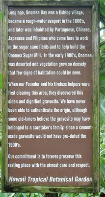
Onomea Bay
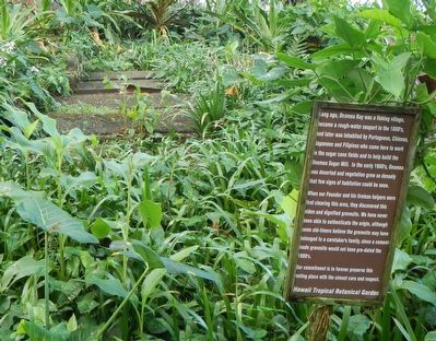
When our Founder and his tireless helpers were first clearing this area, they discovered this olden and dignified gravesite. We have never been able to authenticate the origin, although some old-timers believe the gravesite may have belonged to a caretaker's family, since a cement-made gravesite would not have pre-dated the 1900's.
Our commitment is to forever preserve this resting place with the utmost care and respect.
Erected by Hawaii Tropical Botanical Garden.
Topics. This historical marker is listed in these topic lists: Cemeteries & Burial Sites • Settlements & Settlers.
Location. 19° 48.492′ N, 155° 5.567′ W. Marker is near Papaikou, Hawaii, in Hawaii County. Marker can be reached from Old Mamalahoa Highway near Old Onomea Road, on the right when traveling north. Touch for map. Marker is at or near this postal address: 27-717 Old Mamalahoa Highway, Papaikou HI 96781, United States of America. Touch for directions.
Other nearby markers. At least 8 other markers are within 7 miles of this marker, measured as the crow flies. The Legend of Twin Rocks (within shouting distance of this marker); "KU" - Hawaiian God (approx. 0.2 miles away); Remembrance Bell (approx. ¼ mile away); The Spiritual Power of Stones (approx. 5.8 miles away); Mo'oheau Park and Bandstand (approx. 5.9 miles away); Hilo Town Plantation Bell Tower (approx. 5.9 miles away); Lyman House Memorial (approx. 6 miles away); Waiakea Social Settlement Clock (approx. 6.1 miles away). Touch for a list and map of all markers in Papaikou.
More about this marker. This marker is found on the trails inside Hawaii Tropical Botanical Garden.
Credits. This page was last revised on November 30, 2017. It was originally submitted on November 30, 2017, by Barry Swackhamer of Brentwood, California. This page has been viewed 562 times since then and 33 times this year. Photos: 1, 2. submitted on November 30, 2017, by Barry Swackhamer of Brentwood, California.

