San Diego in San Diego County, California — The American West (Pacific Coastal)
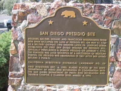
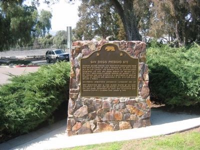
San Diego Presidio Site
Erected 1992 by State Department of Parks and Recreation in Cooperation with The San Diego Department of Parks and Recreation and Squibob Chapter, E Clampus Vitus (August 8, 1992). (Marker Number 59.)
Topics and series. This historical marker is listed in these topic lists: Exploration • Forts and Castles • Landmarks • Military • Native Americans • Notable Places • Settlements & Settlers. In addition, it is included in the California Historical Landmarks, the E Clampus Vitus, and the National Historic Landmarks series lists. A significant historical date for this entry is January 1, 1774.
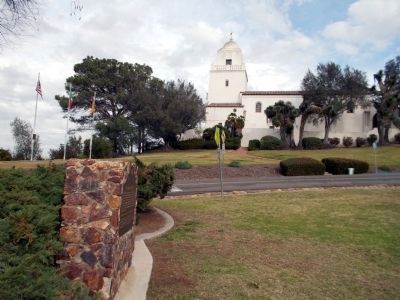
Location. 32° 45.569′ N, 117° 11.648′ W. Marker is in San Diego, California, in San Diego County. Marker can be reached from Presidio Drive. Marker is located next to the parking lot across Presidio Drive from Serra Museum, Presidio Park, Old Town, San Diego. Touch for map. Marker is at or near this postal address: 2727 Presidio Dr, San Diego CA 92103, United States of America. Touch for directions.
Other nearby markers. At least 8 other markers are within walking distance of this marker. Fray Junipero Serra (within shouting distance of this marker); George White Marston (within shouting distance of this marker); Sylvester Pattie (within shouting distance of this marker); Junipero Serra Museum (within shouting distance of this marker); Site with Many Cultures / Un Sitio de Muchas Culturas (about 300 feet away, measured in a direct line); Serra Palm (about 600 feet away); Derby Dike (about 600 feet away); La Playa Trail (about 600 feet away). Touch for a list and map of all markers in San Diego.
Also see . . . California Military Museum: El Presidio Real de San Diego. (Submitted on September 6, 2008.)
Additional commentary.
1. National Historic Landmark
Statement of Significance (as of designation - October 9, 1960):
In 1769, at this site, the Portola-Serra land and sea expeditions united and established the first permanent European settlement of the Pacific Coast of the present-day United States. Fray Junipero Serra founded the Mission of San Diego de Alcala, the first of the California missions. The Presidio served as a base for exploring expeditions into the interior and as the military headquarters for Southern California.
The Presidio site is located on a bluff which was been eroded and undermined since it was cut away for road construction at the foot of the bluff. The bluff has now been stabilized, backfilled and capped, and the site is being regularly monitored by skilled professionals.
— Submitted September 26, 2008.
Credits. This page was last revised on October 25, 2020. It was originally submitted on September 6, 2008, by Syd Whittle of Mesa, Arizona. This page has been viewed 2,148 times since then and 47 times this year. Photos: 1, 2. submitted on September 6, 2008, by Syd Whittle of Mesa, Arizona. 3. submitted on January 29, 2013, by Drew W of Vista, California. • Kevin W. was the editor who published this page.


