Tahoe City in Placer County, California — The American West (Pacific Coastal)
Roads and Bridges
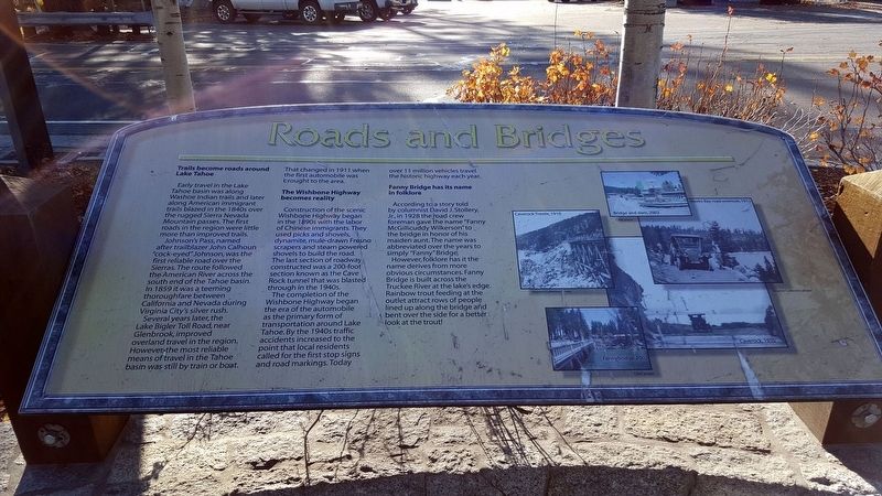
Early travel in the Lake Tahoe basin was along Washoe Indian trails and later along American immigrant trails blazed in the 1840s over the rugged Sierra Nevada Mountain passes. The first roads in the region were little more than improved trails.
Johnson's Pass, named after trailblazer John Calhoun "cock-eyed" Johnson, was the first reliable road over the Sierras. The route followed the American River across the south end of the Tahoe basin. In 1859 it was a teeming thoroughfare between California and Nevada during Virginia City's silver rush.
Several years later, the Lake Bigler Toll Road, near Glenbrook, improved overland travel in the region. However, the most reliable means of travel in the Tahoe basin was still by train or boat. That changed in 1911 when the first automobile was brought to the area.
The Wishbone Highway becomes reality
Construction of the scenic Wishbone Highway began in the 1890s with the labor of Chinese immigrants. They used picks and shovels, dynamite, mule-drawn Fresno scrapers and steam powered shovels to build the road. The last section of roadway constructed was a 200-foot section known as the Cave Rock tunnel that was blasted through in the 1940s.
The completion of Wishbone Highway began the era of the automobile as the primary form of transformation around Lake Tahoe. By the 1940s traffic accidents increased to the point that local residents called for the first stop signs and road markings. Today over 11 million vehicles travel the historic highway each year.
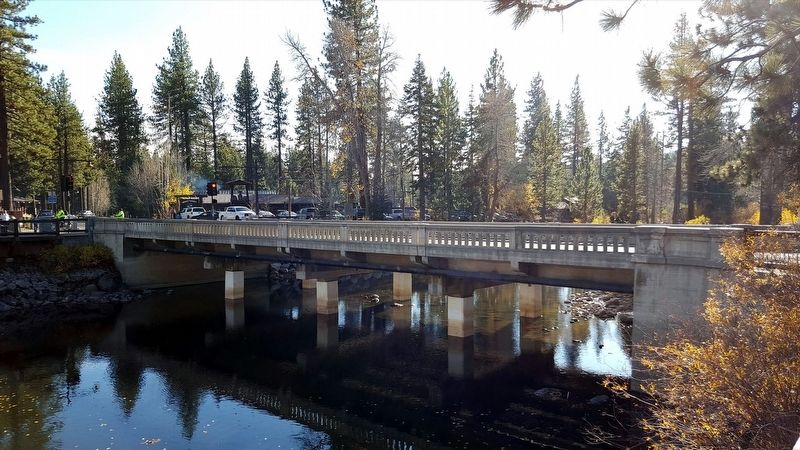
Fanny Bridge has its name in folklore
According to a story told by columnist David J. Stollery, Jr., in 1928 the road crew foreman gave the name "Fanny McGillicuddy Wilkerson "to the bridge in honor of his maiden aunt. The name was abbreviated over the years to simply "Fanny" Bridge.
However, folklore has it the name derives from more obvious circumstances. Fanny Bridge is built across the Truckee River at the lake's edge. Rainbow trout feeding at the outlet attract rows of people lined up along the bridge and bent over the side for a better look at the trout!
Erected by North Lake Tahoe Historical Society.
Topics. This historical marker is listed in these topic lists: Bridges & Viaducts • Roads & Vehicles. A significant historical year for this entry is 1859.
Location. 39° 10.029′ N, 120° 8.669′ W. Marker is in Tahoe City, California, in Placer County. Marker is on W Lake Blvd, on the right when traveling north. Touch for map. Marker is in this post office area: Tahoe City CA 96145, United States of America. Touch for directions.
Other nearby markers. At least 8 other markers are within walking distance of this marker. Conflict Over Water (within shouting distance of this marker); The Gatekeeper’s Cabin and Museum (within shouting distance of this marker); Lake Tahoe (within shouting distance of this marker); A Tradition of Basketmaking (within shouting distance of this marker); The Plentiful Lake (within shouting distance of this marker); A Safe Harbor (about 300 feet away, measured in a direct line); The Sacred Lake (about 300 feet away); William B. Layton Park (about 300 feet away). Touch for a list and map of all markers in Tahoe City.
Credits. This page was last revised on January 22, 2018. It was originally submitted on January 19, 2018, by Douglass Halvorsen of Klamath Falls, Oregon. This page has been viewed 249 times since then and 27 times this year. Photos: 1, 2, 3. submitted on January 19, 2018, by Douglass Halvorsen of Klamath Falls, Oregon. • Andrew Ruppenstein was the editor who published this page.


