Near Fredericksburg in Spotsylvania County, Virginia — The American South (Mid-Atlantic)
First Day at Chancellorsville
The Union Attack
-Union brigade commander Col. Sidney Burbank
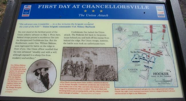
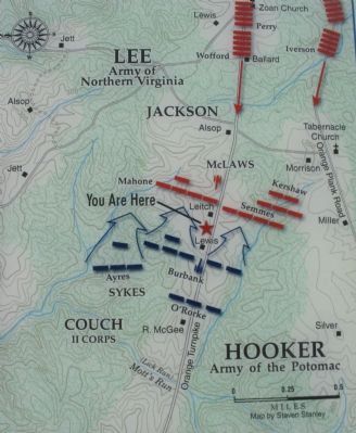
You now stand at the farthest point of the Union infantry advance on May 1. From here, Federal troops poured a murderous fire into the disorganized Confederate line. But the Southerners, under Gen. William Mahone, soon regrouped for battle on the ridge in front of you. One Union officer recalled that his men advanced "steadily and with a will, although exposed to a sharp fire from musketry and artillery."
Confederate fire halted the Union attack. The Federals fell back to the Lewis house behind you and held off the enemy from behind the ridge. For Union troops, however, the battle soon took an unfortunate turn.
Erected 2008 by Virginia Civil War Trails.
Topics and series. This historical marker is listed in this topic list: War, US Civil. In addition, it is included in the Virginia Civil War Trails series list. A significant historical month for this entry is May 1863.
Location. 38° 17.706′ N, 77° 35.425′ W. Marker is near Fredericksburg, Virginia, in Spotsylvania County. Marker is on Plank Road / Germanna Highway (State Highway 3), on the right when traveling west. Located along the Civil War Preservation Trust's walking trail through the First Day at Chancellorsville Battlefield. Touch for map. Marker is in this post office area: Fredericksburg VA 22407, United States of America. Touch for directions.
Other nearby markers. At least 8 other markers are within walking distance of this marker. 11th United States Infantry (about 300 feet away, measured in a direct line); a different marker also named First Day at Chancellorsville (about 400 feet away); a different marker also named First Day at Chancellorsville (about 800 feet away); a different marker also named First Day at Chancellorsville (approx. 0.2 miles away); Chancellorsville Campaign (approx. 0.3 miles away); a different marker also named Chancellorsville Campaign (approx. 0.3 miles away); a different marker also named First Day at Chancellorsville (approx. 0.3 miles away); a different marker also named The First Day at Chancellorsville (approx. 0.3 miles away). Touch for a list and map of all markers in Fredericksburg.
More about this marker. On the lower left is a portrait of Gen. Mahone, who coordinated much of the Confederate attack against the advancing Federals in this part of the battlefield. This was familiar ground to Mahone, who had been a civil engineer before the war and worked on the Orange Turnpike.
In the center is an Alfred Waud drawing showing, Union artillery unlimbered directly on the Orange Turnpike. Confederate artillerists also worked
On the right is a map showing the movements of this phase of the battle: Hooker hoped to advance eastward and gain the clear, high ground east of Zoan Church (far right). Lee's westward movement, however, stopped Hooker's advance and forced him to fight in the Wilderness.
Also see . . .
1. First Day at Chancellorsville. An animated map of the first day's battle from Civil War Preservation Trust. Also links to several excellent resources about the battle. The action described on this marker is roughly occurring at the 1:30 p.m. mark on the animation's time line. (Submitted on September 13, 2008, by Craig Swain of Leesburg, Virginia.)
2. Battle of Chancellorsville. National Park Service page about the battle. (Submitted on September 13, 2008, by Craig Swain of Leesburg, Virginia.)
Photographed By Craig Swain, August 24, 2008
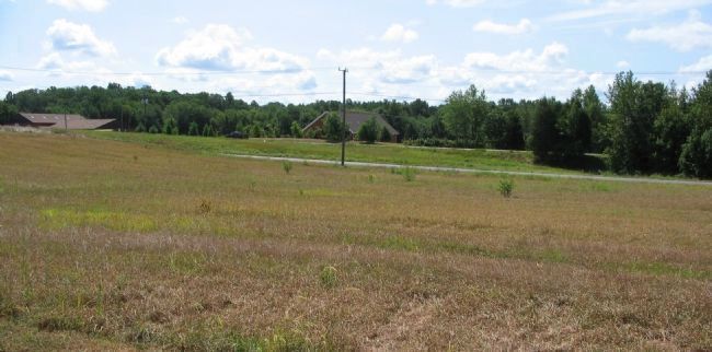
6. Semmes' and Kershaw's Brigades
Looking from the marker location at the south side of the Orange Turnpike. General Paul J. Semmes' and General Joseph Kershaw's Brigades defended on the south side of the Pike, resisting the advance of Col. Sideny Burbank's Brigade of Sykes Division. Semmes' Brigade included the 10th, 50th, 51st, and 53rd Georgia Infantry. Kershaw's included the 2nd, 3rd, 7th, 8th and 15th South Carolina Infantry Regiments along with the 3rd S.C. Infantry Battalion.
Photographed By Craig Swain, August 24, 2008
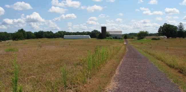
7. Mahone's Brigade
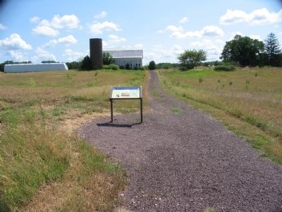
Looking past the marker's location (seen in the center here) down the trail. Mahone's Brigade regrouped on the far side of the ridge spur, behind the modern barn seen here. Mahone's Brigade consisted of the 6th, 12th, 16th, 41st, and 61st Virginia Infantry Regiments. Federals of Burbank's Brigade advanced down the sloping ground here, to attack the ridge spur in the background.
Photographed By Craig Swain, August 24, 2008
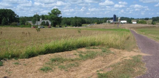
8. Federal Advance
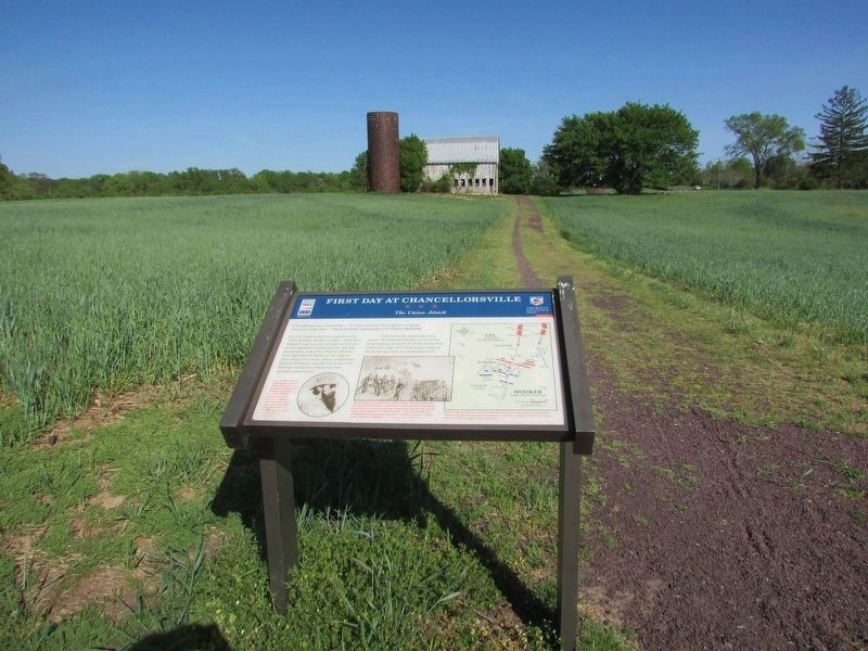
Looking west from the high ground near the marker location. The Col. Sideny Burbank's Brigade was at the fore of the attack. Burbank's men were U.S. Regulars: the 2nd, 6th, 7th, 10th, 11th and 17th U.S. Infantry. Their line was roughly straddling what is today the walking trail, but with elements both north and south of the Pike (seen to the left). Behind and to the right of Burbank was the brigade of Col. Patrick O'Rourke, the 5th, 140th, and 146th New York Infantry. To the left (north) of Burbank was another Brigade of U.S. Regulars under General Romeyn Ayres - the 3rd, 4th, 12th and 14th U.S. Infantry.
Credits. This page was last revised on April 25, 2023. It was originally submitted on September 13, 2008, by Craig Swain of Leesburg, Virginia. This page has been viewed 1,498 times since then and 17 times this year. Photos: 1. submitted on September 13, 2008, by Craig Swain of Leesburg, Virginia. 2. submitted on March 13, 2009, by Craig Swain of Leesburg, Virginia. 3, 4. submitted on September 13, 2008, by Craig Swain of Leesburg, Virginia. 5. submitted on April 22, 2023, by Bill Coughlin of Woodland Park, New Jersey. 6, 7, 8. submitted on September 13, 2008, by Craig Swain of Leesburg, Virginia.
