Dix Hills in Suffolk County, New York — The American Northeast (Mid-Atlantic)
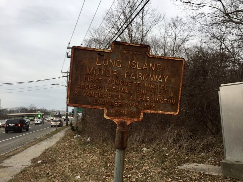
Long Island Motor Parkway
access highway, built by W.
K. Vanderbilt: A. Pardington
engineer 1908 - 1910
Erected 1973 by Town of Huntington.
Topics. This historical marker is listed in this topic list: Roads & Vehicles. A significant historical year for this entry is 1908.
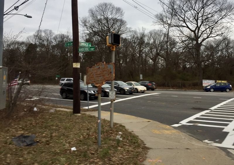
Location. 40° 49.005′ N, 73° 17.643′ W. Marker is in Dix Hills, New York, in Suffolk County. Marker is at the intersection of Vanderbilt Parkway and Commack Road, on the right when traveling east on Vanderbilt Parkway. Touch for map. Marker is in this post office area: Melville NY 11747, United States of America. Touch for directions.
Other nearby markers. At least 8 other markers are within 2 miles of this marker, measured as the crow flies. Central Long Island (approx. 1.3 miles away); a different marker also named Central Long Island (approx. 1˝ miles away); Whitman's Hollow (approx. 1.8 miles away); Hubbs House (approx. 1.8 miles away); Town of Huntington (approx. 1.8 miles away); Comac Church (approx. 2 miles away); Brindley Field (approx. 2 miles away); John Coltrane Home (approx. 2 miles away). Touch for a list and map of all markers in Dix Hills.
Also see . . . Long Island Motor Parkway (Wikipedia). "The Long Island Motor Parkway (LIMP), also known as the Vanderbilt Parkway and Motor Parkway, was a parkway on Long Island, New York, in the United States. It was the first roadway designed for automobile use only. The road was privately built by William Kissam Vanderbilt II with overpasses and bridges to remove intersections. It opened in 1908 as a toll road and closed in 1938 when it was taken over by the state of New York in lieu of back taxes. Parts of the parkway survive today in sections of other roadways and as a bicycle trail in Queens." (Submitted on March 6, 2018.)
Credits. This page was last revised on March 6, 2018. It was originally submitted on March 6, 2018, by Andrew Ruppenstein of Lamorinda, California. This page has been viewed 449 times since then and 38 times this year. Photos: 1, 2. submitted on March 6, 2018, by Andrew Ruppenstein of Lamorinda, California.

