Memphis in Shelby County, Tennessee — The American South (East South Central)
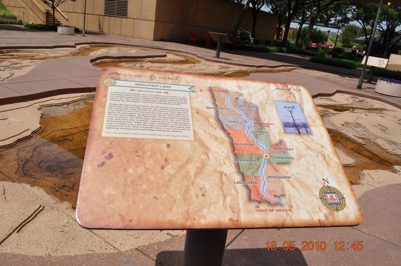
Reelfoot Lake
Panel #59 Mississippi Riverwalk
— Mile 873.0 AHP —
A tremendous earthquake struck this region on December 16, 1811, beginning a three-month series of violent quakes that devastated over 40,000 square miles. Named for the largest settlement in the region, the New Madrid earthquakes altered local geography, changed the Mississippi's course and created Reelfoot Lake.
During the most violent shocks, the Mississippi shrunk from its banks into a 20-foot ridge of water, then rushed outward to flood the countryside. Great stretches of river banks caved in, and mile-long cracks in the earth spewed out sand, rock and sulfurous fumes. In some places, the ground rose 20 feet. Four miles east of the river, near modern-day Tiptonville, the forest sank. Exploding over its banks, the Mississippi flooded into this new basin with such force that witnesses claimed the river downstream flowed backward. When the water retreated, it left Reelfoot Lake - 20 miles long, a few feet deep, crowded with cypress and cottonwood trees. Most eventually died or were set on fire by lighting, leaving trunks and stumps dotting the shallows.
Photo Credit: Bald Eagles at Reelfoot National Wildlife Refuge by David Haggard/USFWS
Erected by Mississippi Riverwalk. (Marker Number 59.)
Topics. This historical marker is listed in these topic lists: Disasters • Settlements & Settlers • Waterways & Vessels. A significant historical date for this entry is December 16, 1811.
Location. 35° 8.968′ N, 90° 3.504′ W. Marker is in Memphis, Tennessee, in Shelby County. Marker can be reached from Island Drive, 0.8 miles West A.W. Willis Avenue when traveling south. Located in Mud Island River Park. Touch for map. Marker is at or near this postal address: 125 N Front St, Memphis TN 38103, United States of America. Touch for directions.
Other nearby markers. At least 8 other markers are within walking distance of this marker. Tennessee River/Cumberland River (here, next to this marker); Palmetto Bend/Jackson Point/St. Catherine’s Creek/Ellis Cliffs (here, next to this marker); Grand Gulf, Mississippi / Yucatan Cutoff / Big Black River (here, next to this marker); Rodney Cutoff/Bayou Pierre (here, next to this marker); Davis Island, Mississippi/Kents Island (here, next to this marker); Vicksburg (here, next to this marker); Young’s Point / Milliken’s Bend / Omega Landing (here, next to this marker); Commercial Barge Traffic (here, next to this marker). Touch for a list and map of all markers in Memphis.
Also see . . . Reelfoot Lake. Reelfoot Lake is a shallow natural lake located in the northwest portion of U.S. state of Tennessee, in Lake and Obion counties. Much of it is really more of a swamp, with bayou-like ditches (some natural, some man-made) connecting more open bodies of water called basins, the largest of which is called Blue Basin. Reelfoot Lake is noted for its bald cypress trees and its nesting pairs of bald eagles. It is the site of Reelfoot Lake State Park. Lake Isom, a similar, smaller lake to the immediate south, is a National Wildlife Refuge area. (Submitted on March 8, 2018, by Sandra Hughes Tidwell of Killen, Alabama, USA.)
Credits. This page was last revised on March 8, 2018. It was originally submitted on March 8, 2018, by Sandra Hughes Tidwell of Killen, Alabama, USA. This page has been viewed 202 times since then and 14 times this year. Photo 1. submitted on March 8, 2018, by Sandra Hughes Tidwell of Killen, Alabama, USA. • Bernard Fisher was the editor who published this page.
Editor’s want-list for this marker. Wide shot of marker and its surroundings. • Can you help?
