Downtown Providence in Providence County, Rhode Island — The American Northeast (New England)
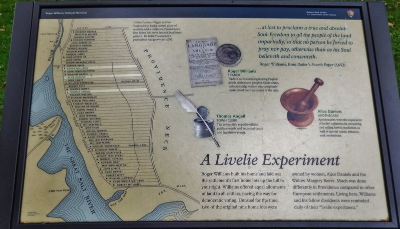
A Livelie Experiment
…at last to proclaim a true and absolute Soul-Freedom to all the people of the land impartially, so that no person be forced to pray nor pay, otherwise than as his Soul believeth and consenteth.
Roger Williams, from Butler's Fourth Paper (1652)
Roger Williams
TRADER
Traders earned a living trading English goods with native peoples. Quite often, unfortunately, neither side completely understood the true nature of the deal.
Thomas Angell
TOWN CLERK
The town clerk kept the official public records and recorded court and legislative events.
Alice Daniels
APOTHECARY
Apothecaries were the equivalent of today's pharmacist, preparing and selling herbal medicines as well as special wines, tobacco, and confections.
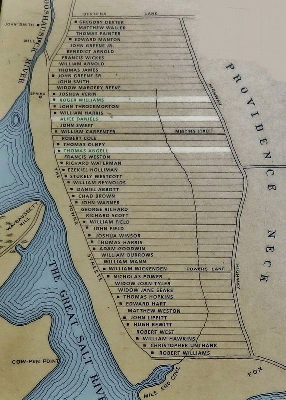
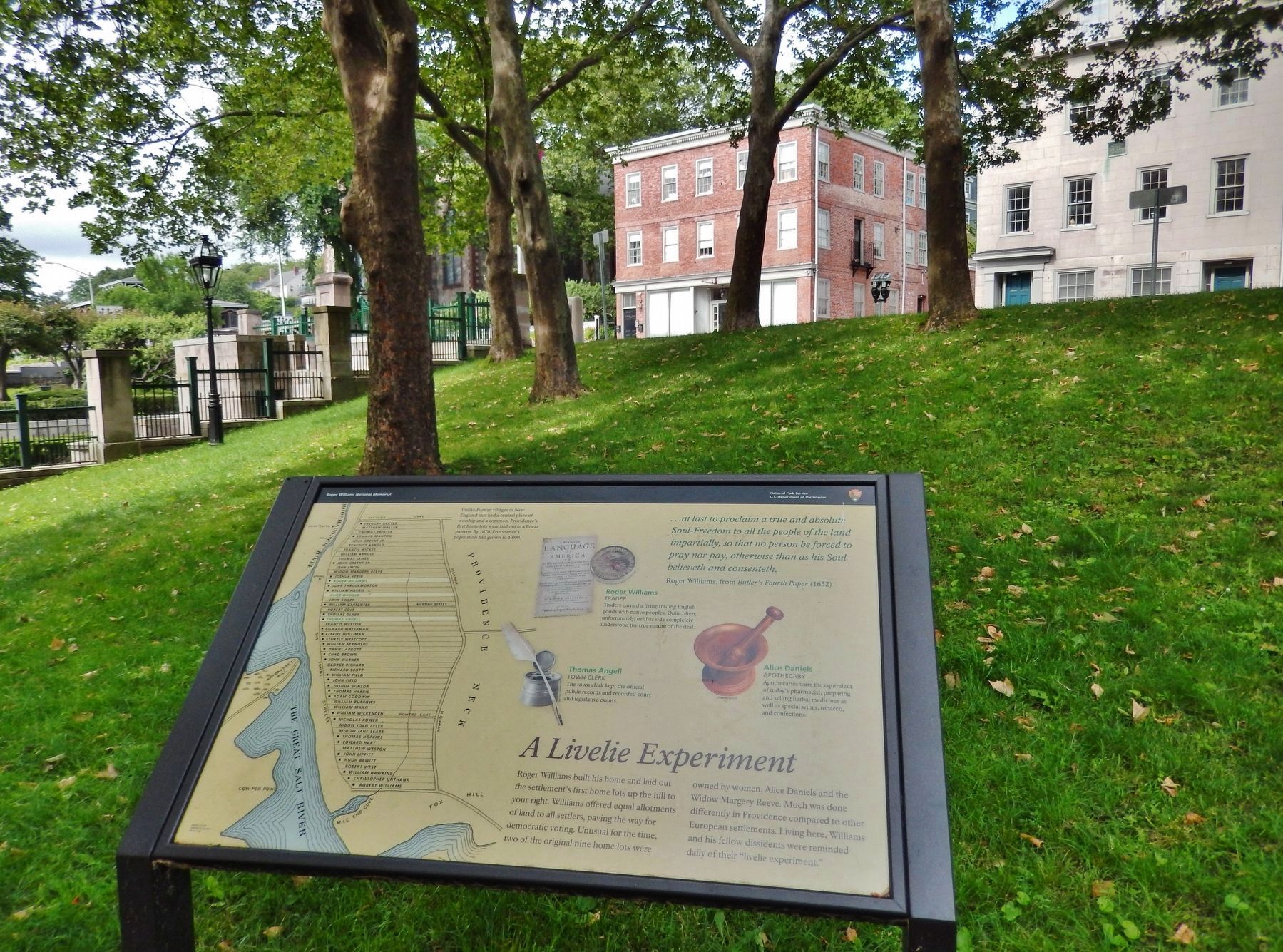
Roger Williams built his home and laid out the settlement's first home lots up the hill to your right. Williams offered equal allotments of land to all settlers, paving the way for democratic voting. Unusual for the time, two of the original nine home lots were owned by women, Alice Daniels and the Widow Margery Reeve. Much was done differently in Providence compared to other European settlements. Living here, Williams and his fellow dissidents were reminded daily of their "livelie experiment."
Erected by National Park Service, U.S. Department of the Interior.
Topics. This historical marker is listed in these topic lists: Churches & Religion • Colonial Era • Settlements & Settlers.
Location. 41° 49.822′ N, 71° 24.628′ W. Marker is in Providence, Rhode Island, in Providence County. It is in Downtown Providence. Marker can be reached from the intersection of North Main Street (U.S. 1) and Howland Street, on the left when traveling north. Marker is within the Roger Williams National Memorial, along the walking path, west of the North Main Street and Howland Street intersection. Touch for map. Marker is at or near this postal address: 237 North Main Street, Providence RI 02903, United States of America. Touch for directions.
Other nearby markers. At least 8 other markers are within walking distance of this marker. Roger Williams Founded Providence Here in 1636 (a few steps from this marker); A Shelter for Persons Distressed (within shouting distance of this marker); The Original Water Supply (within shouting distance of this marker); The Wellspring of Providence (within shouting distance of this marker); Site of Roger Williams House (within shouting distance of this marker); Realizing Providence (within shouting distance of this marker); Roger Williams National Memorial
(within shouting distance of this marker); The Cathedral of St. John (within shouting distance of this marker). Touch for a list and map of all markers in Providence.
Also see . . .
1. Roger Williams National Memorial. Wikipedia entry:
The Roger Williams National Memorial is a landscaped urban park located on a common lot of the original settlement of Providence, Rhode Island, established by Roger Williams in 1636, bounded by North Main, Canal, and Smith Streets, and Park Row. The memorial commemorates the life of the co-founder of the Colony of Rhode Island and Providence Plantations and a champion of the ideal of religious freedom. Williams was banished from the Massachusetts Bay Colony for his beliefs, and he founded this colony as a place where all could come to worship as their conscience dictated without interference from the state. This park is the 20th smallest national park in the nation (Submitted on March 20, 2018, by Cosmos Mariner of Cape Canaveral, Florida.)
2. Thomas Angell. Wikipedia entry:
Thomas Angell was one of the four men who wintered with Roger Williams at Seekonk, Plymouth Colony in early 1636, and then joined him in founding the settlement of Providence Plantation in what became the Colony of Rhode Island and Providence Plantations. He was
a minor at the time of his arrival, but his name appears on several of the early documents related to the settlement of Providence. In the early 1650s, he became active in the affairs of the town, serving as commissioner, juryman, and constable. (Submitted on March 20, 2018, by Cosmos Mariner of Cape Canaveral, Florida.)
3. Roger Williams: In Providence. National Park Service, Roger Williams National Memorial, Rhode Island
Each head of household was given a thin tract of land stretching from the cove up the hill from the Towne Street, totaling approximately six acres. Each parcel of land included a bit of the waterfront, a portion of the slope of the hill and some of the flat land at the top of the hill. There was no ‘big house’ at the top of the hill with the poorer households huddled at the waterfront. Each of the settlers would start with the same type and amount of lands, making Providence a settlement of equals. (Submitted on March 20, 2018, by Cosmos Mariner of Cape Canaveral, Florida.)
Credits. This page was last revised on February 8, 2023. It was originally submitted on March 20, 2018, by Cosmos Mariner of Cape Canaveral, Florida. This page has been viewed 241 times since then and 16 times this year. Photos: 1, 2, 3. submitted on March 20, 2018, by Cosmos Mariner of Cape Canaveral, Florida. • Andrew Ruppenstein was the editor who published this page.


