Portsmouth in Rockingham County, New Hampshire — The American Northeast (New England)
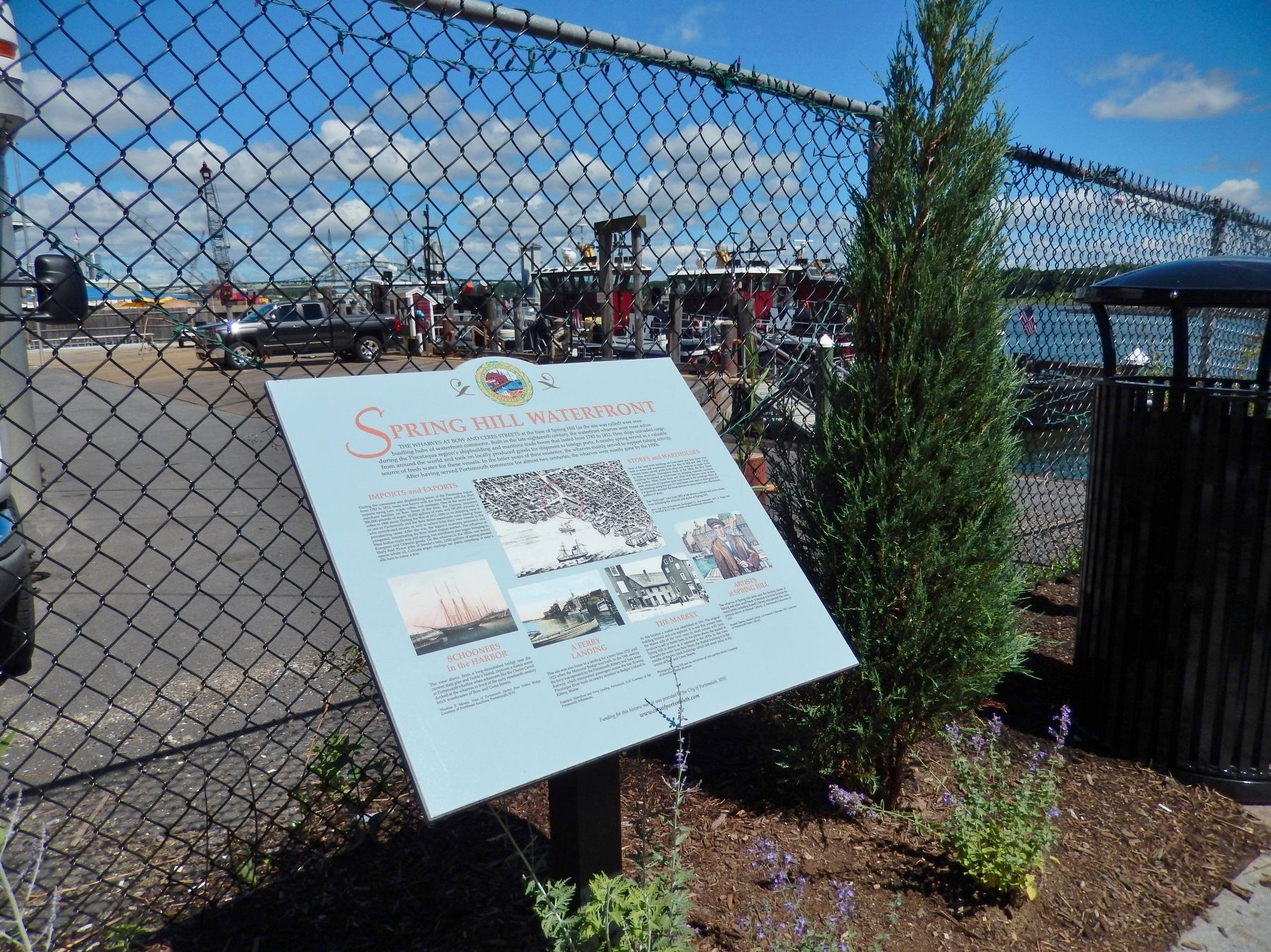
Spring Hill Waterfront
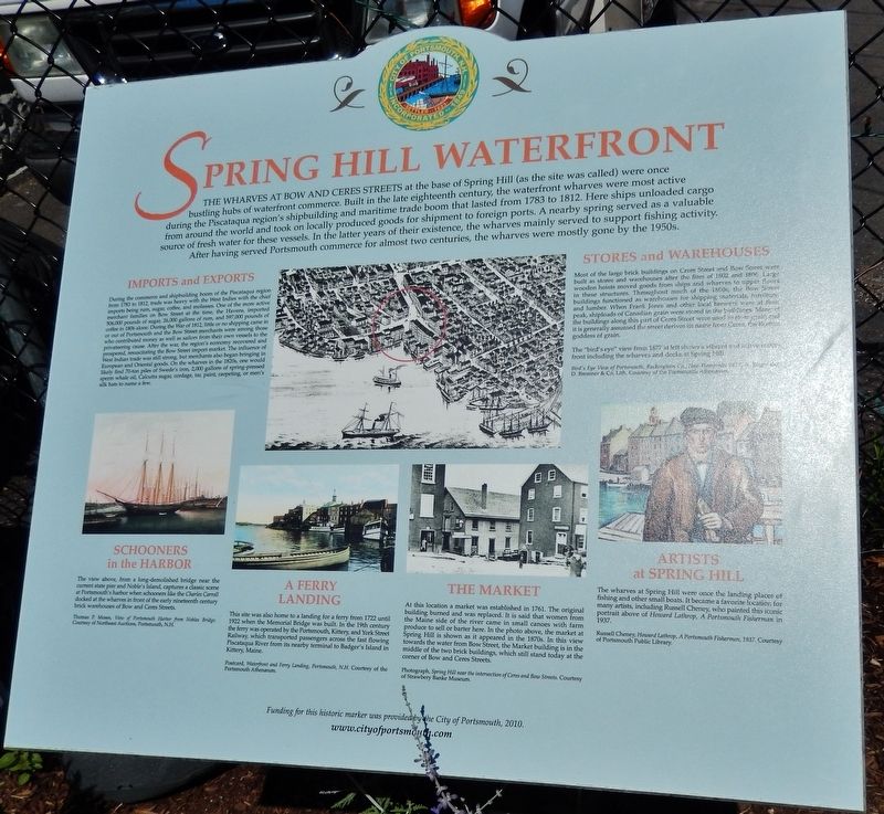
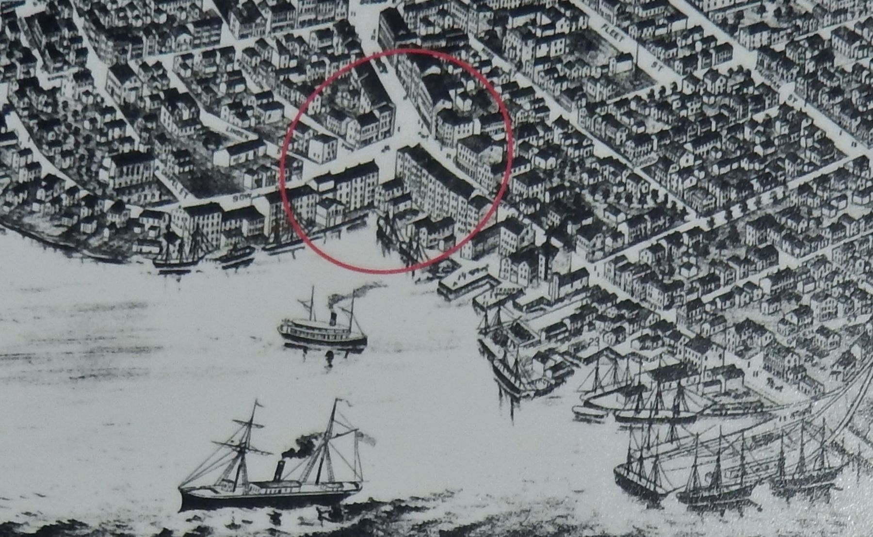
The Wharves at Bow and Ceres Streets at the base of Spring Hill (as the site was called) were once bustling hubs of waterfront commerce. Built in the late eighteenth century, the waterfront wharves were most active during the Piscataqua region's shipbuilding and maritime trade boom that lasted from 1783 to 1812. Here ships unloaded cargo from around the world and took on locally produced goods for shipment to foreign ports. A nearby spring served as a valuable source of fresh water for these vessels. In the latter years of their existence, the wharves mainly served to support fishing activity. After having served Portsmouth commerce for almost two centuries, the wharves were mostly gone by the 1950s.
Imports and Exports
During the commerce and shipbuilding boom of the Piscataqua region from 1783 to 1812, trade was very heavy with the West Indies with the chief imports being rum, sugar coffee and molasses. One of the more active merchant families on Bow Street at the time, the Havens imported 506,000 pounds of sugar 26,000 gallons of rum, and 597,000 pounds of coffee in 1806 alone. During the War of 1812, little or no shipping came in or out of Portsmouth and the Row Street merchants were among those who contributed money as well as sailors from their own vessels to the privateering cause. After the war, the region's economy recovered and prospered, resuscitating the Bow Street import market. The influence of West Indian trade was still strong, but merchants also began bringing in European and Oriental goods. On the wharves in the 1820s, one would likely find 70-ton piles of Swede's rum, 2000 gallons of spring-pressed sperm whale oil, Calcutta sugar, cordage, tar, paint, carpeting or men's silk hats to name a few.
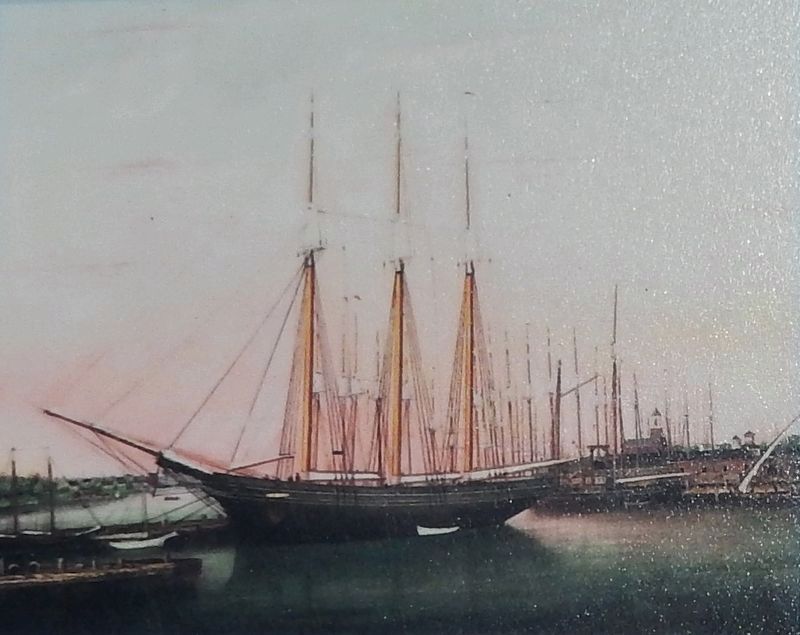
Schooners in the Harbor
In the view above, from a long-demolished bridge near the current state pier and Noble's Island, captures a classic scene at Portsmouth's harbor when schooners like the Charles Carroll docked at the wharves in front of the early nineteenth century brick warehouses of Bow and Ceres Streets.
A Ferry Landing
This site was also home to a landing for a ferry from 1722 until 1922 when the Memorial Bridge was built. In the 19th century the ferry was operated by the Portsmouth, Kittery, and York Street Railway, which transported passengers across the fast flowing Piscataqua River from its nearby terminal to Badger's Island in Kittery, Maine.
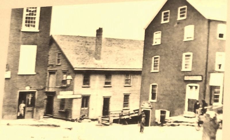
The Market
At this location a market was established in 1761. The original building burned and was replaced. It is said that women from the Maine side of the river came in small canoes with farm produce to sell or
barter here. In the photo above, the market at Spring Hill is shown as it appeared in the 1870s. In this view towards the water from Bow Street, the Market building is in the middle of the two brick buildings, which still stand today at the corner of Bow and Ceres Streets.
Stores and Warehouses
Most of the large brick buildings on Ceres Street and Bow Street were built as stores and warehouses after the fires of 1802 and 1806. Large wooden hoists moved goods from ships and wharves to upper floors in these structures. Throughout much of the 1800s, the Bow Street buildings functioned as warehouses for shipping materials, furniture and lumber. When Frank Jones and other local brewers were at their peak, shiploads of Canadian grain were stored in the buildings. Many of the buildings along this part of Ceres Street were used to store grain and it is generally assumed the street derives its name from Ceres, the Roman goddess of grain.
Artists at Spring Hill
The wharves at Spring Hill were once the landing places of fishing and other small boats. It became a favorite location for many artists, including Russell Cheney, who painted this ironic portrait above of Howard Lathrop, A Portsmouth Fisherman in 1937.
Erected 2011 by City of Portsmouth, New Hampshire.
Topics. This historical
marker is listed in these topic lists: Industry & Commerce • War of 1812 • Waterways & Vessels.
Location. 43° 4.723′ N, 70° 45.438′ W. Marker is in Portsmouth, New Hampshire, in Rockingham County. Marker can be reached from Ceres Street north of Bow Street, on the right when traveling north. Marker is located beside the walkway, in the small Ceres Street/Bow Street Waterfront Park, on the north side of Ceres Street, overlooking the dock and old ferry landing at this location. Touch for map. Marker is at or near this postal address: 2 Ceres Street, Portsmouth NH 03801, United States of America. Touch for directions.
Other nearby markers. At least 8 other markers are within walking distance of this marker. Horse Chestnut (within shouting distance of this marker); John Samuel Blunt, Painter (about 300 feet away, measured in a direct line); Prince Whipple and Winsor Moffatt (about 300 feet away); Ceilia Layton Thaxter (about 500 feet away); The Original New Hampshire State House (about 700 feet away); Nation's Oldest Bank (about 700 feet away); Treaty of Portsmouth 1905 (about 700 feet away); Negro Pews (about 800 feet away). Touch for a list and map of all markers in Portsmouth.
Credits. This page was last revised on April 7, 2018. It was originally submitted on April 6, 2018, by Cosmos Mariner of Cape Canaveral, Florida. This page has been viewed 277 times since then and 22 times this year. Last updated on April 6, 2018, by Cosmos Mariner of Cape Canaveral, Florida. Photos: 1, 2, 3, 4, 5, 6. submitted on April 6, 2018, by Cosmos Mariner of Cape Canaveral, Florida. • Andrew Ruppenstein was the editor who published this page.
