Montrose in Montrose County, Colorado — The American Mountains (Southwest)
Early Freighting Ventures
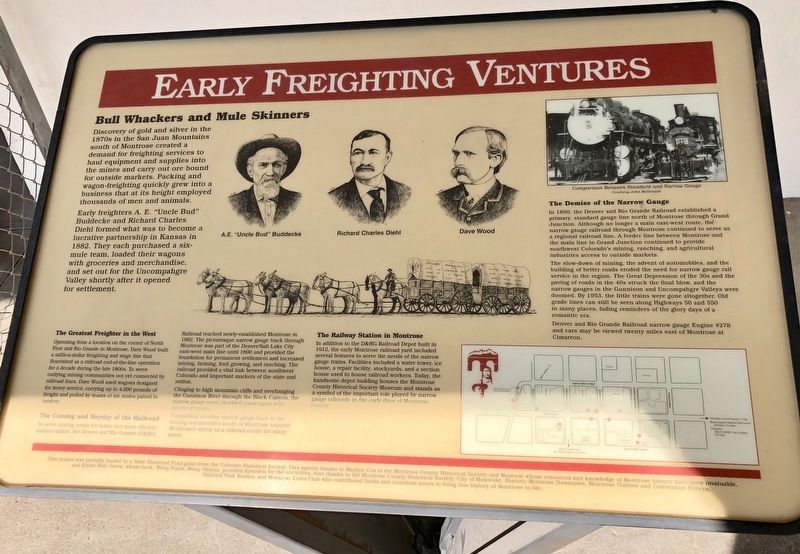
Bull Whackers and Mule Skinners
Discovery of gold and silver in the 1870s in the San Juan Mountains south of Montrose created a demand for freighting services to haul equipment and supplies into the mines and carry out ore bound for outside markets. Packing and wagon-freighting quickly grew into a business that at its height employed thousands of men and animals.
Early freighters A. E. "Uncle Bud" Buddecke and Richard Charles Diehl formed what was to become a lucrative partnership in Kansas in 1882. They each purchased a six-mule team, loaded their wagons with groceries and merchandise, and set out for the Uncompahgre Valley shortly after it opened for settlement.
The Greatest Freighter in the West
Operating from a location on the corner of North First and Rio Grande in Montrose, Dave Wood built a million-dollar freighting and stage line that flourished as a railroad end-of-the-line operation for a decade during the late 1800s. To serve outlying mining communities not yet connected by railroad lines, Dave Wood used wagons designed for heavy service, carrying up to 4,000 pounds of freight and pulled by teams of six mules paired in tandem.
The Coming and Heyday of the Railroad
To serve mining needs for faster and more efficient transportation, the Denver and Rio Grande (D&RG) Railroad reached newly-established Montrose in 1882. The picturesque narrow gauge track through Montrose was part of the Denver/Salt Lake City east-west main line until 1890 and provided the foundation for permanent settlement and increased mining, farming, fruit growing, and ranching. The railroad provided a vital link between southwest Colorado and important markets of the state and nation.
Clinging to high mountain cliffs and overhanging the Gunnison River through the Black Canyon, the narrow gauge route provided passengers with plenty of thrills.
Completion of other narrow gauge lines to the mining communities south of Montrose assured Montrose's status as a railroad center for many years.
The Railway Station in Montrose
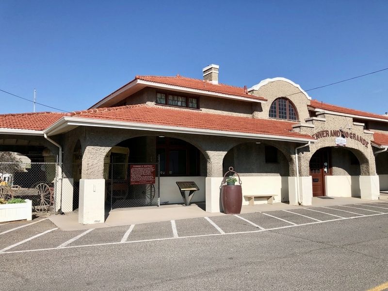
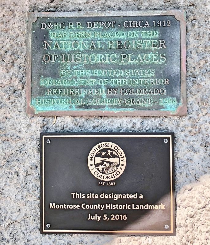
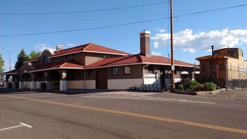
In addition to the D&RG Railroad Depot built in 1912, the early Montrose railroad yard included several features to serve the needs of the narrow gauge trains. Facilities included a water tower, ice house, a repair facility, stockyards, and a section house used to house railroad workers. Today, the handsome depot building houses the Montrose County Historical Society Museum and stands as a symbol of the important role played by narrow gauge railroads in the early days of Montrose history.
The Demise of the Narrow Gauge
In 1890, the Denver and Rio Grande Railroad established a primary, standard gauge line north of Montrose through Grand Junction. Although no longer a main east-west route, the narrow gauge railroad through Montrose continued to serve as a regional railroad line. A feeder line between Montrose and the main line in Grand Junction continued to provide southwest Colorado's mining, ranching, and agricultural industries access to outside markets.
The slow-down of mining, the advent of automobiles, and the building of better roads eroded the need for narrow gauge rail service in the region. The Great Depression of the 30s and the paving of roads in the 40s struck the final blow, and the narrow gauges in the Gunnison and Uncompahgre Valleys were doomed. By 1953, the little trains were gone altogether. Old grade lines can still be seen along Highways 50 and 550 in many places, fading reminders of the glory days of a romantic era.
Denver and Rio Grande Railroad narrow gauge Engine #278 and cars may be viewed twenty miles east of Montrose at Cimarron.
Topics and series. This historical marker is listed in these topic lists: Railroads & Streetcars • Roads & Vehicles. In addition, it is included in the Colorado - Montrose - Preserving Our Heritage series list. A significant historical year for this entry is 1882.
Location. 38° 28.68′ N, 107° 52.791′ W. Marker is in Montrose, Colorado, in Montrose County. Marker is on North Rio Grande Avenue north of West Main Street, on the left when traveling north. Located at the Montrose County Historical Museum. Touch for map. Marker is at or near this postal address: 21 North Rio Grande Avenue, Montrose CO 81401, United States of America. Touch for directions.
Other nearby markers. At least 8 other markers are within walking distance of this marker. Founding of Montrose (here, next to this marker); Preserving Our Heritage (a few steps from this marker); a different marker also named Preserving Our Heritage (about 400 feet away, measured in a direct line); The Gunnison Tunnel (about 600 feet away); a different marker also named Preserving Our Heritage (approx. 0.2 miles away); a different marker also named Preserving Our Heritage (approx. 0.2 miles away); Veterans Memorial (approx. 0.2 miles away); Instrument of Surrender (approx. 0.2 miles away). Touch for a list and map of all markers in Montrose.
Credits. This page was last revised on July 19, 2018. It was originally submitted on July 14, 2018, by Mark Hilton of Montgomery, Alabama. This page has been viewed 206 times since then and 11 times this year. Photos: 1, 2. submitted on July 14, 2018, by Mark Hilton of Montgomery, Alabama. 3. submitted on July 18, 2018. 4. submitted on July 18, 2018, by Tom Bosse of Jefferson City, Tennessee.


