Near Burroughs in Chatham County, Georgia — The American South (South Atlantic)
The 15th Corps at the Savannah and Ogeechee Canal
Inscription.
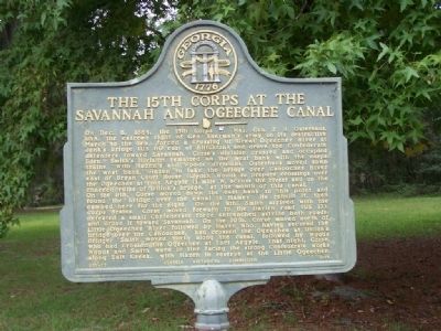
On Dec. 6 1864, the 15th Corps [US], Maj. Gen. P. J. Osterhaus, USA, the extreme right of Gen. Sherman's army on its destructive March to the Sea, forced a crossing of Great Ogeechee River at Jenk's Bridge (US 80 east of Blitchton) and drove the Confederate defenders toward Savannah. Corse's division crossed and occupied Eden. Smith's division remained on the west bank with the corps trains. With Hazen's and Woods' divisions, Osterhaus moved down the west bank. Hazen to take the bridge over Canoochee River east of Bryan Court House (Clyde), Woods to prepare crossings over the Ogeechee at Fort Argyle (1 mile W. across the river) and on the charred ruins of Dillon's bridge, at the mouth of this canal.
On the 8th, Corse moved down the east bank to this point and found the bridge over the canal in flames. He rebuilt it, then camped here for the night. On the 9th, Smith arrived with the corps trains. Corse moved forward to the Darien road (US 17), defeated a small Confederate force entrenched astride both roads, and drove it toward Savannah. On the 10th, Corse moved north of Little Ogeechee River followed by Hazen who, having secured the bridge over the Canoochee, had crossed the Ogeechee at Dillon's Bridge. Smith moved north along the canal, followed by Woods who had crossed the Ogeechee at Fort Argyle. That night, Corse, Woods and Smith were in line facing the strong Confederate works along Salt Creek, with Hazen in reserve at the Little Ogeechee.
Erected 1959 by Georgia Historical Commission. (Marker Number 025-72.)
Topics and series. This historical marker is listed in this topic list: War, US Civil. In addition, it is included in the Georgia Historical Society, and the Sherman’s March to the Sea series lists. A significant historical month for this entry is December 1862.
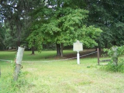
Location. 32° 1.419′ N, 81° 19.027′ W. Marker is near Burroughs, Georgia, in Chatham County. Marker is at the intersection of Fort Argyle Road (State Highway 204) and Bush Drive, on the left when traveling west on Fort Argyle Road. Touch for map. Marker is in this post office area: Savannah GA 31419, United States of America. Touch for directions.
Other nearby markers. At least 8 other markers are within 6 miles of this marker, measured as the crow flies. The Savannah and Ogeechee Canal (within shouting distance of this marker); Savannah-Ogeechee Canal (about 600 feet away, measured in a direct line); King's Bridge (approx. 3˝ miles away); Fort Argyle (approx. 5 miles away); Hazen's Division at the Canoochee River (approx. 5 miles away); Fort McAllister (approx. 5.1 miles away); "Dead Town" of Hardwicke (approx. 5.1 miles away); Courthouse Annex (approx. 5.2 miles away).
Also see . . .
1. General Peter J. Osterhaus. 17th Missouri Volunteer website entry (Submitted on October 3, 2008, by Mike Stroud of Bluffton, South Carolina.)
2. Sherman's March to the Sea. New Georgia Encyclopedia website entry (Submitted on October 3, 2008, by Mike Stroud of Bluffton, South Carolina.)
Credits. This page was last revised on October 16, 2021. It was originally submitted on October 3, 2008, by Mike Stroud of Bluffton, South Carolina. This page has been viewed 1,814 times since then and 23 times this year. Last updated on October 5, 2008, by Mike Stroud of Bluffton, South Carolina. Photos: 1, 2, 3, 4. submitted on October 3, 2008, by Mike Stroud of Bluffton, South Carolina. • Craig Swain was the editor who published this page.


