Weippe in Clearwater County, Idaho — The American West (Mountains)
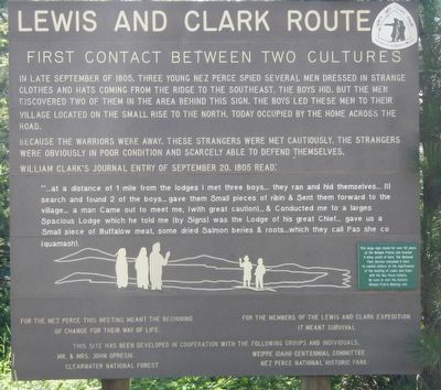
First Contact Between Two Cultures
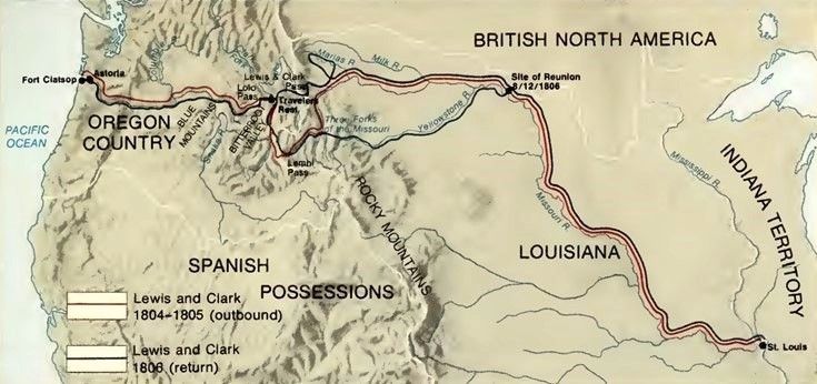
Lewis and Clark Route
Because the warriors were away, these strangers were met cautiously. The strangers were obviously in poor condition and scarcely able to defend themselves.
William Clark's journal entry of September 20, 1805 read:
"...at a distance of 1 mile from the lodges I met three boys... they ran and hid themselves... (I) search and found 2 of the boys... gave them Small pieces of ribin & Sent them forward to the village... a man Came out to meet me, (with great caution)... & Conducted me to a larges Spacious Lodge which he told me (by Signs) was the Lodge of his great Chief... gave us a Small piece of Buffalow meat, some dried Salmon berries & roots... which they call Pas she co (quamash)
For the Nez Perce this meeting meant the beginning of change for their way of life -- For the members of the Lewis and Clark Expedition it meant survival.
This large sign stood for over 40 years at the Weippe Prairie site located 3 miles south of here. The National Park Service relocated it here to remind visitors of the significance of the meeting of Lewis and Clark with the Nez Perce Indians. Be sure to visit the historic Weippe Prairie Meeting site.
Erected by Clearwater National Forest, Nez Perce National Historical Park.
Topics and series. This historical marker is listed in these topic lists: Exploration • Native Americans. In addition, it is included in the Lewis & Clark Expedition series list. A significant historical date for this entry is September 20, 1805.
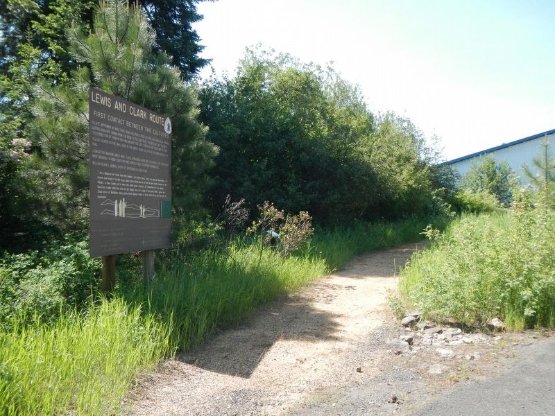
Location. 46° 22.53′ N, 115° 56.532′ W. Marker is in Weippe, Idaho, in Clearwater County. Marker is at the intersection of Woods Street and West Pierce Street (State Highway 11), on the right when traveling east on Woods Street. Touch for map. Marker is at or near this postal address: 204 Woods Street, Weippe ID 83553, United States of America. Touch for directions.
Other nearby markers. At least 8 other markers are within 5 miles of this marker, measured as the crow flies. Lewis and Clark (approx. 0.4 miles away); Weippe Prairie (approx. 0.4 miles away); "Handsome Small Prairie" (approx. 0.4 miles away); Corps of Discovery (approx. 1.9 miles away); a different marker also named First Contact Between Two Cultures (approx. 2 miles away); a different marker also named Weippe Prairie (approx. 2 miles away); Fraser Park (approx. 5.1 miles away); Fraser (approx. 5.1 miles away). Touch for a list and map of all markers in Weippe.
More about this marker. This marker is next to the public library.
Also see . . . Nez Perce Country. 1983 U.S. National Park Service handbook for the Nez Perce National Historical Park. Excerpt:
Lewis and Clark entered the Nez Perce Country in September 1805. Having ascended the Missouri River to its head, they were seeking navigable waters to the Pacific. The rugged canyon of Idaho’s Salmon River had rebuffed them and, traveling north to Montana’s Bitterroot Valley, they had struck westward across the wilds of the Bitterroot Mountains on horses bartered from the Eastern Shoshonis. Though two Shoshonis helped them follow the high Lolo Trail, which the Nez Perces customarily used in going to the buffalo country, the season was late, and the expedition members floundered in snowstorms and almost starved. After extreme privations, an advanee party of Clark and six hunters descended on September 20 to the snow-free meadows of Weippe Prairie where a fall encampment of Nez Perces was gathering camas roots.(Submitted on September 16, 2023, by J. J. Prats of Powell, Ohio.)
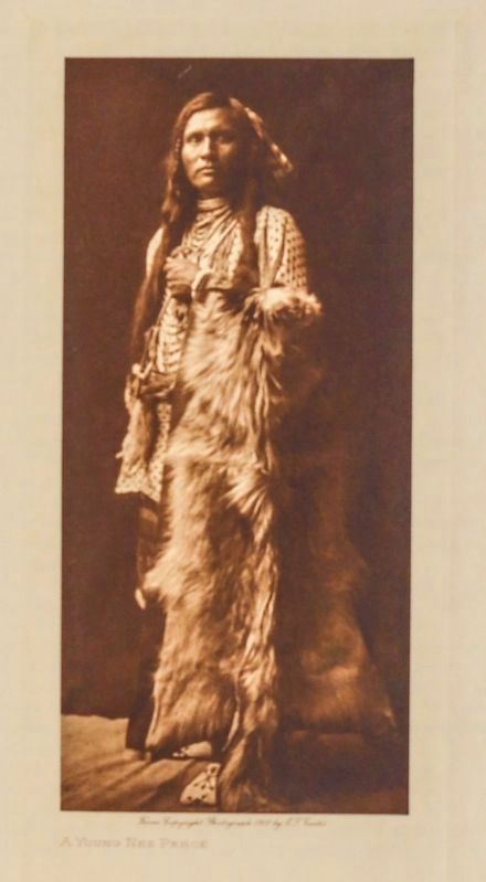
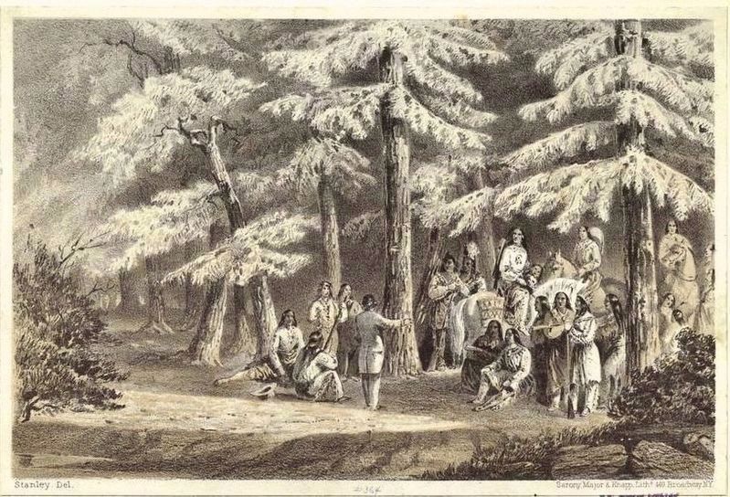
“ ... at the distance of 1 mile from the lodges,” wrote Clark of this firstencounter, “I met 3 Indian boys, when they saw me [they] ran and hid themselves, in the grass. I desmounted gave my gun and horse to one of the men, searched in the grass and found 2 of the boys gave them Small pieces of ribin & sent them forward to the village. Soon after a man Came out to meet me with great caution & Conducted me to a large Spacious Lodge . . . those people gave us a Small piece of Buffalow meat, Some dried beries & roots in different States ... I gave them a fiew Small articles as preasants ....”Photogravure by Edward S. Curtis (Public Domain) via the State Historical Society of Missouri, 19113. “A Young Nez Perce”From the Historical Society's description: “... While the Indigenous people who posed for Curtis sometimes played a role in fashioning their own identities, the photographer often manipulated their clothing and surroundings in order to further his own agenda. This manipulation has opened Curtis up to widespread criticism from scholarly and tribal communities. Although his photographs have been a valuable resource for art historians, anthropologists, and historians, many people have criticized Curtis for sometimes seeming oblivious and/or insensitive to the autonomy and dignity of his models. ...”
The encampment was apparently that of Kamiah area villagers, and Clark learned that the band’s great head chief, Tuna-kehm-mu-toolt, or Broken Arm, together with all the warriors, had left three days before in a southwesterly direction to fight their enemies, the Tewelka. These were the Western Shoshonis, Paiutes, and Bannocks, all of whom, together with the Eastern Shoshonis, Lewis and Clark and other whites had learned from more easterly tribes to refer to as Snake lndians. The great chief and the warriors were not expected back for another 15 or 18 days.
Guided by the Nez Perces, who provided food, Clark the next day reached the Clearwater River at present-day Greer and three kilometers (two miles) downstream stopped at a village whose elderly headman was Aleiya, which Clark understood meant The Twisted Hair.It was in this village that Wet-khoo-weis, the woman who had returned from the east, saw the whites and told her people to do the strangers no harm. Possibly for this reason, the Nez Perces showed the small band of explorers friendship and hospitality. The Twisted Hair welcomed them and the next day accompanied them back to Weippe Prairie where Lewis and the rest of the expedition had arrived weak and starving.
Though many of the whites became temporarily ill from dysentery, the food generously supplied them by the Nez Perces saved their lives, and they gradually regained their strength. At the same time, The Twisted Hair and other Nez Perces made maps on whitened elk skins to show them the water route ahead. Escorted by some Nez Perces-whom Lewis and Clark called the Chopunnish, which may have been a corruption of Sahaptian-they made their way down the Clearwater to a point opposite the mouth of the North Fork of that river, where they halted long enough to construct dugout canoes. On October 7, after caching some of their supplies and entrusting their horses to members of The Twisted Hair's family until they returned the next year, they left what is now known as Canoe Camp and set off down the Clearwater in the canoes.
They passed many small Nez Perce winter villages and fishing camps and at the site of present-day Lewiston turned into the Snake River. The two Eastern Shoshonis who had conducted them over the Bitterroot Mountains had meanwhile returned to their own tribe, but The Twisted Hair and another Nez Perce man went along with them down the Snake and Columbia rivers, helping them negotiate with the new peoples through whose countries they passed. At the great Dalles fishing center, the explorers finally parted with the two helpful Nez Perces and continued their journey to the Pacific Ocean.
Credits. This page was last revised on September 18, 2023. It was originally submitted on August 10, 2018, by Barry Swackhamer of Brentwood, California. This page has been viewed 1,045 times since then and 541 times this year. Last updated on September 17, 2023, by Carl Gordon Moore Jr. of North East, Maryland. It was the Marker of the Week September 17, 2023. Photos: 1, 2. submitted on August 10, 2018, by Barry Swackhamer of Brentwood, California. 3, 4, 5. submitted on September 16, 2023, by J. J. Prats of Powell, Ohio. • J. Makali Bruton was the editor who published this page.
