Near Saltese in Mineral County, Montana — The American West (Mountains)
A Lost World
Precambrian Belt Rocks
Inscription.
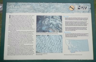
Imagine a world very different than we know today. About 1.5 billion years ago during the Precambrian Era, the earth's environment was desolate, with no trees, fish, animals or birds. Shallow seas with extensive near-shore flats were fed by streams that deposited great amounts of sand and mud. Rain frequently fell and pooled in vast shallow lakes and ponds in what would one day become northwest Montana.
Despite the hostile environment, blue-green algae mats often trapped fine particles of calcium carbonate to form structures called stromatolites, that grew in shallow near-shore environment. The surface of the rocks often display mud cracks, ripple marks, and, sometimes, the spatter marks of primeval raindrops.
The earth's curst slowly sank for about 100 million years forming a large geologic basin in which Belt Supergroup sediments accumulated as much as 10 miles thick! The rocks are common in northern and central Idaho and western Montana, and extend east to the Little Belt Mountains in central Montana. The sedimentary rocks along Interstate 90 between Lookout Pass and Alberton are almost entirely rocks of the Belt Supergroup. These rocks are distinguished by brown, grey, red, green, purple, and yellow colors and locally form dramatic cliffs where resistant, well-cemented sandstones are exposed in the canyon.
Interstate 90 from near Lookout Pass through Missoula is located along the Lewis and Clark Fault Zone, a series of faults that stretch between northwest Washington State and the Helena area. The faults had significant movement about 70 million years ago when the Rocky Mountains were uplifting and were active until at least 25 million years ago. Interstate 90 and US Highway 10 in western Montana follow the trend of the faults along straight canyon that eroded along the fault zone.
(sidebar)
Geo-facts
• Geologists map rocks as formations. The Belt rocks are so thick that similar formations have been combined into "groups," and the groups in turn are referred to as one very large unit called a "Supergroup."
• Ancient rocks indicate that oxygen was not abundant in Earth's atmosphere until about 2.2 billion years ago. An explosion of abundant and complex life forms, such as trilobites, did not occur until about 550 million years ago in the presence of abundant oxygen and protective ozone layer that filtered solar radiation.
• The lack of burrowing organisms during the Precambrian time allow excellent preservation of finely layered sedimentary rocks of the Belt Supergroup. Some of the thin beds in the Belt rocks can be traced for miles.
Geo-Activity:
• As you travel along I-90, keep in mind that your are also following the path of a fault. How may times can you count cliffs of brown, gray, red, green, purple and yellow colors rocks that have been eroded away along the fault lines?
Erected by Montana Department of Transportation.
Topics. This historical marker is listed in these topic lists: Natural Features • Paleontology.
Location. 47° 25.164′ N, 115° 37.728′ W. Marker is near Saltese, Montana, in Mineral County. Marker is on Interstate 90 at milepost 4. Touch for map. Marker is in this post office area: Saltese MT 59867, United States of America. Touch for directions.
Other nearby markers. At least 8 other markers are within 2 miles of this marker, measured as the crow flies. A wonderful Piece of Engineering: The Mullan Road (a few steps from this marker); Join the Voyage of Discovery (within shouting distance of this marker); Substation 13 (approx. 1.6 miles away); Life Along the Line (approx. 1.6 miles away); Pluck and Good Fortune (approx. 1.6 miles away); A Battle That Could Not Be Won (approx. 1.6 miles away); When the Mountains Roared (approx. 1.6 miles away); An Unlikely Safe Haven (approx. 1.6 miles away). Touch for a list and map of all markers in Saltese.
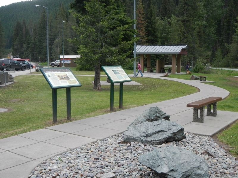
More about this marker. This marker is located at the Dena Mora Rest Area Eastbound.
Credits. This page was last revised on September 6, 2018. It was originally submitted on September 6, 2018, by Barry Swackhamer of Brentwood, California. This page has been viewed 222 times since then and 28 times this year. Photos: 1, 2. submitted on September 6, 2018, by Barry Swackhamer of Brentwood, California.

