Cumberland Township near Gettysburg in Adams County, Pennsylvania — The American Northeast (Mid-Atlantic)
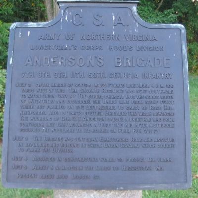
Anderson's Brigade
Hood's Division - Longstreet's Corps
— Army of Northern Virginia —
Army of Northern Virginia
Longstreet's Corps Hood's Division
Anderson's Brigade
7th. 8th. 9th. 11th. 59th. Georgia Infantry
July 2 After march of several miles formed line about 4 p.m. 100 yards west of this. The Seventh Regiment was sent southward to watch Union Cavalry. The others charged into the woods south of Wheatfield and dislodged the Union line from stone fence there but flanked on the left retired to crest of Rose Hill. Reinforced later by parts of other Brigades they again advanced. The wounding of Gen. G.T. Anderson caused a brief halt and some confusion but they advanced a third time and after a struggle occupied the woodland to its border on Plum Run Valley.
July 3 The Brigade was sent down Emmitsburg Road and assisted in repulsing and holding in check Union Cavalry which sought to flank the Division.
July 4 Assisted in constructing works to protect the flank.
July 5 About 5 a.m. began the march to Hagerstown, Md.
Present about 1800. Losses 671.
Erected 1910 by Gettysburg National Military Park Commission.
Topics. This historical marker is listed in this topic list: War, US Civil. A significant historical year for this entry is 1800.
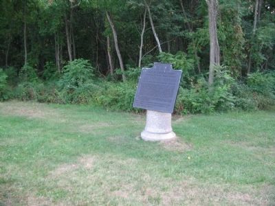
Location. 39° 47.517′ N, 77° 15.29′ W. Marker is near Gettysburg, Pennsylvania, in Adams County. It is in Cumberland Township. Marker is at the intersection of West Confederate Avenue and Emmitsburg Road (U.S. 15), on the right when traveling south on West Confederate Avenue. Located near the Snyder Farm, in the Biesecker Woods, in Gettysburg National Military Park. Touch for map. Marker is in this post office area: Gettysburg PA 17325, United States of America. Touch for directions.
Other nearby markers. At least 8 other markers are within walking distance of this marker. Arkansas (within shouting distance of this marker); Robertson's Brigade (about 600 feet away, measured in a direct line); Latham's Battery - Henry's Battalion (about 600 feet away); Hood's Texas Brigade (about 600 feet away); Hood's Division (about 600 feet away); Texas (about 700 feet away); Bachman's Battery - Henry's Battalion (approx. 0.2 miles away); Fraser's Battery - Cabell's Battalion (approx. ¼ mile away). Touch for a list and map of all markers in Gettysburg.
Related markers. Click here for a list of markers that are related to this marker. Anderson's Brigade Tablets.
Also see . . . Report of Col. W. W. White, 7th Georgia. With General Anderson wounded, the command of the Brigade passed to Col. White of the 7th Georgia. He presented a consolidated report of the campaign. (Submitted on October 11, 2008, by Craig Swain of Leesburg, Virginia.)
Credits. This page was last revised on February 7, 2023. It was originally submitted on October 11, 2008, by Craig Swain of Leesburg, Virginia. This page has been viewed 1,061 times since then and 33 times this year. Photos: 1, 2. submitted on October 11, 2008, by Craig Swain of Leesburg, Virginia.

