Near Almo in Cassia County, Idaho — The American West (Mountains)
Pinnacle Pass
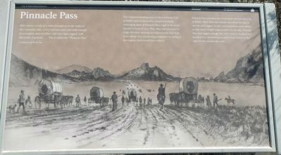
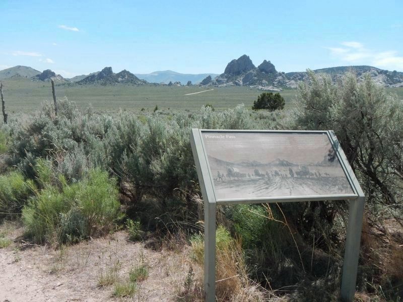
The emigrants heading west on the California Trail probably fanned out as they crossed this basin, converging again at Pinnacle Pass, a gap in the rocks directly in front of you. They often did not travel in single-file lines; fanning out helped avoid dust from those ahead. Nor would many emigrants be riding in the wagons; most would have walked.
Pinnacle Pass provided the westbound exit from the City of Rocks. More than one traveler described the pass as narrow and rugged. In later years teamsters used cables to ease heavy freight wagons down the far side. Pinnacle Pass was rugged enough that 20th-century road builders avoided it by dynamiting an easier route farther to the right for the present-day road.
Erected by National Park Service, Idaho Department of Parks and Recreation.
Topics and series. This historical marker is listed in these topic lists: Roads & Vehicles • Settlements & Settlers. In addition, it is included in the California Trail series list.
Location. 42° 3.686′ N, 113° 42.078′ W. Marker is near Almo, Idaho, in Cassia County. Marker is on Twin Sister Road (Road 3400 S) near City of Rocks Road (Road 3075 S), on the left when traveling west. Touch for map. Marker is in this post office area: Almo ID 83312, United States of America. Touch for directions.
Other nearby markers. At least 8 other markers are within 3 miles of this marker, measured as the crow flies. A Pleasant Place (approx. 0.9 miles away); California Trail -- Silent City of Rocks (approx. 0.9 miles away); California Trail -- Pinnacle Pass (approx. 0.9 miles away); Fading Away (approx. one mile away); Distant Views (approx. one mile away); Twin Sisters (approx. 2˝ miles away); Passing Through (approx. 2˝ miles away); City of Rocks Stage Station (approx. 2.6 miles away). Touch for a list and map of all markers in Almo.
More about this marker. The coordinates entered are based on Google Maps but they do not align with those from my camera which are 42.0598, -113.6909.
Credits. This page was last revised on September 29, 2018. It was originally submitted on September 29, 2018, by Barry Swackhamer of Brentwood, California. This page has been viewed 388 times since then and 56 times this year. Photos: 1, 2. submitted on September 29, 2018, by Barry Swackhamer of Brentwood, California.

