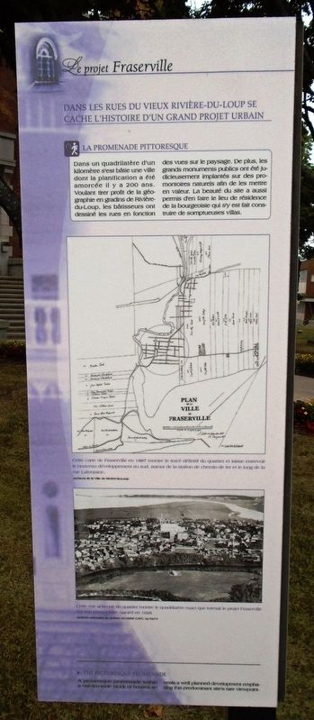
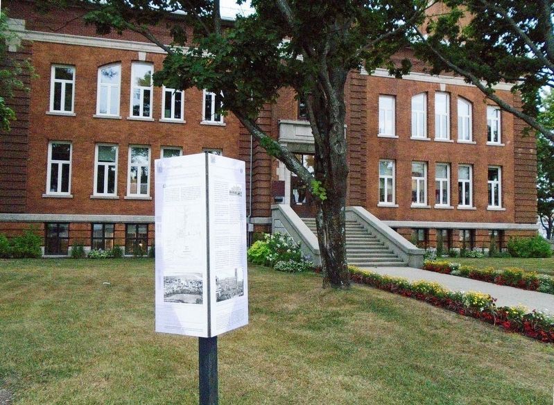
Le projet Fraserville / The Fraserville Project
Dans les rues du vieux Rivière-du-Loup se cache l'histoire d'un grand projet urbain
La promenade pittoresque
Dans un quadrilatère d'un kilomètre s'est bâtie une ville dont la planification a été amorcée il y a 200 ans. Voulant tirer profit de la géographie en gradins de Rivière-du-Loup, les bâtisseurs ont dessiné les rues en fonction des vues sur le paysage. De plus, les grands monuments publics ont été judicieusement implantés sur des promontoires naturels afin de les mettre en valeur. La beauté du site a aussi permis d'en faire le lieu de résidence de la bourgeoisie qui s'y est fait construire de somptueuses villas.
Cette carte de Fraserville en 1887 montre le tracé définitif du quartier et laisse entrevoir le nouveau développement au sud, autour de la station de chemin de fer et le long de la rue Lafontaine.
Cette vue aérienne du quartier montre le quadrilatère exact que formait le projet Fraserville sur son promontoire naturel en 1928.
A picturesque promenade within a one-km-wide block of houses reveals a well planned development emphazing [sic - emphasizing] this predominant site's rare viewpoint.
[Expanded English translation follows]
The streets of old Rivière-du-Loup hides the story of a major urban project
The Picturesque Promenade
In a one-kilometer quadrangle, a city was built whose planning began 200 years ago. Wanting to take advantage of the stepped geography of Rivière-du-Loup, the builders planned the streets according to the views of the landscape. In addition, the great public monuments were judiciously implanted on natural promontories in order to highlight them. The beauty of the site has also made it the place of residence of the bourgeoisie who had sumptuous villas built there.
This map of Fraserville in 1887 shows the final layout of the neighborhood and suggests the new development to the south, around the railway station and along Lafontaine Street.
This 1928 aerial view of the district shows the exact quadrilateral formed by the Fraserville project on its natural promontory.
Erected by Tourisme Rivière-du-Loup.
Topics. This historical marker is listed in these topic lists: Environment • Settlements & Settlers. A significant historical year for this entry is 1887.
Location. 47°
Other nearby markers. At least 8 other markers are within 26 kilometers of this marker, measured as the crow flies. Hôtel de Ville / City Hall (here, next to this marker); John McLoughlin (a few steps from this marker); Hôtel-de-Ville-de-Rivière-du-Loup / Rivière-du-Loup Town Hall (a few steps from this marker); L'Hôtel de ville de Rivière-du-Loup (within shouting distance of this marker); CJFP (within shouting distance of this marker); L'Église de Saint-André / The Church of Saint-André (approx. 23.1 kilometers away); L'Église / The Church (approx. 24.8 kilometers away); Le couvent du Saint-Rosaire / The Saint-Rosaire Convent (approx. 24.9 kilometers away). Touch for a list and map of all markers in Rivière-du-Loup.
Also see . . .
1. The history of Rivière-du-Loup. Société d'histoire et de généalogie de Rivière-du-Loup website entry (Submitted on October 31, 2018, by William Fischer, Jr. of Scranton, Pennsylvania.)
2. Tourisme Rivière-du-Loup. City website homepage (Submitted on October 31, 2018, by William Fischer, Jr. of Scranton, Pennsylvania.)
3. Ville de Rivière-du-Loup . City website homepage (Submitted on October 31, 2018, by William Fischer, Jr. of Scranton, Pennsylvania.)
4. Histoire et trésors du Vieux Rivière-du-Loup / History and Treasures of Old Rivière-du-Loup. Visite à pied, complètement en Français / Walking tour, completely in French (Submitted on November 1, 2018, by William Fischer, Jr. of Scranton, Pennsylvania.)
Credits. This page was last revised on January 8, 2022. It was originally submitted on October 31, 2018, by William Fischer, Jr. of Scranton, Pennsylvania. This page has been viewed 141 times since then and 8 times this year. Photos: 1, 2. submitted on October 31, 2018, by William Fischer, Jr. of Scranton, Pennsylvania.

