Innovation
Armé pour durer
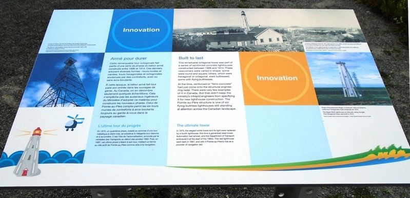
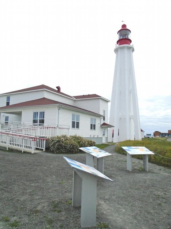
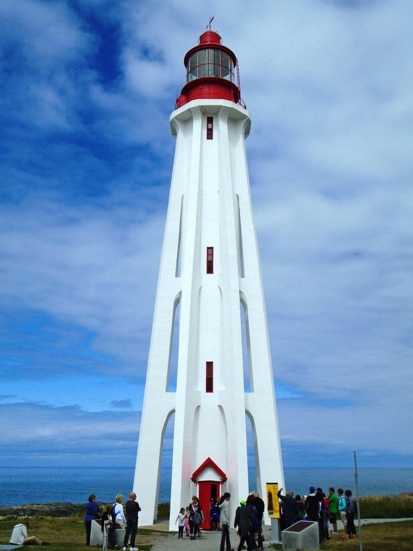
Cette remarquable tour octogonale fait partie d'une série de phares et béton armé construits entre 1906 et 1914. Ces derniers arborent diverses formes : tours rondes et carrées, tours hexagonales et octogonales soutenues par des contreforts, avec ou sans arcs-boutants.
À cette époque, le béton armé fait tout juste son entrée dans les ouvrages de génie. Au Canada, on en dénombre seulement quelques échantillons. Cela n'empêche pas les audacieux ingénieurs du Ministère d'adopter ce matériau pour construire les nouveaux phares. Celui de Pointe-au-Père compte parmi les six tours munies de contreforts à arcs-boutants tourjours au garde-à-vous dans le paysage canadien.
L'ultime tour du progrés
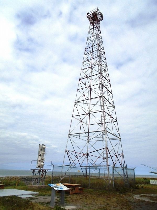
En 1975, un quatrième phare, installé au sommet d'une tour métallique à claire-voie, se substitue à l'élégante tour blanche et à sa lumière. C'est l'ère de l'automatisation, amorcée par le ministère des Transports au début des années 1960. Puis, en 1997, cet ultime phare s'éteint à son tour, mettant un terme au rôle actif de Pointe-au-Père comme aide à la navigation.
[Illustrations, en haut à gauche,
dans le sens des aiguilles d'une montre, lisez]
• La tour à claire-voie de 33,5 mètres de hauteur supportait un phare automatique, dont la portée minimale atteignait 37 kilomètres.
• Le phare d'Estevan Point (C.-B.) a été construit en 1909, suivant les plans de Miffonis. Il a la même architecture que celui de Pointe-au-Père.
• Phare d'Escarpement Bagot, à Anticosti, sans sa lanterne. Cette tour hexagonale a été construite en 1912.
This remarkable octagonal tower was part of a series of reinforced concrete lighthouses constructed between 1906 and 1914. These newcomers were varied in shape: some were round and square; others, which were hexagonal or octagonal, were buttressed, some with flying buttresses.
At the time, reinforced or "ferro-concrete" had just come onto the structural engineering radar. There were very few examples of it in Canada. But that didn't keep the ministry's intrepid engineers from specifying it for new lighthouse construction. The Pointe-au-Père structure is one of six flying buttress lighthouses still standing at attention across the Canadian landscape.
The ultimate tower
In 1975, the elegant white tower and its light were replaced by a fourth lighthouse,
[Illustrations, clockwise from top left, read]
• The 33.5m. tall skeleton tower had an automatic light with a minimum range of 37 km.
• The Estevan Point Lighthouse (B.C.) was built in 1909 using plans from Miffonis. Its architecture is identical to that of Pointe-au-Père.
• The Bagot Bluff Lighthouse at Anticosti, minus its light. This hexagonal tower was built in 1912.
Erected by Parks/Parcs Canada.
Topics and series. This historical marker is listed in these topic lists: Architecture • Communications • Industry & Commerce • Waterways & Vessels. In addition, it is included in the Lighthouses series list. A significant historical year for this entry is 1906.
Location. 48° 31.065′ N, 68° 28.117′ W. Marker is in Rimouski, Québec, in Rimouski-Neigette. Marker is on rue du Phare, on the left when traveling east. Marker is on the Pointe-au-Père Lighthouse station grounds. Touch for map. Marker is at or near this postal address: 1000 rue du Phare, Rimouski QC G5M 1L8, Canada. Touch for directions.
Other nearby markers. At least 8 other markers are within walking distance of this marker. Modernisation / Modernizing (here, next to this marker); L'épave du/The Wreck of RMS Empress of Ireland
Also see . . .
1. Lieu historique national du Canada du Phare-de-Pointe-au-Père. (Submitted on January 9, 2019, by William Fischer, Jr. of Scranton, Pennsylvania.)
2. Pointe-au-Père Lighthouse National Historic Site of Canada Management Plan (2007). (Submitted on January 9, 2019, by William Fischer, Jr. of Scranton, Pennsylvania.)
Credits. This page was last revised on September 4, 2020. It was originally submitted on January 9, 2019, by William Fischer, Jr. of Scranton, Pennsylvania. This page has been viewed 97 times since then and 10 times this year. Photos: 1, 2. submitted on January 9, 2019, by William Fischer, Jr. of Scranton, Pennsylvania. 3. submitted on December 26, 2018, by William Fischer, Jr. of Scranton, Pennsylvania. 4. submitted on November 27, 2018, by William Fischer, Jr. of Scranton, Pennsylvania.


