Battle in East Sussex, England, United Kingdom — Northwestern Europe (the British Isles)
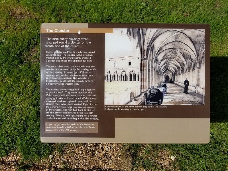
The Cloister
Sheltered from cold north winds they would catch the sun. The cloister walks or alleys, marked out by the gravel paths, enclosed a garden and linked the adjoining buildings.
The north alley, next to the church, was the sunniest and warmest place for reading, study or the copying of manuscripts. Cellarers' accounts record the purchase of rush mats to improve its comfort. This was also a processional route into the church through a doorway at its western end.
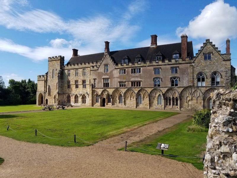
The earliest cloister alleys had simple lean-to or pentice roofs. They were rebuilt in the 12th century, still with open arcades, cold and draughty in winter. From the mid-13th century traceried windows replaced these, and the cloister roofs were stone vaulted. Opposite on the surviving west range you can see remains of the arcades. The first two bays on the left are the earliest and date from the late 13th century. Those to the right belong to a further modernisation and rebuilding in the 15th century.
As part of the extensive works at the abbey the duchess of Cleveland laid out an elaborate formal garden here in the 19th century.
( photo caption )
- A reconstruction of the north cloister alley in the 13th century. It shows monks working on manuscripts.
Topics. This historical marker is listed in these topic lists: Churches & Religion • Notable Events.
Location. 50° 54.864′ N, 0° 29.245′ E. Marker is in Battle, England, in East Sussex. Marker can be reached from the intersection of High Street and Park Lane, on the right when traveling south. Located next to Battle Abbey along the battlefield path at the Battle of Hastings Battlefield. Touch for map. Marker is in this post office area: Battle, England TN33 0AD, United Kingdom. Touch for directions.
Other nearby markers. At least 8 other markers are within walking distance of this marker. The Chapter House (a few steps from this marker); The 11th-century Church (a few steps from this marker); The Refectory (within shouting distance of this marker); Parlour (within shouting distance of this marker); The High Altar of Battle Abbey (within shouting distance of this marker); The Dormitory (within shouting distance of this marker); Dairy and Icehouse (within shouting distance of this marker); Rebuilding the Abbey Church (within shouting distance of this marker). Touch for a list and map of all markers in Battle.
Also see . . .
1. English Heritage - 1066 Battle of Hastings, Abbey and Battlefield. (Submitted on January 30, 2019, by Michael Herrick of Southbury, Connecticut.)
2. Battle Abbey School. (Submitted on January 30, 2019, by Michael Herrick of Southbury, Connecticut.)
Credits. This page was last revised on January 27, 2022. It was originally submitted on January 30, 2019, by Michael Herrick of Southbury, Connecticut. This page has been viewed 228 times since then and 13 times this year. Photos: 1, 2. submitted on January 30, 2019, by Michael Herrick of Southbury, Connecticut.

