Coulsdon in Greater London, England, United Kingdom — Northwestern Europe (the British Isles)
The City of London
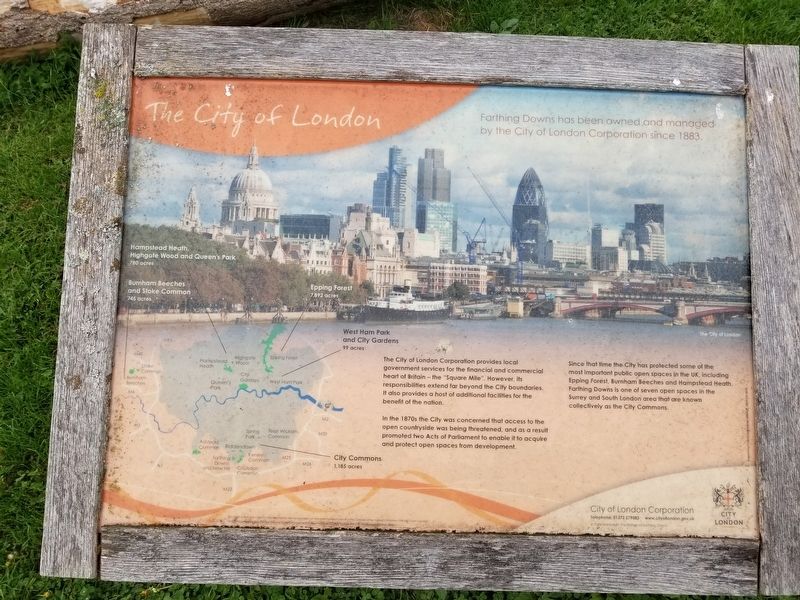
The City of London
Farthing Downs has been owned and managed by the City of London Corporation since 1883,
The City of London Corporation provides local government services for the financial and commercial heart of Britain — the "Square Mile". However, its responsibilities extend far beyond the City boundaries. It also provides a host of additional facilities for the benefit of the nation.
In the 1870s the City was concerned that access to the open countryside was being threatened, and as a result promoted two Acts of Parliament to enable it to acquire and protect open spaces from development.
Since that time the City has protected some of the most important public open spaces in the UK, including Epping Forest, Burnham Beeches and Hampstead Heath. Farthing Downs is one of seven open spaces in the Surrey and South London area that are known collectively as the City Commons.
Topics. This historical marker is listed in this topic list: Parks & Recreational Areas. A significant historical year for this entry is 1883.
Location. 51° 17.974′ N, 0° 8.101′ W. Marker is in Coulsdon, England, in Greater London. Marker is at the intersection of Ditches Lane and Drive Road, on the left when traveling north on Ditches Lane. Located on Farthing Downs. Touch for map. Marker is in this post office area: Coulsdon, England CR5 1DA, United Kingdom. Touch for directions.
Other nearby markers. At least 8 other markers are within 14 kilometers of this marker, measured as the crow flies. Open Spaces (here, next to this marker); Chalk Grassland (here, next to this marker); Early History (here, next to this marker); Recent History (here, next to this marker); Lord Nelson Memorial (approx. 13.3 kilometers away); Merton Place (approx. 13.4 kilometers away); The Mansion (approx. 13.5 kilometers away); Sweech House (approx. 13.6 kilometers away). Touch for a list and map of all markers in Coulsdon.
Also see . . . Farthing Downs on Wikipedia. (Submitted on February 11, 2019, by Michael Herrick of Southbury, Connecticut.)
Credits. This page was last revised on January 27, 2022. It was originally submitted on February 11, 2019, by Michael Herrick of Southbury, Connecticut. This page has been viewed 94 times since then and 5 times this year. Photos: 1, 2, 3. submitted on February 11, 2019, by Michael Herrick of Southbury, Connecticut.


