Marker Logo HMdb.org THE HISTORICAL
MARKER DATABASE
“Bite-Size Bits of Local, National, and Global History”
Tybee Island in Chatham County, Georgia — The American South (South Atlantic)
 

The Breached Wall

April 10-11, 1862


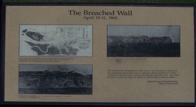
The Breached Wall Marker image. Click for full size.
Photographed By Mike Stroud, October 19, 2008
1. The Breached Wall Marker
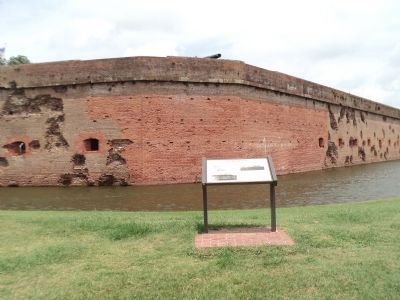
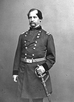
Inscription. " The result of this bombardment must cause, I am convinced, a change in the construction of fortification as radical as that foreshadowed in naval architecture by the conflict between the Monitor and Merrimac. No works of stone or brick can resist the impact of rifled artillery of heavy caliber"
Major General David Hunter,
Dept. of the South
 
Erected by National Park Service.
 
Topics. This historical marker is listed in these topic lists: Forts and CastlesWar, US Civil.
 
Location. 32° 1.612′ N, 80° 53.364′ W. Marker is on Tybee Island, Georgia, in Chatham County. Marker can be reached from Islands Expressway (U.S. 80), on the left when traveling east. Located at Fort Pulaski National Monument. Touch for map. Marker is in this post office area: Tybee Island GA 31328, United States of America. Touch for directions.
 
Other nearby markers. At least 8 other markers are within walking distance of this marker. Shifting Shoreline (within shouting distance of this marker); Brooke Rifle (within shouting distance of this marker); 4.5 Inch Blakely Rifle (within shouting distance of this marker); Prepared for Battle (within shouting distance of this marker); A Devastating Bombardment (within shouting distance of this marker); Through the Thick Brick Wall
Paid Advertisement
Click on the ad for more information.
Please report objectionable advertising to the Editor.
Click or scan to see
this page online
(within shouting distance of this marker); Federal Siege Batteries (about 300 feet away, measured in a direct line); Red-hot Shot (about 300 feet away). Touch for a list and map of all markers in Tybee Island.
 
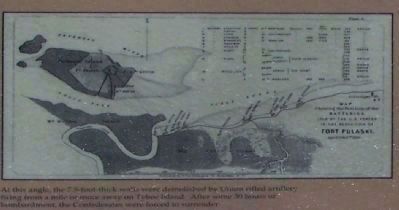
More about this marker. In the upper left is a wartime map of Fort Pulaski, captioned, At this angle, the 7.5-foot-thick walls were demolished by Union rifled artillery firing from a mile or more away on Tybee Island. After some 30 hours of bombardment, the Confederates were forced to surrender.

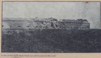
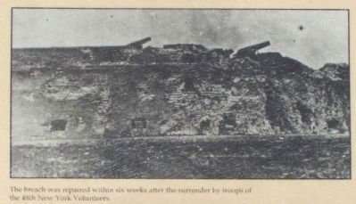
In the lower left is a photograph of the fort after surrender. The breech was repaired within six weeks after the surrender by troops of the 48th New York Volunteers. Another photo in the upper right is captioned, A few of the 5,275 shots fired can still be seen in the wall.
 
Also see . . .  Fort Pulaski. National Park Service (Submitted on November 2, 2008, by Mike Stroud of Bluffton, South Carolina.) 
 
The Breached Wall Marker, top left picture image. Click for full size.
Photographed By National Park Service
2. The Breached Wall Marker, top left picture
"At this angle, the 7.5- foot-thick walls were demolished by Union rifled artillery firing from a mile or more away on Tybee Island. After some 30 hours of bombardment, the Confederates were forced to surrender."
The Breached Wall Marker, right picture image. Click for full size.
Photographed By National Park Service
3. The Breached Wall Marker, right picture
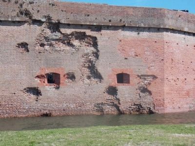
"A few of the 5,275 shots fired can still be seen in the wall."
The Breached Wall Marker image. Click for full size.
Photographed By Bill Coughlin, August 5, 2013
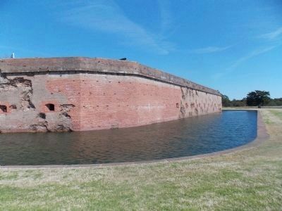
4. The Breached Wall Marker
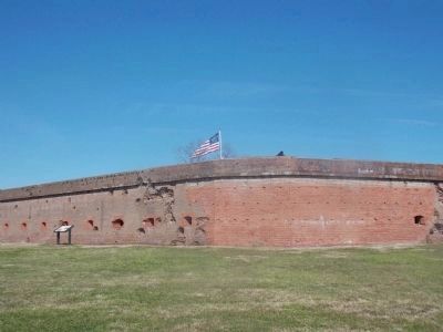
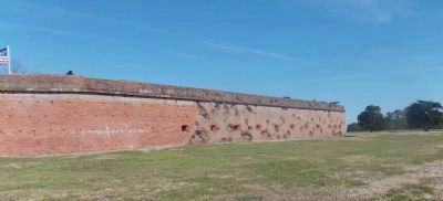
Artillery damage can still be seen on the unbreached portion of the Fort Pulaski walls.
The Breached Wall Marker, lower left picture image. Click for full size.
Photographed By National Park Service
5. The Breached Wall Marker, lower left picture
"The breach was repaired within six weeks after the surrender by troops of the 48th New York Volunteers."
The Breached Wall Marker image. Click for full size.
Photographed By Stanley and Terrie Howard, March 9, 2013
6. The Breached Wall Marker
Federal Siege Batteries image. Click for full size.
Photographed By Mike Stroud
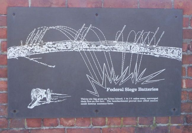
7. Federal Siege Batteries
"Thirty-six big guns on Tybee Island, 1 to 1½ miles away, converged their fire on the fort. The bombardment proved that rifled cannon could destroy masonary forts."
Major General David Hunter, Dept. of the South image. Click for full size.
8. Major General David Hunter, Dept. of the South
"No works of stone or brick can resist the impact of rifled artillery of heavy caliber"
Breached Wall image. Click for full size.
Photographed By Stanley and Terrie Howard, March 9, 2013
9. Breached Wall
Breached Wall image. Click for full size.
Photographed By Stanley and Terrie Howard, March 9, 2013
10. Breached Wall
Breached Wall image. Click for full size.
Photographed By Stanley and Terrie Howard, March 9, 2013
11. Breached Wall
 
 
Credits. This page was last revised on May 3, 2020. It was originally submitted on November 2, 2008, by Mike Stroud of Bluffton, South Carolina. This page has been viewed 1,350 times since then and 27 times this year. Photos:   1, 2, 3. submitted on November 2, 2008, by Mike Stroud of Bluffton, South Carolina.   4. submitted on August 8, 2013, by Bill Coughlin of Woodland Park, New Jersey.   5. submitted on November 2, 2008, by Mike Stroud of Bluffton, South Carolina.   6. submitted on March 10, 2013, by Stanley and Terrie Howard of Greer, South Carolina.   7, 8. submitted on November 2, 2008, by Mike Stroud of Bluffton, South Carolina.   9, 10, 11. submitted on March 10, 2013, by Stanley and Terrie Howard of Greer, South Carolina. • Craig Swain was the editor who published this page.
Share this page.  
Share on Tumblr
m=13224

CeraNet Cloud Computing sponsors the Historical Marker Database.
This website earns income from purchases you make after using our links to Amazon.com. We appreciate your support.
Paid Advertisement
May. 7, 2024